


For 7000 ft. to 8000 ft.
| Saturday | Saturday Night | Sunday | |
|---|---|---|---|
| Weather: | Mostly sunny to partly cloudy with a slight chance of isolated thunderstorms in the afternoon | Partly cloudy with a slight chance of isolated thunderstorms in the evening becoming clear overnight | Sunny |
| Temperatures: | 52 to 59 deg. F. | 28 to 35 deg. F. | 43 to 50 deg. F. |
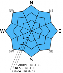
| Mid Slope Winds: | West | West | Northeast shifting to the east in the afternoon |
| Wind Speed: | Light in the morning increasing to 10 to 15 mph in the afternoon | 10 to 15 mph with gusts to 30 mph | 10 to 15 mph with gusts to 25 mph increasing to 25 to 35 mph with gusts to 45 mph |
| Expected snowfall: | 0 | 0 | 0 |
For 8000 ft. to 9000 ft.
| Saturday | Saturday Night | Sunday | |
|---|---|---|---|
| Weather: | Mostly sunny to partly cloudy with a slight chance of isolated thunderstorms in the afternoon | Partly cloudy with a slight chance of isolated thunderstorms in the evening becoming clear overnight | Sunny |
| Temperatures: | 51 to 57 deg. F. | 28 to 35 deg. F. | 41 to 47 deg. F. |
| Ridge Top Winds: | Northwest | West shifting to the northwest after midnight | Northeast |
| Wind Speed: | 10 to 15 mph with gusts to 25 mph in the afternoon | 15 to 20 mph with gusts to 35 mph increasing to 25 to 30 mph with gusts to 45 mph after midnight | 20 to 25 mph with gusts to 40 mph increasing to 30 to 35 mph with gusts to 50 mph in the afternoon |
| Expected snowfall: | 0 | 0 | 0 |


