THIS AVALANCHE FORECAST EXPIRED ON December 9, 2014 @ 6:59 am
Avalanche Forecast published on December 8, 2014 @ 6:59 am
Issued by Brandon Schwartz - Tahoe National Forest

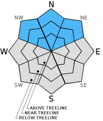
Avalanche danger is LOW for all elevations and aspects. Normal caution is advised.


1. Low

?

Above Treeline
Generally safe avalanche conditions. Watch for unstable snow on isolated terrain features.

1. Low

?

Near Treeline
Generally safe avalanche conditions. Watch for unstable snow on isolated terrain features.

1. Low

?

Below Treeline
Generally safe avalanche conditions. Watch for unstable snow on isolated terrain features.
    Generally safe avalanche conditions. Watch for unstable snow on isolated terrain features.
Avalanche Problem 1: Normal Caution
  • Type ?
  • Aspect/Elevation ?
  • Likelihood ?
    Certain
    Very Likely
    Likely
    Possible
    Unlikely
  • Size ?
    Historic
    Very Large
    Large
    Small

Generally stable snowpack conditions exist throughout the forecast area. If an avalanche were to occur today, it would be an isolated persistent slab avalanche. This is a very low likelihood, high consequence scenario. A difficult to trigger weak layer of basal facets lingers above 9,000'-9,500' on NW-N-NE aspects. The most likely points for human triggering exist at relative shallow areas of the snowpack commonly found near exposed rocks, isolated trees, and along cliff bands. While triggering a large avalanche is not outside the realm of possibility today, it has become more of a future snowpack concern following additional new snow loading.

recent observations

Observations made yesterday near 10,000' on Relay Peak (Mount Rose area) indicated that basal facets remain on upper elevation N aspects. Snowpit tests indicated that transferring sufficient force through the mid and upper snowpack to collapse these weak facets is very difficult to accomplish. This is a major contributing factor as to why avalanche activity is not occurring in areas where this weak layer exists. Snowpit tests further indicate the once collapsed, fractures readily propagate over distances along the top of this weak layer. This has potential implications under future new snow loading conditions that can stress the snowpack much more than a typical human trigger.

Observations were also received from the South Ridge of Red Lake Peak (Carson Pass area) from a NE aspect at 9,000'. In this area basal facets were absent and no signs of instability were noted. Based on the submitted snowpit data, this appears to be a location where new snow from the last storm cycle fell on bare ground.

Weather and CURRENT CONDITIONS
weather summary

A break in the weather will continue today and tomorrow ahead of an approaching storm system. For today, expect building mid and high level cloud cover, above freezing air temperatures, and moderate speed southwest ridgetop winds. Remote sensors between 8,000' and 8,800' are reporting air temperatures this morning in the upper 20s to mid 30s. Maximum daytime air temperatures are expected to reach the mid 30s to mid 40s again today for areas above 7,000'. Ridgetop winds have become light this morning but are forecast to increase with gusts of 30 to 45 mph.

CONDITIONS ALONG THE SIERRA CREST BETWEEN 8200 FT. AND 9200 FT. IN THE LAST 24 HOURS
6am temperature: 29 to 36 deg. F.
Max. temperature: 37 to 45 deg. F.
Average ridgetop wind direction: Southwest
Average ridgetop wind speed: 20 mph
Maximum ridgetop wind gust: 42 mph
New snowfall: 0 inches
Total snow depth: 13 to 29 inches
Two-Day Mountain Weather Forecast Produced in partnership with the Reno NWS
For 7000 ft. to 8000 ft.
Monday Monday Night Tuesday
Weather: Mostly cloudy skies. Mostly cloudy skies. Mostly cloudy skies.
Temperatures: 38 to 45 deg. F. 25 to 32 deg. F. 39 to 46 deg. F.
Mid Slope Winds: SW SW SW
Wind Speed: 15 to 20 mph with gusts to 30 mph. 10 to 15 mph with gusts to 25 mph. Light winds.
Expected snowfall: 0 0 0
For 8000 ft. to 9000 ft.
Monday Monday Night Tuesday
Weather: Mostly cloudy skies. Mostly cloudy skies. Mostly cloudy skies.
Temperatures: 35 to 42 deg. F. 23 to 30 deg. F. 37 to 44 deg. F.
Ridge Top Winds: SW SW SW
Wind Speed: 20 to 30 mph with gusts to 45 mph. 15 to 25 mph with gusts to 40 mph. 10 to 15 mph.
Expected snowfall: 0 0 0
Disclaimer

This avalanche advisory is provided through a partnership between the Tahoe National Forest and the Sierra Avalanche Center. This advisory covers the Central Sierra Nevada Mountains between Yuba Pass on the north and Ebbetts Pass on the south. Click here for a map of the forecast area. This advisory applies only to backcountry areas outside established ski area boundaries. This advisory describes general avalanche conditions and local variations always occur. This advisory expires 24 hours after the posted time unless otherwise noted. The information in this advisory is provided by the USDA Forest Service who is solely responsible for its content.