


For 7000 ft. to 8000 ft.
| Wednesday | Wednesday Night | Thursday | |
|---|---|---|---|
| Weather: | Cloudy with snow in the afternoon. Slight chance of thunderstorms in the afternoon. | Snow with a slight chance of thunderstorms in the evening becoming partly cloudy with a slight chance of snow showers after midnight. | Partly cloudy |
| Temperatures: | 39 to 46 deg F. falling to near 28 to 32 deg. F. | 11 to 18 deg. F. | 17 to 24 deg. F. |
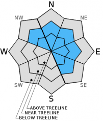
| Mid Slope Winds: | Southwest | North | Northeast |
| Wind Speed: | 15 to 25 mph with gusts to 55 mph | 10 to 20 mph | 10 to 20 mph with gusts to 30 mph |
| Expected snowfall: | 2 to 4 | 4 to 7 | 0 |
For 8000 ft. to 9000 ft.
| Wednesday | Wednesday Night | Thursday | |
|---|---|---|---|
| Weather: | Cloudy with snow in the afternoon. Slight chance of thunderstorms in the afternoon. | Snow with a slight chance of thunderstorms in the evening becoming partly cloudy with a slight chance of snow showers after midnight. | Partly cloudy |
| Temperatures: | 35 to 40 deg F. falling to 25 to 30 deg. F. | 8 to 15 deg. F. | 13 to 20 deg. F. |
| Ridge Top Winds: | Southwest | North | Northeast |
| Wind Speed: | 40 to 45 mph with gusts to 70 mph increasing to 65 to 70 mph with gusts to 105 mph in the afternoon | 35 to 45 mph with gusts to 65 mph | 20 to 30 mph with gusts to 45 mph |
| Expected snowfall: | 2 to 4 | 4 to 8 | 0 |


