THIS AVALANCHE FORECAST EXPIRED ON January 31, 2015 @ 6:49 am
Avalanche Forecast published on January 30, 2015 @ 6:49 am
Issued by Brandon Schwartz - Tahoe National Forest

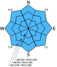
Avalanche danger remains LOW for all elevations and aspects. Small isolated areas of instability may linger in complex or extreme terrain. Normal caution is advised.

1. Low

?

Above Treeline
Generally safe avalanche conditions. Watch for unstable snow on isolated terrain features.

1. Low

?

Near Treeline
Generally safe avalanche conditions. Watch for unstable snow on isolated terrain features.

1. Low

?

Below Treeline
Generally safe avalanche conditions. Watch for unstable snow on isolated terrain features.
    Generally safe avalanche conditions. Watch for unstable snow on isolated terrain features.
Avalanche Problem 1: Normal Caution
  • Type ?
  • Aspect/Elevation ?
  • Likelihood ?
    Certain
    Very Likely
    Likely
    Possible
    Unlikely
  • Size ?
    Historic
    Very Large
    Large
    Small

Small and shallow lingering wind slabs and small amounts of surface wet snow are expected today, neither of which are expected to pose a major hazard to backcountry travelers. The most likely locations to encounter a lingering unstable wind slab is in complex or extreme terrain in the form of couloirs, gullies, and unsupported slopes above cliff bands. Slab size is expected at 6 inches deep or less and only extending a short distance down slope. The most significant associated hazard is the possibility of being pushed into rocks, trees, or over cliffs. Areas of wet snow will be slow to form today due to cloud cover, but an inch or so of wet snow is likely to form during the afternoon hours. If cloud cover clears either slower or faster than forecast, this will affect the amount of surface wet snow that forms today.

recent observations

Observations made yesterday on Rubicon Peak (West Shore Tahoe area) revealed no signs of instability. Snow surface conditions consisted of 0.5 to 2 inches of recent new snow on top of supportable crust. Snow cover was very thin to nonexistent below 7,600' on all aspects. Snowpack depth quickly increased to 3 to 4 feet above 8,000' on NW-N-NE aspects. Old near crust facets are continuing to round and gain strength on northerly aspects in this area with snowpit tests indicating that failure of this layer is unlikely. Very small amounts of surface wet snow were noted at 12:45 pm on flat terrain at 7,500'. Observations made the day prior near Elephant's Back (Carson Pass area) revealed signs of lingering small and shallow wind slabs in recently wind loaded areas.

Weather and CURRENT CONDITIONS
weather summary

Low pressure passing well to the south of the forecast area brought overcast cloud cover to the region last night. As this weather system moves off to the east today, skies are expected to clear from north to south during the afternoon hours. Ridgetop winds will increase in speed out of the northeast this afternoon and tonight, lasting through Saturday. Air temperatures are in the mid 20s to mid 30s this morning across the 6,000' to 10,000' elevation range with minimal inversion. Maximum daytime air temperatures are forecast to reach the upper 30s to low 40s today for areas above 7,000'. For Saturday expect sunny skies, a warming trend at the upper elevations, and strong northeast winds.

CONDITIONS ALONG THE SIERRA CREST BETWEEN 8200 FT. AND 9200 FT. IN THE LAST 24 HOURS
6am temperature: 29 to 33 deg. F.
Max. temperature: 41 to 46 deg. F.
Average ridgetop wind direction: Northeast
Average ridgetop wind speed: 15 mph
Maximum ridgetop wind gust: 24 mph
New snowfall: 0 inches
Total snow depth: 24 to 33 inches
Two-Day Mountain Weather Forecast Produced in partnership with the Reno NWS
For 7000 ft. to 8000 ft.
Friday Friday Night Saturday
Weather: Mostly cloudy skies in the morning, then partly cloudy. Partly cloudy skies, becoming clear. Sunny skies.
Temperatures: 36 to 43 deg. F. 20 to 27 deg. F. 37 to 44 deg. F.
Mid Slope Winds: E NE NE
Wind Speed: 10 to 15 mph with gusts to 25 mph. 20 to 30 mph with gusts to 45 mph. 20 to 30 mph with gusts to 45 mph.
Expected snowfall: 0 0 0
For 8000 ft. to 9000 ft.
Friday Friday Night Saturday
Weather: Mostly cloudy skies in the morning, then partly cloudy. Partly cloudy skies, becoming clear. Sunny skies.
Temperatures: 37 to 43 deg. F. 21 to 28 deg. F. 41 to 47 deg. F.
Ridge Top Winds: E shifting to NE NE NE
Wind Speed: 10 to 15 mph with gusts to 25 mph, shifting and increasing to 25 to 30 mph with gusts to 45 mph in the afternoon. 40 to 50 mph with gusts to 75 mph. 45 to 50 mph with gusts to 75 mph, decreasing to 35 to 40 mph with gusts to 60 mph in the afternoon.
Expected snowfall: 0 0 0
Disclaimer

This avalanche advisory is provided through a partnership between the Tahoe National Forest and the Sierra Avalanche Center. This advisory covers the Central Sierra Nevada Mountains between Yuba Pass on the north and Ebbetts Pass on the south. Click here for a map of the forecast area. This advisory applies only to backcountry areas outside established ski area boundaries. This advisory describes general avalanche conditions and local variations always occur. This advisory expires 24 hours after the posted time unless otherwise noted. The information in this advisory is provided by the USDA Forest Service who is solely responsible for its content.