


For 7000 ft. to 8000 ft.
| Sunday | Sunday Night | Monday | |
|---|---|---|---|
| Weather: | Partly cloudy skies, becoming mostly cloudy. | Mostly cloudy skies with a slight chance of snow in the evening. Snow likely after midnight. | Cloudy skies with snow likely in the morning. Scattered snow showers in the afternoon. |
| Temperatures: | 26 to 33 deg. F. | 9 to 17 deg. F. | 18 to 25 deg. F. |
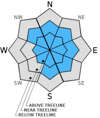
| Mid Slope Winds: | SW | SW | SW shifting to N in the afternoon. |
| Wind Speed: | Light winds becoming 10 to 15 mph in the afternoon. | 15 to 20 mph with gusts to 30 mph. | 10 to 15 mph with gusts to 25 mph. |
| Expected snowfall: | 0 | Up to 2 | 2 to 4 |
For 8000 ft. to 9000 ft.
| Sunday | Sunday Night | Monday | |
|---|---|---|---|
| Weather: | Partly cloudy skies, becoming mostly cloudy. | Mostly cloudy skies with a slight chance of snow in the evening. Snow likely after midnight. | Cloudy skies with snow likely in the morning. Scattered snow showers in the afternoon. |
| Temperatures: | 26 to 33 deg. F. | 7 to 14 deg. F. | 15 to 22 deg. F. |
| Ridge Top Winds: | SW | SW | W shifting to N in the afternoon. |
| Wind Speed: | 15 to 20 mph with gusts to 35 mph. | 20 to 30 mph with gusts to 45 mph. | 20 to 25 mph with gusts up to 40 mph. |
| Expected snowfall: | 0 | Up to 2 | 2 to 4 |


