


For 7000 ft. to 8000 ft.
| Sunday | Sunday Night | Monday | |
|---|---|---|---|
| Weather: | Mostly cloudy skies with scattered snow showers. | Partly cloudy skies, becoming mostly cloudy. | Mostly cloudy skies. |
| Temperatures: | 37 to 44 deg. F. | 25 to 33 deg. F. | 42 to 49 deg. F. |
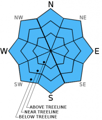
| Mid Slope Winds: | SW | SW | SW |
| Wind Speed: | 30 to 40 mph with gusts to 60 mph. | 20 to 30 mph with gusts to 45 mph. Gusts decreasing to 35 mph after midnight. | 15 to 25 mph with gusts to 35 mph. |
| Expected snowfall: | 0 to 2 | 0 | 0 |
For 8000 ft. to 9000 ft.
| Sunday | Sunday Night | Monday | |
|---|---|---|---|
| Weather: | Mostly cloudy skies with scattered snow showers. | Partly cloudy skies, becoming mostly cloudy. | Mostly cloudy skies. |
| Temperatures: | 34 to 41 deg. F. | 27 to 33 deg. F. | 40 to 47 deg. F. |
| Ridge Top Winds: | SW | SW | SW |
| Wind Speed: | 55 to 60 mph with gusts to 90 mph, decreasing to 45 to 50 mph with gusts to 70 mph in the afternoon. | 30 to 40 mph with gusts to 60 mph. | 25 to 35 mph with gust to 50 mph. Gusts decreasing to 40 mph in the afternoon. |
| Expected snowfall: | 0 to 2 | 0 | 0 |


