THIS AVALANCHE FORECAST EXPIRED ON January 3, 2016 @ 7:00 am
Avalanche Forecast published on January 2, 2016 @ 7:00 am
Issued by Andy Anderson - Tahoe National Forest - Sierra Avalanche Center

The avalanche danger remains LOW on all aspects and elevations. While avalanches remain unlikely, some unstable snow could linger on isolated terrain features. Small isolated avalanches can still have consequences depending on the terrain where they occur. Continue to use normal caution when traveling in the backcountry.

1. Low

?

Above Treeline
Generally safe avalanche conditions. Watch for unstable snow on isolated terrain features.

1. Low

?

Near Treeline
Generally safe avalanche conditions. Watch for unstable snow on isolated terrain features.

1. Low

?

Below Treeline
Generally safe avalanche conditions. Watch for unstable snow on isolated terrain features.
    Generally safe avalanche conditions. Watch for unstable snow on isolated terrain features.
Avalanche Problem 1: Normal Caution
  • Type ?
  • Aspect/Elevation ?
  • Likelihood ?
    Certain
    Very Likely
    Likely
    Possible
    Unlikely
  • Size ?
    Historic
    Very Large
    Large
    Small

Avalanche problems should remain isolated, small, and unlikely again today. Some minor wind slabs may form or linger on some of the upper elevation slopes near ridgelines due to the shifting winds. These wind slabs should remain shallow and not extend very far away from the ridgelines due to a lack of snow available for transport. Some minor sluffing could also still occur on some steep slopes where the snow remains soft and unconsolidated. A wide variety of snow surface conditions exist ranging from soft unconsolidated snow on sheltered near and below treeline NW-N-NE aspects to icy crusts and firm wind scoured surfaces on more exposed near and above treeline slopes to thin sun crusts on sunny SE-S-SW aspects. On the slopes where the exposed icy crusts exist, travel may be difficult and arresting a fall could prove challenging.  

Even though avalanches remain unlikely, continue to practice normal caution and safe travel techniques when traveling in the backcountry. Those techniques include avoiding areas of unstable snow, only exposing one person at a time to avalanche terrain, regrouping in safe spots out of the avalanche path, avoiding terrain traps, and communicating clearly with your partners.

recent observations

Observations since New Year's Eve on Squaw Ridge south of Carson Pass, on Echo Peak near Echo Summit, and on Basin Peak north of Donner Summit have shown wind scoured icy crusts on exposed near and above treeline slopes along the Sierra Crest. East of Lake Tahoe near Ginny Lake in the Mt. Rose backcountry, the exposed near and above treeline slopes hold firm wind scoured snow surfaces without the icy crusts. In all of these areas soft cold snow still exists on the sheltered NW-N-NE aspects and some sheltered slopes facing E and W also held soft snow. Surface hoar has also formed on some of the open northerly facing slopes. Thin sun crusts existed on the SE-S-SW aspects.

Snowpit tests, handpits, probing, ski and snowmobile cuts on test slopes, and other observations have not revealed any signs of instability except for a few very small wind slabs less than 4 inches in depth on some wind loaded NW-W-SW aspects near ridgelines and some minor sluffing on steep sheltered north facing slopes. One party reported triggering one of these small wind slabs on Herlan Peak along the east shore of Lake Tahoe on New Year's Eve. This slab was only 1-4 inches deep and certainly did not involve enough snow to bury a person, but it still carried the skier who triggered it about 50 ft. before he was able to get out of it.

Weather and CURRENT CONDITIONS
weather summary

Cold air settled into the valleys and lower elevations last night keeping temperatures colder at the lower elevations than the higher elevations. Remote sensors between 8000 and 9000 ft. reported temperatures in the teens and low 20's this morning. The forecast calls for daytime highs to remain in the 20's above 7000 ft. today. The winds have shifted to the south and cloud cover should begin to increase this afternoon and tonight ahead of a low pressure system approaching southern CA. Due to the more southerly flow and increased cloud cover temperatures should remain slightly warmer tonight and tomorrow. The forecast calls for daytime highs in the 30's above 7000 ft. tomorrow. 

CONDITIONS ALONG THE SIERRA CREST BETWEEN 8200 FT. AND 9200 FT. IN THE LAST 24 HOURS
6am temperature: 15 to 23 deg. F.
Max. temperature: 18 to 24 deg. F.
Average ridgetop wind direction: East shifting to south last night
Average ridgetop wind speed: Until midnight: 10 to 15 mph | since midnight: 25 to 35 mph
Maximum ridgetop wind gust: 53 mph
New snowfall: trace inches
Total snow depth: 48 to 56 inches
Two-Day Mountain Weather Forecast Produced in partnership with the Reno NWS
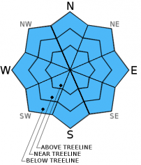
For 7000 ft. to 8000 ft.
Saturday Saturday Night Sunday
Weather: Partly cloudy becoming mostly cloudy Mostly cloudy Mostly cloudy
Temperatures: 23 to 30 deg. F. 19 to 25 deg. F. 30 to 37 deg. F.
Mid Slope Winds: South South Southeast
Wind Speed: 15 to 25 mph with gusts to 30 mph increasing to 40 mph in the afternoon 15 to 25 mph with gusts to 35 mph 20 to 30 mph with gusts to 40 mph
Expected snowfall: 0 0 0
For 8000 ft. to 9000 ft.
Saturday Saturday Night Sunday
Weather: Partly cloudy becoming mostly cloudy Mostly cloudy Mostly cloudy
Temperatures: 22 to 29 deg. F. 16 to 23 deg. F. 28 to 35 deg. F.
Ridge Top Winds: Southwest South South
Wind Speed: 25 to 30 mph with gusts to 50 mph increasing to 35 to 40 mph with gusts to 60 mph in the afternoon 30 to 40 mph with gusts to 60 mph 30 to 40 mph with gusts to 60 mph
Expected snowfall: 0 0 0
Disclaimer

This avalanche advisory is provided through a partnership between the Tahoe National Forest and the Sierra Avalanche Center. This advisory covers the Central Sierra Nevada Mountains between Yuba Pass on the north and Ebbetts Pass on the south. Click here for a map of the forecast area. This advisory applies only to backcountry areas outside established ski area boundaries. This advisory describes general avalanche conditions and local variations always occur. This advisory expires 24 hours after the posted time unless otherwise noted. The information in this advisory is provided by the USDA Forest Service who is solely responsible for its content.