THIS AVALANCHE FORECAST EXPIRED ON March 18, 2016 @ 7:00 am
Avalanche Forecast published on March 17, 2016 @ 7:00 am
Issued by Andy Anderson - Tahoe National Forest - Sierra Avalanche Center

MODERATE avalanche danger will form on sun exposed E-SE-S-SW-W aspects steeper than 35 degrees as wet snow forms on these aspects due to daytime warming. Loose wet snow avalanches including roller balls, pinwheels, and point releases will be possible today. This warming will also weaken the large overhanging cornices that exist on the NW-N-NE-E-SE aspects along exposed ridgelines making it possible for them to fail as well. 

2. Moderate

?

Above Treeline
Heightened avalanche conditions on specific terrain features. Evaluate snow and terrain carefully; identify features of concern.

2. Moderate

?

Near Treeline
Heightened avalanche conditions on specific terrain features. Evaluate snow and terrain carefully; identify features of concern.

2. Moderate

?

Below Treeline
Heightened avalanche conditions on specific terrain features. Evaluate snow and terrain carefully; identify features of concern.
    Heightened avalanche conditions on specific terrain features. Evaluate snow and terrain carefully; identify features of concern.
Avalanche Problem 1: Loose Wet
  • Type ?
  • Aspect/Elevation ?
  • Likelihood ?
    Certain
    Very Likely
    Likely
    Possible
    Unlikely
  • Size ?
    Historic
    Very Large
    Large
    Small

The strong March sunshine and very warm daytime temperatures will cause wet snow to form sun exposed aspects today. These aspects have not been through enough melt freeze cycles for good drainage channels to form through the recent snow or for the recent snow to transition to corn snow. Loose wet snow avalanches will become possible today as wet snow forms in response to daytime warming. Most of these loose wet instabilities should manifest as small roller balls, pinwheels, and point releases, but some of them could entrain enough snow to cause problems for backcountry travelers. 

Sinking into boot-top deep wet snow and smaller surface wet snow instabilities like roller balls and pinwheels indicate that enough wet snow exists for problematic loose wet avalanches. These signs indicate that the time has come to move to more frozen slopes, move to less steep slopes, and/or switch activities for the afternoon. 

Avalanche Problem 2: Cornice
  • Type ?
  • Aspect/Elevation ?
  • Likelihood ?
    Certain
    Very Likely
    Likely
    Possible
    Unlikely
  • Size ?
    Historic
    Very Large
    Large
    Small

Large overhanging cornices formed above many wind loaded slopes along exposed ridgelines during the recent storm. Some of these cornices failed during the storm, and some have broken under the weight of a person or snowmobile since the storm, but many of them still remain perched above wind loaded slopes. Today's warming will weaken these cornices, and they may become easier to break. These cornices could fail well away from their edges and would result in large heavy pieces of dense snow hitting the slopes below them. These large blocks tumbling down a steep slope could easily injure a person. If these cornices do break, they will provide very large triggers for the wind loaded slopes below them and could cause wind slab avalanches on those slopes even though human triggered wind slab avalanches have become unlikely. This wind slab cornice combination would be especially suspect in complex or extreme terrain like couliors or unsupported wind loaded slopes where less well bonded wind slabs may still lurk.  

Identify where cornices exist and stay well back from their edges. Often determining how much a cornice overhangs a slope is difficult, and even when the overhang is visible, they can break behind that point. Giving these large cornices more space than seems necessary represents a wise choice. 

recent observations

Yesterday on Castle Peak in the Donner Summit area and on Fireplug in the Mt. Rose backcountry observations showed a mix of snow surface conditions on the northerly aspects ranging from firm wind packed snow to small areas of shallow cold soft snow to breakable crusts below 8000 ft. Snowpit data and other tests on these aspects did not produce any signs of instability. On the more sun exposed SE-S-SW aspects a mix of thin melt freeze crusts and rain crusts below 7500 ft. existed on the the snow surface. By 1pm on the sun exposed aspects of Fireplug, the snow did soften, and wet sticky snow formed on surface up to at least 9000 ft. Ski cuts on test slopes where this wet snow existed did result in small skier triggered loose wet snow instabilities.

Very large and very overhanging cornices existed above the steep wind loaded slopes on the far east ridge of Tamarack Peak as well as on the north side of Castle Peak. Large cornices have also been reported in the Carson Pass area. 

Weather and CURRENT CONDITIONS
weather summary

Sunny warm weather with light winds should continue over the region today. As the high pressure ridge off the CA coast moves inland during the next few days, temperature should gradually climb. Expect daytime highs today in the upper 40's and low 50's above 7000 ft. and low to mid 50 's tomorrow with below freezing overnight lows. Winds should remain light, and skies should remain clear. 

CONDITIONS ALONG THE SIERRA CREST BETWEEN 8200 FT. AND 9200 FT. IN THE LAST 24 HOURS
6am temperature: 27 to 36 deg. F.
Max. temperature: 46 to 53 deg. F.
Average ridgetop wind direction: Southwest to northeast
Average ridgetop wind speed: 10 mph
Maximum ridgetop wind gust: 20 mph
New snowfall: 0 inches
Total snow depth: 84 to 120 inches
Two-Day Mountain Weather Forecast Produced in partnership with the Reno NWS
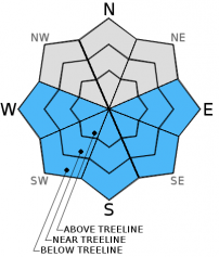
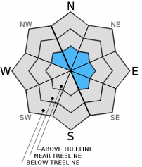
For 7000 ft. to 8000 ft.
Thursday Thursday Night Friday
Weather: Sunny Clear Sunny
Temperatures: 46 to 53 deg. F. 23 to 30 deg. F. 49 to 56 deg. F.
Mid Slope Winds: Variable Variable Variable
Wind Speed: Light Light Light
Expected snowfall: 0 0 0
For 8000 ft. to 9000 ft.
Thursday Thursday Night Friday
Weather: Sunny Clear Sunny
Temperatures: 43 to 50 deg. F. 24 to 31 deg. F. 46 to 53 deg. F.
Ridge Top Winds: Northwest West Southwest
Wind Speed: 10 to 15 mph with gusts to 25 mph in the morning 10 to 15 mph in the evening becoming light 10 to 15 mph
Expected snowfall: 0 0 0
Disclaimer

This avalanche advisory is provided through a partnership between the Tahoe National Forest and the Sierra Avalanche Center. This advisory covers the Central Sierra Nevada Mountains between Yuba Pass on the north and Ebbetts Pass on the south. Click here for a map of the forecast area. This advisory applies only to backcountry areas outside established ski area boundaries. This advisory describes general avalanche conditions and local variations always occur. This advisory expires 24 hours after the posted time unless otherwise noted. The information in this advisory is provided by the USDA Forest Service who is solely responsible for its content.

For a recorded version of the Avalanche Advisory call (530) 587-3558 x258