


For 7000 ft. to 8000 ft.
| Wednesday | Wednesday Night | Thursday | |
|---|---|---|---|
| Weather: | Mostly cloudy skies. | Cloudy skies. A slight chance of snow in the evening, then a chance of snow after midnight. | Cloudy skies, becoming mostly cloudy. Snow, possibly mixing with rain at 7,000' in the afternoon. |
| Temperatures: | 38 to 48 deg. F. | 25 to 30 deg. F. | 30 to 37 deg. F. |
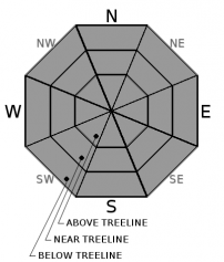
| Mid Slope Winds: | SW | S | S |
| Wind Speed: | 10 to 20 mph with gusts to 35 mph. | 10 to 20 mph with gusts to 35 mph. | 15 to 25 mph with gusts to 40 mph. |
| Expected snowfall: | 0 | Up to 1 | 3 to 5 |
For 8000 ft. to 9000 ft.
| Wednesday | Wednesday Night | Thursday | |
|---|---|---|---|
| Weather: | Mostly cloudy skies. | Cloudy skies. A slight chance of snow in the evening, then a chance of snow after midnight. | Cloudy skies with snow, becoming mostly cloudy. |
| Temperatures: | 32 to 42 deg. F. | 22 ot 27 deg. F. | 27 to 31 deg. F. |
| Ridge Top Winds: | SW | S | SW |
| Wind Speed: | 20 to 30 mph. Gusts to 50 mph increasing to 70 mph. | 20 to 35 mph. Gusts to 70 mph increasing to 85 mph after midnight. | 30 to 45 mph with gusts to 90 mph. |
| Expected snowfall: | 0 | Up to 2 | 5 to 8 |


