


For 7000 ft. to 8000 ft.
| Monday | Monday Night | Tuesday | |
|---|---|---|---|
| Weather: | Cloudy. Rain and snow. | Cloudy. Rain and snow. | Cloudy. Snow. |
| Temperatures: | 37 to 42 deg. F. | 28 to 33 deg. F. | 30 to 35 deg. F. |
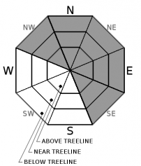
| Mid Slope Winds: | SW | SW | SW |
| Wind Speed: | 20 to 30mph with gusts to 65mph increasing to 25 to 40mph with gusts to 75mph in the afternoon. | 30 to 50mph with gusts to 85mph. | 25 to 40mph. Gusts to 75mph decreasing to 65mph in the afternoon. |
| Expected snowfall: | 8 to 18 | 8 to 16 | 3 to 8 |
For 8000 ft. to 9000 ft.
| Monday | Monday Night | Tuesday | |
|---|---|---|---|
| Weather: | Cloudy. Heavy snow. | Cloudy. Heavy snow. | Cloudy. Snow. |
| Temperatures: | 32 to 37 deg. F. | 25 to 30 deg. F. | 26 to 32 deg. F. |
| Ridge Top Winds: | SW | SW | SW |
| Wind Speed: | 40 to 60mph increasing to 50 to 65mph in the afternoon. Wind gusts up to 130mph. | 45 to 65mph with gusts to 155mph. | 35 to 55mph. Gusts to 130mph decreasing to 115mph in the afternoon. |
| Expected snowfall: | 12 to 24 | 10 to 20 | 4 to 9 |


