


For 7000 ft. to 8000 ft.
| Tuesday | Tuesday Night | Wednesday | |
|---|---|---|---|
| Weather: | Partly cloudy skies. | Partly cloudy skies. | Mostly cloudy skies. |
| Temperatures: | 43 to 48 deg. F. | 23 to 29 deg. F. | 39 to 44 deg. F. |
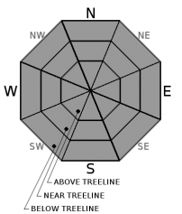
| Mid Slope Winds: | SW | SW | SW |
| Wind Speed: | 10 to 15 mph with gusts to 30 mph. | 10 to 15 mph with gusts to 30 mph. | 15 to 25 mph with gusts to 40 mph. |
| Expected snowfall: | 0 | 0 | 0 |
For 8000 ft. to 9000 ft.
| Tuesday | Tuesday Night | Wednesday | |
|---|---|---|---|
| Weather: | Partly cloudy skies. | Partly cloudy skies. | Mostly cloudy skies. |
| Temperatures: | 41 to 47 deg. F. | 27 to 32 deg. F. | 35 to 41 deg. F. |
| Ridge Top Winds: | SW | SW | SW |
| Wind Speed: | 20 to 35 mph with gusts up to 60 mph. | 20 to 30 mph with gusts to 60 mph. | 20 to 35 mph. Gusts to 60 mph increasing to 80 mph in the afternoon. |
| Expected snowfall: | 0 | 0 | 0 |


