THIS AVALANCHE FORECAST EXPIRED ON February 23, 2014 @ 6:48 am
Avalanche Forecast published on February 22, 2014 @ 6:48 am
Issued by Andy Anderson - Tahoe National Forest - Sierra Avalanche Center

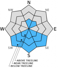
The avalanche danger remains LOW at all elevations and on all aspects. Continue to use normal caution when traveling in the backcountry.

1. Low

?

Above Treeline
Generally safe avalanche conditions. Watch for unstable snow on isolated terrain features.

1. Low

?

Near Treeline
Generally safe avalanche conditions. Watch for unstable snow on isolated terrain features.

1. Low

?

Below Treeline
Generally safe avalanche conditions. Watch for unstable snow on isolated terrain features.
    Generally safe avalanche conditions. Watch for unstable snow on isolated terrain features.
Avalanche Problem 1: Normal Caution
  • Type ?
  • Aspect/Elevation ?
  • Likelihood ?
    Certain
    Very Likely
    Likely
    Possible
    Unlikely
  • Size ?
    Historic
    Very Large
    Large
    Small

Human triggered avalanches remain unlikely. Unlikely does not mean impossible and some unstable snow could still lurk on isolated terrain features. Complex or extreme terrain like unsupported slopes above cliff bands, couliors, etc represent the places where unstable snow could linger in the form of small wind slabs. On the most sun-exposed SE-S-SW aspects a few small isolated wet snow instabilities could also from today. Continue to exercise caution and use best-practice backcountry travel techniques like avoiding terrain traps that magnifiy the consequences of small avalanches.

recent observations

Yesterday on Red Lake Peak, a variety of wind packed, wind affected, and wind scoured snow surfaces existed on near and above treeline E-NE-N aspects. In some places hard wind slabs up to 18 inches thick still remained on the N-NE aspects. Softer snow existed on the more sheltered northerly aspects. Snowpit tests, ski cuts on wind loaded test slopes, hand pits, and general observations did not reveal signs of instability in these areas.

On the more sun-exposed SE-S-SW aspects of Red Lake Peak, 1-2 inches of soft melt-freeze snow (aka "corn") had formed on the surface up to 9800 ft. by 1-2 pm. Below this shallow layer of soft wet snow frozen and supportable melt-freeze snow existed. Ski cuts on steep sun-exposed test slopes did not trigger any wet snow instabilities.

Weather and CURRENT CONDITIONS
weather summary

Sunny, warm, and dry weather should prevail over the region through early next week due to a high pressure ridge parked on top of the area.  For this weekend expect daytime highs in the 40's above 7000 ft. and light south to southwest winds. Tonight temperatures should drop into the upper 20's to low 30's under clear skies. 

CONDITIONS ALONG THE SIERRA CREST BETWEEN 8200 FT. AND 9200 FT. IN THE LAST 24 HOURS
6am temperature: 24 to 32 deg. F.
Max. temperature: 37 to 46 deg. F.
Average ridgetop wind direction: Shifting between NE and SW
Average ridgetop wind speed: 5 to 10 mph
Maximum ridgetop wind gust: 20 mph
New snowfall: 0 inches
Total snow depth: 37 to 46 inches
Two-Day Mountain Weather Forecast Produced in partnership with the Reno NWS
For 7000 ft. to 8000 ft.
Saturday Saturday Night Sunday
Weather: Sunny Clear Sunny
Temperatures: 39 to 46 deg. F. 24 to 30 deg. F. 40 to 47 deg. F.
Mid Slope Winds: West Variable Southwest
Wind Speed: 10 to 15 mph in the morning becoming light in the afternoon Light Light winds in the morning increasing to 10 to 15 mph in the afternoon
Expected snowfall: 0 0 0
For 8000 ft. to 9000 ft.
Saturday Saturday Night Sunday
Weather: Sunny Clear Sunny
Temperatures: 35 to 42 deg. F. 25 to 31 deg. F. 36 to 43 deg. F.
Ridge Top Winds: West South Southwest
Wind Speed: 15 to 20 mph with gusts to 30 mph in the morning becoming light in the afternoon Light winds increasing to 10 to 15 mph after midnight 10 to 15 mph with gusts to 25 mph in the afternoon
Expected snowfall: 0 0 0
Disclaimer

This avalanche advisory is provided through a partnership between the Tahoe National Forest and the Sierra Avalanche Center. This advisory covers the Central Sierra Nevada Mountains between Yuba Pass on the north and Ebbetts Pass on the south. Click here for a map of the forecast area. This advisory applies only to backcountry areas outside established ski area boundaries. This advisory describes general avalanche conditions and local variations always occur. This advisory expires 24 hours after the posted time unless otherwise noted. The information in this advisory is provided by the USDA Forest Service who is solely responsible for its content.