


For 7000 ft. to 8000 ft.
| Sunday | Sunday Night | Monday | |
|---|---|---|---|
| Weather: | Cloudy skies with isolated showers. | Cloudy skies with scattered rain showers, changing to snow after midnight. | Cloudy skies becoming mostly cloudy. Snow in the morning. A chance of snow showers in the afternoon. |
| Temperatures: | 44 to 50 deg. F. | 28 to 32 deg. F. | 32 to 40 deg. F. |
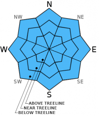
| Mid Slope Winds: | Southwest | Southwest | Southwest |
| Wind Speed: | 15 to 25 mph with gusts to 40 mph. | 30 to 40 mph with gusts to 60 mph. | 25 to 35 mph with gusts to 55 mph. |
| Expected snowfall: | 0 | Up to 1 | 1 to 3 |
For 8000 ft. to 9000 ft.
| Sunday | Sunday Night | Monday | |
|---|---|---|---|
| Weather: | Cloudy skies with isolated showers. | Cloudy skies with scattered snow showers. | Cloudy skies becoming mostly cloudy. Snow in the morning. A chance of snow showers in the afternoon. |
| Temperatures: | 37 to 44 deg. F. | 25 to 31 deg. F. | 28 to 34 deg. F. |
| Ridge Top Winds: | Southwest | Southwest | Southwest |
| Wind Speed: | 50 to 55 mph with gusts to 80 mph. | 50 to 55 mph with gusts to 80 mph, increasing to 60 to 65 mph with gusts to 90 mph after midnight. | 55 to 60 mph with gusts to 90 mph, decreasing to 45 to 50 mph with gusts to 75 mph in the afternoon. |
| Expected snowfall: | 0 to trace | Up to 1 | 1 to 4 |


