


For 7000 ft. to 8000 ft.
| Tuesday | Tuesday Night | Wednesday | |
|---|---|---|---|
| Weather: | Mostly cloudy becoming partly cloudy this afternoon. Slight chance of rain showers this afternoon. | Partly cloudy | Partly cloudy with a slight chance of rain showers and thunderstorms in the afternoon |
| Temperatures: | 44 to 51 deg. F. | 26 to 33 deg. F. | 44 to 51 deg. F. |
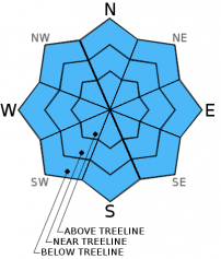
| Mid Slope Winds: | Southwest | Northwest | Variable |
| Wind Speed: | 15 to 20 mph with gusts to 30 mph | 10 to 15 mph with gusts to 25 mph in the evening becoming light over night | Light |
| Expected snowfall: | 0 | 0 | 0 |
For 8000 ft. to 9000 ft.
| Tuesday | Tuesday Night | Wednesday | |
|---|---|---|---|
| Weather: | Mostly cloudy becoming partly cloudy this afternoon. Slight chance of rain showers this afternoon. | Partly cloudy | Partly cloudy with a slight chance of rain showers and thunderstorms in the afternoon |
| Temperatures: | 43 to 49 deg. F. | 24 to 31 deg. F. | 44 to 50 deg. F. |
| Ridge Top Winds: | Southwest | Northwest shifting to the northeast after midnight | East |
| Wind Speed: | 30 to 35 mph with gusts to 50 mph decreasing to 20 to 25 mph with gusts to 40 mph in the afternoon | 15 to 20 mph with gusts to 30 mph | 10 to 15 mph in the morning becoming light in the afternoon |
| Expected snowfall: | 0 | 0 | 0 |


