


For 7000 ft. to 8000 ft.
| Monday | Monday Night | Tuesday | |
|---|---|---|---|
| Weather: | Mostly cloudy. Slight chance of showers. | Cloudy. Chance of showers in the evening, then showers likely after midnight. | Cloudy. Showers through the day. Slight chance of thunderstorms through the day. |
| Temperatures: | 47 to 53 deg. F. | 32 to 37 deg. F. | 35 to 42 deg. F. |
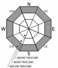
| Mid Slope Winds: | S | SW | S |
| Wind Speed: | 15 to 25mph with gusts to 55mph. | 15 to 25mph. Gusts up to 45mph increasing to 60mph after midnight. | 20 to 30mph with gusts to 40mph. |
| Expected snowfall: | 0 | Trace | Up to 2 |
For 8000 ft. to 9000 ft.
| Monday | Monday Night | Tuesday | |
|---|---|---|---|
| Weather: | Mostly cloudy. | Cloudy. Chance of showers in the evening, then showers likely after midnight. | Cloudy. Snow showers in the morning, then snow showers and slight chance of thunderstorms in the afternoon. |
| Temperatures: | 41 to 49 deg. F. | 31 to 37 deg. F. | 28 to 35 deg. F. |
| Ridge Top Winds: | S | SW | SW |
| Wind Speed: | 30 to 40mph with gusts to 70mph. | 30 to 40mph with gusts to 80mph. | 30 to 50mph with gusts to 80mph. |
| Expected snowfall: | 0 | Up to 2 | 2 to 8 |


