The last avalanche forecast for the 2023-2024 season posted on April 21st. Thank you to all who contributed to the avalanche center this season through observations, volunteer time, and/or financial contributions.
In partnership with: 
The last avalanche forecast for the 2023-2024 season posted on April 21st. Thank you to all who contributed to the avalanche center this season through observations, volunteer time, and/or financial contributions.
| Date and time of observation or avalanche occurrence | Location | Media | Observation made by |
|---|---|---|---|
|
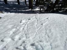
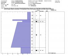
04/19/2019 - 10:30 Snowpack Observation |
Yuba Pass Yuba Pass Area |
    |
Forecaster |
|
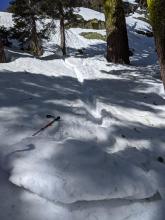
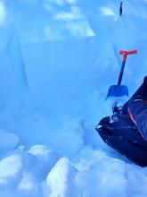
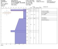
12/01/2022 - 12:00 Avalanche Observation |
Lincoln Ridge Yuba Pass Area |
|
Forecaster |
|
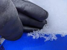
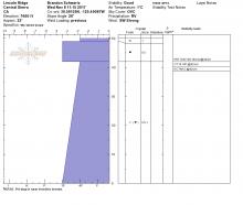
03/27/2017 - 10:30 Snowpack Observation |
Lincoln Ridge Yuba Pass Area |
   |
Forecaster |
|
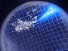
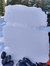
11/22/2020 - 11:00 Snowpack Observation |
Lincoln Ridge Yuba Pass Area |
     |
Forecaster |
|
04/12/2020 - 11:00 Snowpack Observation |
Yuba Pass Yuba Pass Area |
       |
Forecaster |
|
11/08/2017 - 11:15 Snowpack Observation |
Lincoln Ridge Yuba Pass Area |
    |
Forecaster |
|
12/29/2009 - 10:50 Snowpack Observation |
Lincoln Ridge Yuba Pass Area |
 |
Forecaster |
|
02/09/2023 - 11:30 Snowpack Observation |
Yuba Pass Yuba Pass Area |
   |
Forecaster |
|
12/30/2011 - 10:30 Snowpack Observation |
Lincoln Ridge Yuba Pass Area |
|
Forecaster |
|
12/23/2018 - 11:00 Snowpack Observation |
Peak 8040' Yuba Pass Area |
   |
Forecaster |
|
01/04/2020 - 12:00 Snowpack Observation |
Lincoln Ridge Yuba Pass Area |
  |
Forecaster |
|
03/08/2019 - 11:15 Snowpack Observation |
Lincoln Ridge Yuba Pass Area |
  |
Forecaster |
|
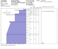
03/19/2022 - 13:00 Snowpack Observation |
Lincoln Ridge Yuba Pass Area |
       |
Forecaster |
|
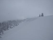
01/09/2022 - 11:15 Snowpack Observation |
Lincoln Ridge Yuba Pass Area |
      |
Forecaster |
|
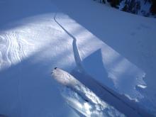
03/31/2020 - 11:00 Avalanche Observation |
Lincoln Ridge Yuba Pass Area |
|
Forecaster |


This website is owned and maintained by the non-profit arm of the Sierra Avalanche Center. Some of the content is updated by the USDA avalanche forecasters including the forecasts and some observational data. The USDA is not responsible for any advertising, fund-raising events/information, or sponsorship information, or other content not related to the forecasts and the data pertaining to the forecasts.