

The last avalanche forecast for the 2023-2024 season will post on April 21st. Thank you to all who contributed to the avalanche center this season through observations, volunteer time, and/or financial contributions.
In partnership with: 
The last avalanche forecast for the 2023-2024 season will post on April 21st. Thank you to all who contributed to the avalanche center this season through observations, volunteer time, and/or financial contributions.
| Date and time of observation or avalanche occurrence | Location | Media | Observation made by |
|---|---|---|---|
|
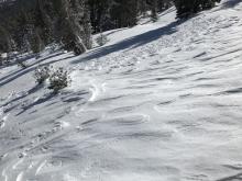
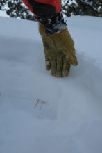
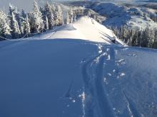
12/27/2019 - 12:00 Snowpack Observation |
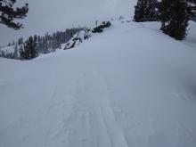
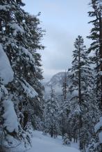
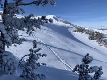
Meiss Carson Pass Area |
     |
Professional Observer |
|
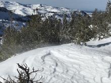
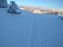
12/27/2019 - 11:45 Snowpack Observation |
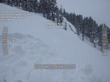
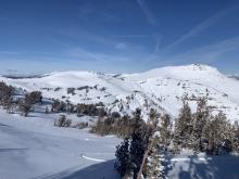
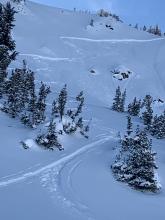
Silver Peak Cabin Creek, Deep Creek, or Pole Creek Area |
      |
Forecaster |
|
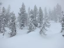
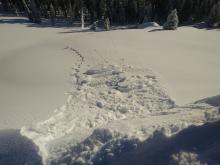
12/27/2019 - 11:30 Snowpack Observation |
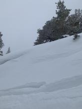
Rubicon Peak West Shore Area |
   |
Professional Observer |
|
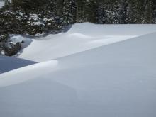
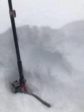
12/27/2019 - 10:15 Snowpack Observation |
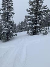
Mt. Reba Bear Valley Area |
Public | |
|
12/26/2019 - 12:00 Snowpack Observation |
Indian Valley Ebbetts Pass Area |
   |
Professional Observer |
|
12/26/2019 - 12:00 Snowpack Observation |
Little Round Top Carson Pass Area |
      |
Public |
|
12/26/2019 - 11:00 Snowpack Observation |
Silver Peak Cabin Creek, Deep Creek, or Pole Creek Area |
    |
Forecaster |
|
12/26/2019 - 10:30 Snowpack Observation |
Blue Lakes Carson Pass Area |
  |
Public |
|
12/26/2019 - 08:00 Snowpack Observation |
Luther Pass Luther Pass Area (including Job and Freel) |
   |
Professional Observer |
|
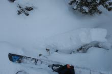
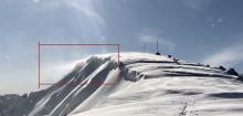
12/24/2019 - 12:00 Avalanche Observation |
Red Lake Peak Carson Pass Area |
   |
Educator Lake Tahoe Community College - Wilderness Educati |
|
12/24/2019 - 10:30 Snowpack Observation |
National Geographic Bowl Cabin Creek, Deep Creek, or Pole Creek Area |
  |
Guide Alpenglow Expeditio |
|
12/24/2019 - 10:00 Snowpack Observation |
Mt. Judah Donner Summit Area |
 |
Public |
|
12/24/2019 - 07:45 Snowpack Observation |
Mt. Judah Donner Summit Area |
    |
Forecaster |
|
12/23/2019 - 14:15 Snowpack Observation |
Rubicon West Shore Area |
  |
Public |
|
12/23/2019 - 13:30 Snowpack Observation |
South of Webber lake, near the grills Independence Lake Area |
Public |


This website is owned and maintained by the non-profit arm of the Sierra Avalanche Center. Some of the content is updated by the USDA avalanche forecasters including the forecasts and some observational data. The USDA is not responsible for any advertising, fund-raising events/information, or sponsorship information, or other content not related to the forecasts and the data pertaining to the forecasts.