

The last avalanche forecast for the 2023-2024 season will post on April 21st. Thank you to all who contributed to the avalanche center this season through observations, volunteer time, and/or financial contributions.
In partnership with: 
The last avalanche forecast for the 2023-2024 season will post on April 21st. Thank you to all who contributed to the avalanche center this season through observations, volunteer time, and/or financial contributions.
| Date and time of observation or avalanche occurrence | Location | Media | Observation made by |
|---|---|---|---|
|
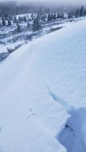
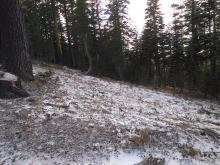
12/01/2019 - 10:00 Snowpack Observation |
West Grouse Blackwood Canyon or Ward Canyon Area |
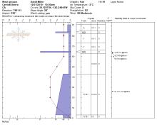 |
Public |
|
11/30/2019 - 15:45 Snowpack Observation |
Tahoma West Shore Area |
 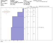 |
Public |
|
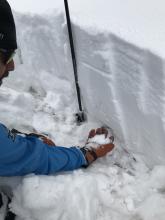
11/30/2019 - 13:30 Snowpack Observation |
Hour glass Mount Rose Area |
Guide Alpine Skills International (AS |
|
|
11/30/2019 - 12:15 Snowpack Observation |
Elephant's Back Carson Pass Area |
    |
Professional Observer |
|
11/29/2019 - 10:30 Snowpack Observation |
Tamarack PK Mount Rose Area |
 |
Public |
|
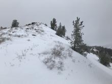
11/29/2019 - 09:30 Snowpack Observation |
Frog Lake Carson Pass Area |
    |
Educator Lake Tahoe Community College - Wilderness Educati |
|
11/28/2019 - 07:30 Snowpack Observation |
Donner ridge. Donner Summit Area |
  |
Public |
|
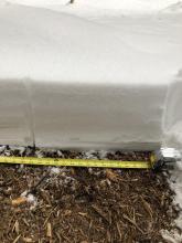
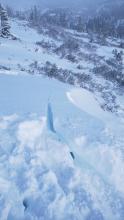
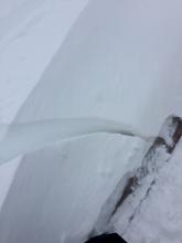
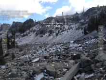
11/27/2019 - 11:30 Avalanche Observation |
East Ridge Tamarack Peak Mount Rose Area |
  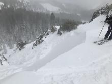 |
Professional Observer |
|
11/27/2019 - 10:15 Snowpack Observation |
Ward Canyon Blackwood Canyon or Ward Canyon Area |
  |
Guide Tahoe Mountain Scho |
|
11/27/2019 - 10:00 Snowpack Observation |
Tamarack Peak Mount Rose Area |
 |
Public |
|
11/26/2019 - 10:00 Snowpack Observation |
Spooner Summit/White Hill East Shore Area |
    |
Forecaster |
|
11/25/2019 - 11:30 Snowpack Observation |
Incline Lake Peak Mount Rose Area |
    |
Forecaster |
|
11/23/2019 - 15:00 Snowpack Observation |
Chickadee Ridge Mount Rose Area |
Public | |
|
11/22/2019 - 12:00 Snowpack Observation |
Round Top Carson Pass Area |
    |
Professional Observer |
|
11/21/2019 - 14:30 Snowpack Observation |
Barker Pass Mount Rose Area |
  |
Forecaster |


This website is owned and maintained by the non-profit arm of the Sierra Avalanche Center. Some of the content is updated by the USDA avalanche forecasters including the forecasts and some observational data. The USDA is not responsible for any advertising, fund-raising events/information, or sponsorship information, or other content not related to the forecasts and the data pertaining to the forecasts.