THIS AVALANCHE FORECAST EXPIRED ON December 19, 2013 @ 7:00 am
Avalanche Forecast published on December 18, 2013 @ 7:00 am
Issued by Andy Anderson - Tahoe National Forest - Sierra Avalanche Center

MODERATE avalanche danger still persists on near treeline and below treeline NW-N-NE aspects on slopes 32 degrees and steeper due to lingering persistent slabs.

Human triggered avalanches remain possible. Due to the shallow snowpack any avalanches that do occur would drag people through and into obstacles like rocks, stumps, and other hard immobile obstacles.

1. Low

?

Above Treeline
Generally safe avalanche conditions. Watch for unstable snow on isolated terrain features.

2. Moderate

?

Near Treeline
Heightened avalanche conditions on specific terrain features. Evaluate snow and terrain carefully; identify features of concern.

2. Moderate

?

Below Treeline
Heightened avalanche conditions on specific terrain features. Evaluate snow and terrain carefully; identify features of concern.
    Heightened avalanche conditions on specific terrain features. Evaluate snow and terrain carefully; identify features of concern.
Avalanche Problem 1: Persistent Slab
  • Type ?
  • Aspect/Elevation ?
  • Likelihood ?
    Certain
    Very Likely
    Likely
    Possible
    Unlikely
  • Size ?
    Historic
    Very Large
    Large
    Small

A persistent weak layer (the Dec. 7th facets) with a slab layer above it still exists on near and below treeline NW-N-NE aspects. Human triggered avalanche activity remains possible on these slopes. People can trigger these kind of persistent slabs remotely while standing in low angle terrain or on ridgelines or anywhere that the snowpack under their feet connects to steeper and/or deeper terrain because fractures can travel through the persistent weak layer. 

Any of these avalanches that do occur would drag a person through rocks, stumps, trees, and other obstacles because of the shallow snowpack and the fact that the near and below treeline terrain holds the most unstable snow.

recent observations

Yesterday near Red Lake in the Carson Pass area (photos, videos, snowpit, more info), widespread whumpfing and collapsing continued to occur as the layer of weak sugary snow (Dec. 7th facets) near the bottom of the snowpack broke under the weight of a person on the slope. The more recent snow above has warmed and consolidated into a more cohesive slab layer. In addition to the collapsing and whumfing, snowpit tests also indicated that the current snowpack structure remains unstable and that fractures can travel along the Dec. 7th facets. Yesterday's data came from a spot where previous observations (on 12/12 and 12/9) also showed similar signs of instability. These three observations indicate a very persistent weak snowpack in which the weak layer is NOT gaining much if any strength.

Barely covered rocks, stumps, logs, and other hard, immobile, season-ending, equipment-breaking objects still exist on all slopes. The shallow snowpack does not have enough structure or strength to keep a person above all these things. It only camouflages their existence.

Weather and CURRENT CONDITIONS
weather summary

Cloud cover and the SW winds have started to increase ahead of an approaching cold front. Both should continue to increase today. Tonight the winds should shift to the W and decrease some. As the cold front arrives early tomorrow morning, the winds should begin shifting to the NE and increasing. The arrival and passage of this front tomorrow morning should also bring some snow to the region. With the system approaching from the NE, snowfall should start in the north and move south over the course of the morning. The forecast calls for 2-5 inches of accumulation above 7000 ft. by tomorrow afternoon. By the end of the day tomorrow snowfall should taper off and cloud cover should decrease as the system departs leaving behind colder weather. Check out the Reno NWS for more details. 

CONDITIONS ALONG THE SIERRA CREST BETWEEN 8200 FT. AND 9200 FT. IN THE LAST 24 HOURS
6am temperature: 36 to 42 deg. F.
Max. temperature: 47 to 52 deg. F.
Average ridgetop wind direction: Southwest
Average ridgetop wind speed: 20 to 25 mph
Maximum ridgetop wind gust: 43 mph
New snowfall: 0 inches
Total snow depth: 7 to 16 inches
Two-Day Mountain Weather Forecast Produced in partnership with the Reno NWS
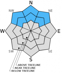
For 7000 ft. to 8000 ft.
Wednesday Wednesday Night Thursday
Weather: Mostly Cloudy Cloudy with snow becoming likely after midnight Cloudy with snow in the morning. Snow and clouds decreasing in the afternoon
Temperatures: 39 to 46 deg. F. 14 to 21 deg. F. 17 to 24 deg. F.
Mid Slope Winds: Southwest West Northeast
Wind Speed: 15-20 mph with gusts to 30 mph increasing to 20-30 mph with gusts to 40 mph in the afternoon 15-20 mph with gusts to 35 mph 15-20 mph with gusts to 30 mph increasing to 20-30 mph with gusts to 40 mph in the afternoon
Expected snowfall: 0 up to 1 2-5
For 8000 ft. to 9000 ft.
Wednesday Wednesday Night Thursday
Weather: Mostly Cloudy Cloudy with snow becoming likely after midnight Cloudy with snow in the morning. Snow and clouds decreasing in the afternoon
Temperatures: 40 to 46 deg. F. 15 to 21 deg. F. 17 to 23 deg. F.
Ridge Top Winds: Southwest Southwest shifting to the West after midnight Northeast
Wind Speed: 30-40 mph with gusts to 50 mph increasing to gusts to 60 mph in the afternoon 35-40 mph with gusts to 60 mph decreasing to 25-30 mph with gusts to 40 mph after midnight 25-30 mph with gusts to 45 mph increasing to 30-40 mph with gusts to 60 mph in the afternoon
Expected snowfall: 0 up to 1 2-5
Disclaimer

This avalanche advisory is provided through a partnership between the Tahoe National Forest and the Sierra Avalanche Center. This advisory covers the Central Sierra Nevada Mountains between Yuba Pass on the north and Ebbetts Pass on the south. Click here for a map of the forecast area. This advisory applies only to backcountry areas outside established ski area boundaries. This advisory describes general avalanche conditions and local variations always occur. This advisory expires 24 hours after the posted time unless otherwise noted. The information in this advisory is provided by the USDA Forest Service who is solely responsible for its content.