


For 7000 ft. to 8000 ft.
| Friday | Friday Night | Saturday | |
|---|---|---|---|
| Weather: | Mostly cloudy skies. | Mostly cloudy skies. | Mostly cloudy skies with a slight chance of snow showers in the morning. Snow likely in the afternoon. |
| Temperatures: | 45 to 50 deg. F. | 30 to 35 deg. F. | 33 to 38 deg. F. |
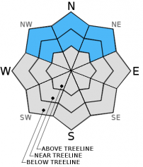
| Mid Slope Winds: | West | West | Southwest |
| Wind Speed: | 10 to 20 mph with gusts to 30 mph. | 10 to 20 mph with gusts to 30 mph, increasing to 25 to 40 mph with gusts to 60 mph after midnight. | 30 to 45 mph with gusts to 75 mph. |
| Expected snowfall: | 0 | 0 | 1 to 5 |
For 8000 ft. to 9000 ft.
| Friday | Friday Night | Saturday | |
|---|---|---|---|
| Weather: | Mostly cloudy skies. | Mostly cloudy skies. | Mostly cloudy skies with a slight chance of snow showers in the morning. Snow likely in the afternoon. |
| Temperatures: | 41 to 47 deg. F. | 28 to 33 deg. F. | 30 to 35 deg. F. |
| Ridge Top Winds: | Northwest | West | Southwest |
| Wind Speed: | 30 to 45 mph with gusts to 70 mph. | 40 to 50 mph with gusts to 80 mph. | 45 to 60 mph with gusts to 95 mph, increasing to 55 to 70 mph with gusts to 105 mph in the afternoon. |
| Expected snowfall: | 0 | 0 | 1 to 5 |


