THIS AVALANCHE FORECAST EXPIRED ON February 10, 2014 @ 6:19 am
Avalanche Forecast published on February 9, 2014 @ 6:19 am
Issued by Brandon Schwartz - Tahoe National Forest

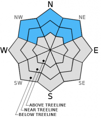
Near treeline and above treeline, avalanche danger remains HIGH on NW-N-NE-E-SE aspects on slopes 32 degrees and steeper. For all other areas, avalanche danger is CONSIDERABLE on slopes 32 degrees and steeper. Wind slab, storm slab, and deep persistent slab avalanches are all possible today.

4. High

?

Above Treeline
Very dangerous avalanche conditions. Travel in avalanche terrain not recommended.

4. High

?

Near Treeline
Very dangerous avalanche conditions. Travel in avalanche terrain not recommended.

3. Considerable

?

Below Treeline
Dangerous avalanche conditions. Careful snowpack evaluation, cautious route-finding and conservative decision-making essential.
    Very dangerous avalanche conditions. Travel in avalanche terrain not recommended.
Avalanche Problem 1: Wind Slab
  • Type ?
  • Aspect/Elevation ?
  • Likelihood ?
    Certain
    Very Likely
    Likely
    Possible
    Unlikely
  • Size ?
    Historic
    Very Large
    Large
    Small

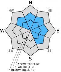
Wind slabs continue to build in size. Additional new snow and wind transport over the past 24 hours has further increased the size of already unstable wind slabs that have built over the past several days. Winds slabs 2 to 6+ feet thick now exist near treeline and above treeline on NW-N-NE-E-SE aspects. Large destructive avalanches remain possible today.

Avalanche Problem 2: Storm Slab
  • Type ?
  • Aspect/Elevation ?
  • Likelihood ?
    Certain
    Very Likely
    Likely
    Possible
    Unlikely
  • Size ?
    Historic
    Very Large
    Large
    Small

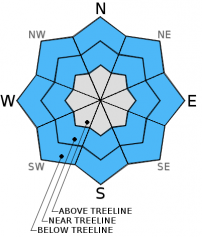
In wind protected areas near treeline and below treeline, new snow continues to load on top of weak layers of near crust facets and lower density storm snow that exist between the Jan 30 rain crust and the snow surface. Some of these avalanches could be large and destructive and occur on any aspect in near treeline or below treeline terrain.

Avalanche Problem 3: Deep Slab
  • Type ?
  • Aspect/Elevation ?
  • Likelihood ?
    Certain
    Very Likely
    Likely
    Possible
    Unlikely
  • Size ?
    Historic
    Very Large
    Large
    Small

In areas above 9,500' deep persistent slabs linger near treeline and below treeline on NW-N-NE aspects. Weak layers of well developed facets and depth hoar remain buried in the snowpack in these areas and were not destroyed by rain on January 28 and 29. The likelihood of failure of these basal facets will increase as this storm cycle progresses and additional new snow load stresses the snowpack above these weak layers. Locations that are both above 9,500' and near treeline or below treeline terrain represent only a small portion of the forecast area, keeping this problem isolated in distribution.

recent observations

Observations made yesterday near the Blue Lakes Road (Carson Pass area) and below Andesite Ridge (Donner Summit area) revealed unstable wind slabs and storm slabs. Near the Blue Lakes Road, near treeline and below treeline terrain with good to moderate wind protection revealed wind slabs and storm slabs up to 1.5 feet deep with cracking occurring in response to snowmobile slope cuts. Snowpit data collected in below treeline terrain on a N aspect at 8,200' revealed very repeatable storm slab propagation. The weak layer in the snowpit data and in many other areas was lower density storm snow below higher density storm snow. Below Andesite Ridge, close to the Castle Peak Road, widespread skier triggered whumphing and cracking was observed in low angle terrain below treeline on flat to NE aspects. In both areas, all snowpack instability was observed to occur above the prominent January 30 rain crust.

Weather and CURRENT CONDITIONS
weather summary

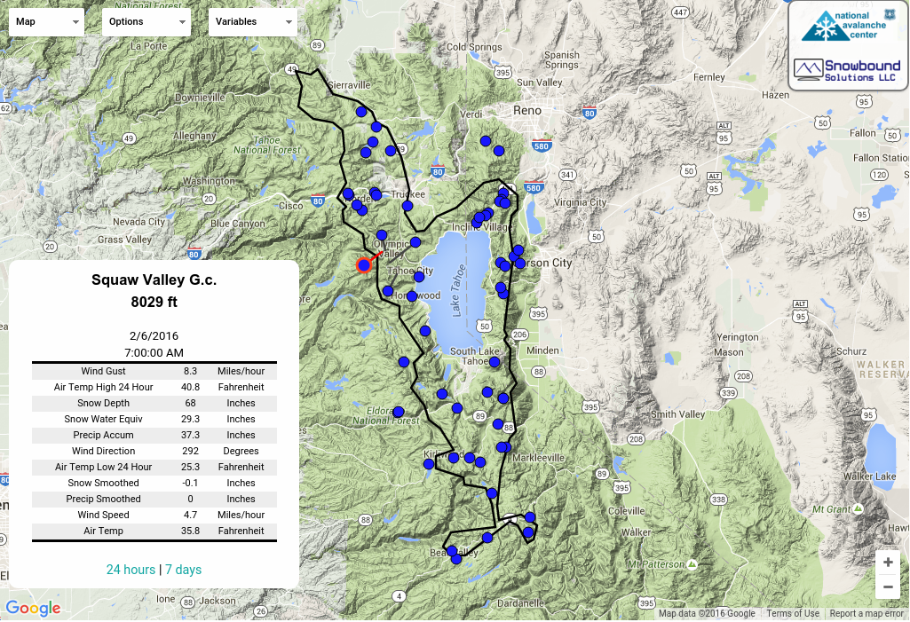
The strong pacific storm system that has impacted the forecast area for the past two days will continue to bring high intensity precipitation through tonight. Snow levels have remained below forecast elevations, holding at 7,100' to 7,300' through the day yesterday. Snow levels lowered slightly last night, down to around 6,500'. Snow level is forecast to hold between 6,200' and 7,000' today. Thus far, 2 to 4 feet of new snow has accumulated above 7,000' to 7,500'. In most places above 7,800', the snowpack depth has more than doubled during this storm cycle. Additional snowfall accumulation for the next 24 hours is forecast at 1 to 2 feet between 7,000' and 8,000' and 2 to 4 feet above 8,000'. Ridgetop winds have remained strong out of the southwest for the past 48 hours and will continue into tonight, decreasing in speed before sunrise tomorrow.

CONDITIONS ALONG THE SIERRA CREST BETWEEN 8200 FT. AND 9200 FT. IN THE LAST 24 HOURS
6am temperature: 30 to 34 deg. F.
Max. temperature: 30 to 34 deg. F.
Average ridgetop wind direction: Southwest
Average ridgetop wind speed: 39 mph
Maximum ridgetop wind gust: 68 mph
New snowfall: 18 to 28 inches
Total snow depth: 33 to 55 inches
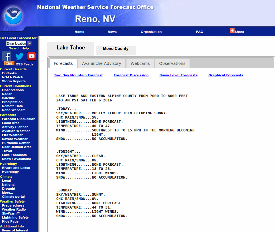
Two-Day Mountain Weather Forecast Produced in partnership with the Reno NWS
For 7000 ft. to 8000 ft.
Sunday Sunday Night Monday
Weather: Cloudy skies with snow. Cloudy skies with snow. Mostly cloudy skies with a chance of snow.
Temperatures: 25 to 30 deg. F. 24 to 28 deg. F. 30 to 35 deg. F.
Mid Slope Winds: Southwest Southwest Southwest
Wind Speed: 15 to 25 mph with gusts to 40 mph. 10 to 20 mph with gusts to 35 mph. 10 to 15 mph, becoming light.
Expected snowfall: 6 to 18 4 to 10 Trace to 2
For 8000 ft. to 9000 ft.
Sunday Sunday Night Monday
Weather: Cloudy skies with snow. Cloudy skies with snow. Mostly cloud skies with a chance of snow.
Temperatures: 25 to 30 deg. F. 21 to 26 deg. F. 24 to 30 deg. F.
Ridge Top Winds: Southwest Southwest South
Wind Speed: 35 to 50 mph. Gusts 60 to 70 mph. 30 to 45 mph with gusts to 65 mph, decreasing to 15 to 30 mph with gusts to 40 mph after midnight. 15 to 25 mph with gusts to 40 mph.
Expected snowfall: 8 to 24 6 to 10 Trace to 2
Disclaimer

This avalanche advisory is provided through a partnership between the Tahoe National Forest and the Sierra Avalanche Center. This advisory covers the Central Sierra Nevada Mountains between Yuba Pass on the north and Ebbetts Pass on the south. Click here for a map of the forecast area. This advisory applies only to backcountry areas outside established ski area boundaries. This advisory describes general avalanche conditions and local variations always occur. This advisory expires 24 hours after the posted time unless otherwise noted. The information in this advisory is provided by the USDA Forest Service who is solely responsible for its content.