


For 7000 ft. to 8000 ft.
| Thursday | Thursday Night | Friday | |
|---|---|---|---|
| Weather: | Partly cloudy skies becoming mostly cloudy. Isolated snow showers in the afternoon. | Cloudy skies with isolated snow showers. | Cloudy skies with scattered snow showers. |
| Temperatures: | 33 to 40 deg. F. | 16 to 23 deg. F. | 27 to 34 deg. F. |
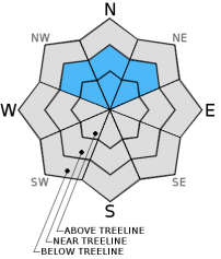
| Mid Slope Winds: | Southwest | Southwest | West |
| Wind Speed: | Light winds increasing to 10 to 15 mph in the afternoon. | 10 to 15 mph with gusts to 25 mph in the evening, becoming light. | 10 to 15 mph. Gusts up to 25 mph in the afternoon. |
| Expected snowfall: | 0 to trace | 0 to trace | Trace to 2 |
For 8000 ft. to 9000 ft.
| Thursday | Thursday Night | Friday | |
|---|---|---|---|
| Weather: | Partly cloudy skies becoming mostly cloudy. Isolated snow showers in the afternoon. | Cloudy skies with isolated snow showers. | Cloudy skies with scattered snow showers. |
| Temperatures: | 29 to 35 deg. F. | 12 to 19 deg. F. | 25 to 31 deg. F. |
| Ridge Top Winds: | Southwest | Southwest | West |
| Wind Speed: | Light winds increasing to 10 to 15 mph with gusts to 25 mph in the afternoon. | 15 to 20 mph. Gusts to 35 mph decreasing to 25 mph after midnight. | 15 to 20 mph with gusts to 30 mph. |
| Expected snowfall: | 0 to trace | 0 to trace | Trace to 2 |


