


For 7000 ft. to 8000 ft.
| Thursday | Thursday Night | Friday | |
|---|---|---|---|
| Weather: | Sunny skies becoming partly cloudy. | Partly cloudy skies. | Partly cloudy skies becoming mostly cloudy. A slight chance of thunderstorms in the afternoon. |
| Temperatures: | 55 to 62 deg. F. | 27 to 34 deg. F. | 53 to 60 deg. F. |
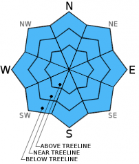
| Mid Slope Winds: | Southwest | Southwest | Southwest |
| Wind Speed: | Light winds | Light winds | Light winds |
| Expected snowfall: | 0 | 0 | 0 |
For 8000 ft. to 9000 ft.
| Thursday | Thursday Night | Friday | |
|---|---|---|---|
| Weather: | Sunny skies becoming partly cloudy. | Partly cloudy skies. | Partly cloudy skies becoming mostly cloudy. A slight chance of thunderstorms in the afternoon. |
| Temperatures: | 51 to 57 deg. F. | 27 to 34 deg. F. | 50 to 56 deg. F. |
| Ridge Top Winds: | Southwest | Southwest | Southwest |
| Wind Speed: | 10 to 15 mph. | 10 to 15 mph | 10 to 15 mph |
| Expected snowfall: | 0 | 0 | 0 |


