


For 7000 ft. to 8000 ft.
| Tuesday | Tuesday Night | Wednesday | |
|---|---|---|---|
| Weather: | Partly cloudy skies. | Partly cloudy skies. | Partly cloudy skies. |
| Temperatures: | 54 to 60 deg. F. | 32 to 37 deg. F. | 54 to 60 deg. F. |
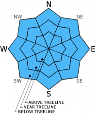
| Mid Slope Winds: | Southwest | West | Northwest |
| Wind Speed: | 10 to 20 mph with gusts to 30 mph. | 15 to 20 mph with gusts to 30 mph in the evening, decreasing to around 10 mph. | 10 to 15 mph. Gusts up to 25 mph in the morning. |
| Expected snowfall: | 0 | 0 | 0 |
For 8000 ft. to 9000 ft.
| Tuesday | Tuesday Night | Wednesday | |
|---|---|---|---|
| Weather: | Partly cloudy skies. | Partly cloudy skies. | Partly cloudy skies. |
| Temperatures: | 45 to 53 deg. F. | 29 to 34 deg. F. | 48 to 54 deg. F. |
| Ridge Top Winds: | West | West | West shifting to north. |
| Wind Speed: | 20 to 30 mph with gusts to 40 mph. | 15 to 25 mph. Gusts to 40 mph decreasing to 30 mph after midnight. | 20 to 25 mph with gusts to 35 mph, shifting and decreasing to 10 to 15 mph with gusts to 25 mph in the afternoon. |
| Expected snowfall: | 0 | 0 | 0 |


