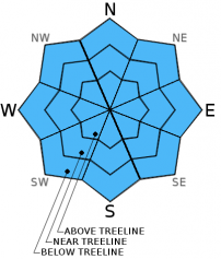
THIS AVALANCHE FORECAST EXPIRED ON December 30, 2014 @ 6:24 am
Avalanche Forecast published on December 29, 2014 @ 6:24 am
Issued by Andy Anderson - Tahoe National Forest - Sierra Avalanche Center

The avalanche danger will remain LOW for all elevations and aspects today. Even though the avalanche danger will remain low today, other hazards including icy conditions on some exposed near and above treeline slopes where arresting a fall would be difficult and a shallow snowpack with lots of obstacles remain. Continue to use caution and practice safe travel habits when traveling in the backcountry.

1. Low

?

Above Treeline
Generally safe avalanche conditions. Watch for unstable snow on isolated terrain features.

1. Low

?

Near Treeline
Generally safe avalanche conditions. Watch for unstable snow on isolated terrain features.

1. Low

?

Below Treeline
Generally safe avalanche conditions. Watch for unstable snow on isolated terrain features.
    Generally safe avalanche conditions. Watch for unstable snow on isolated terrain features.
Avalanche Problem 1: Normal Caution
  • Type ?
  • Aspect/Elevation ?
  • Likelihood ?
    Certain
    Very Likely
    Likely
    Possible
    Unlikely
  • Size ?
    Historic
    Very Large
    Large
    Small

Avalanche activity remains unlikely today. The west and southwest winds that transported some snow yesterday should continue today, but even less snow will remain available for transport. This lack of available snow means that any wind slabs that have formed or that will form today should remain too small, shallow, and isolated to cause significant problems for backcountry travelers.

Even though the avalanche danger will remain low today, other hazards including icy conditions on which arresting a fall would be difficult and a shallow snowpack with lots of obstacles remain. Continue to use caution and practice safe travel habits when traveling in the backcountry.

recent observations

Observations from Ellis Peak yesterday and other areas around the forecast region this week have not revealed any significant signs of instabilities. On northerly slopes sheltered from the north and east winds, a few inches of soft, unconsolidated snow exist on top of a supportable crust. In areas exposed to the north and east winds, previous wind scouring has uncovered vast areas of icy crusts. Conditions on the more southerly facing slopes remain variable and include wind packed snow, crusts, and some consolidated surface snow. Below the surface snowpit data continues to hint at a weak layer beginning to form around the supportable rain crust.

Weather and CURRENT CONDITIONS
weather summary

After another sunny and slightly warmer than normal day, a cold front moving down the east side of the Sierra should begin to impact the forecast region tonight and tomorrow. The forecast calls for temperatures in the single digits and low teens for overnight lows tonight and daytime highs tomorrow. The winds should shift to the north and east and increase tonight and tomorrow as this front passes over the area. Some light snow may also accompany this front with a chance of scattered snow showers tonight and more snow showers tomorrow. 1 to 3 inches of new snow could accumulate during the day tomorrow.

CONDITIONS ALONG THE SIERRA CREST BETWEEN 8200 FT. AND 9200 FT. IN THE LAST 24 HOURS
6am temperature: 15 to 25 deg. F.
Max. temperature: 28 to 36 deg. F.
Average ridgetop wind direction: West to southeast
Average ridgetop wind speed: 25 to 30 mph
Maximum ridgetop wind gust: 42 mph
New snowfall: 0 inches
Total snow depth: 25 to 37 inches
Two-Day Mountain Weather Forecast Produced in partnership with the Reno NWS
For 7000 ft. to 8000 ft.
Monday Monday Night Tuesday
Weather: Mostly sunny Mostly cloudy with scatter snow showers beginning during the night - mainly after midnight Cloudy with snow showers
Temperatures: 31 to 36 deg. F. 8 to 13 deg. F. 10 to 15 deg. F.
Mid Slope Winds: West Southwest shifting to the east after midnight Northeast
Wind Speed: 15 to 20 mph with gusts to 35 mph increasing to 20 to 30 mph with gusts to 45 mph in the afternoon 10 to 20 mph with gusts to 30 mph 20 to 25 mph with gusts to 40 mph increasing to 30 to 35 mph with gusts to 50 mph in the afternoon
Expected snowfall: 0 trace with a chance of up to 1 1 to 3
For 8000 ft. to 9000 ft.
Monday Monday Night Tuesday
Weather: Mostly sunny Mostly cloudy with scatter snow showers beginning during the night - mainly after midnight Cloudy with snow showers
Temperatures: 28 to 33 deg. F. 1 to 8 deg. F. 2 to 9 deg. F.
Ridge Top Winds: West West shifting to the northeast after midnight Northeast
Wind Speed: 25 to 40 mph with gusts to 75 mph 15 to 25 mph with gusts to 50 mph increasing to 20 to 25 mph with gusts to 35 mph after midnight 30 to 40 mph with gusts to 60 mph increasing to 45 to 55 mph with gusts to 75 mph in the afternoon
Expected snowfall: 0 trace with a chance of up to 2 1 to 3
Disclaimer

This avalanche advisory is provided through a partnership between the Tahoe National Forest and the Sierra Avalanche Center. This advisory covers the Central Sierra Nevada Mountains between Yuba Pass on the north and Ebbetts Pass on the south. Click here for a map of the forecast area. This advisory applies only to backcountry areas outside established ski area boundaries. This advisory describes general avalanche conditions and local variations always occur. This advisory expires 24 hours after the posted time unless otherwise noted. The information in this advisory is provided by the USDA Forest Service who is solely responsible for its content.