


For 7000 ft. to 8000 ft.
| Saturday | Saturday Night | Sunday | |
|---|---|---|---|
| Weather: | Sunny becoming partly cloudy this afternoon | Mostly cloudy with a slight chance of snow especially south of Lake Tahoe | Mostly cloudy with a chance of snow especially south of Lake Tahoe |
| Temperatures: | 42 to 48 deg. F. | 15 to 22 deg. F. | 22 to 29 deg. F. |
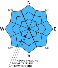
| Mid Slope Winds: | North | Northeast | Northeast |
| Wind Speed: | 15 to 20 mph with gusts to 30 mph | 10 to 15 mph with gusts to 25 mph after midnight | 15 to 25 mph with gusts to 35 mph |
| Expected snowfall: | 0 | 0 | up to 2 in. | South of Lake Tahoe has a chance for 2-4 |
For 8000 ft. to 9000 ft.
| Saturday | Saturday Night | Sunday | |
|---|---|---|---|
| Weather: | Sunny becoming partly cloudy this afternoon | Mostly cloudy with a slight chance of snow especially south of Lake Tahoe | Mostly cloudy with a chance of snow especially south of Lake Tahoe |
| Temperatures: | 38 to 44 deg. F. | 12 to 19 deg. F. | 21 to 27 deg. F. |
| Ridge Top Winds: | Northwest | North shifting to the northeast | Northeast |
| Wind Speed: | 20 to 30 mph with gusts to 45 mph | 10 to 15 mph with gusts to 25 mph increasing to 20 to 25 mph with gusts to 35 mph after midnight | 15 to 25 mph with gusts to 30 mph increasing to 40 mph in the afternoon |
| Expected snowfall: | 0 | 0 | up to 2 in. | South of Lake Tahoe has a chance for 2-4 |


