THIS AVALANCHE FORECAST EXPIRED ON February 4, 2015 @ 6:55 am
Avalanche Forecast published on February 3, 2015 @ 6:55 am
Issued by Andy Anderson - Tahoe National Forest - Sierra Avalanche Center

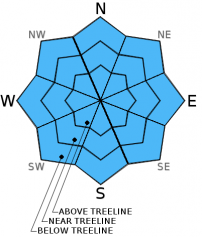
The avalanche danger should remain LOW today for all aspects and elevations. LOW danger does not mean no danger and unlikely does not mean impossible. Some small, shallow, isolated areas of unstable snow could still exist on some isolated terrain features. Continue to practice safe travel habits and thoughtful decision making when traveling in the backcountry.

1. Low

?

Above Treeline
Generally safe avalanche conditions. Watch for unstable snow on isolated terrain features.

1. Low

?

Near Treeline
Generally safe avalanche conditions. Watch for unstable snow on isolated terrain features.

1. Low

?

Below Treeline
Generally safe avalanche conditions. Watch for unstable snow on isolated terrain features.
    Generally safe avalanche conditions. Watch for unstable snow on isolated terrain features.
Avalanche Problem 1: Normal Caution
  • Type ?
  • Aspect/Elevation ?
  • Likelihood ?
    Certain
    Very Likely
    Likely
    Possible
    Unlikely
  • Size ?
    Historic
    Very Large
    Large
    Small

Avalanche activity will remain unlikely today. Data and observations indicate that the recent snow has consolidated and bonded to the old snow surfaces in most areas. While some small isolated areas of unstable snow may still linger on isolated terrain features, finding and triggering one of these small patches of lingering instability has become difficult. Some small isolated wet snow instabilities involving the recent snow may occur today as the day warms up, but these should remain small as well since very little recent snow exists above the crusts.

Any instabilities that do occur today should not involve enough snow to do much more than knock a person off balance or push a person off his/her intended course. In most areas any snowpack instabilities would represent more an inconvenience than an actual problem unless they occur in areas that magnify the consequences of any size avalanche or where any stumble or fall can have serious consequences. These kind of places include steep couliors, slopes above cliffs, and other complex or extreme terrain.

recent observations

Yesterday on Powderhouse Peak near Luther Pass, wet sticky snow existed on the northerly aspects at all elevations by 1 pm. Some small skier triggered pinwheels did occur on steep test slopes, but observations showed no other signs of wet snow instabilities. Snowpit data and general observations also indicated that the snowpack continues to gain strength. A softer layer of snow does remain below the crust at the base of the recent snow, but tests targeting this layer did not reveal any signs of instability associated with this layer. Below 8500 ft. in this area, the snow cover remains sparse with large rocks, stumps, logs, and areas of bare ground exposed on the slopes.

Weather and CURRENT CONDITIONS
weather summary

The lingering cloud cover should begin to clear out today as a high pressure ridge builds over the area. The forecast calls for continued warmer than average temperatures with daytime highs in the upper 30's to upper 40's above 7000 ft. both today and tomorrow. The southwest winds should also remain moderate through tonight. Tomorrow these winds should begin increasing ahead of an approaching storm system. For more information on this approaching storm check in with the Reno NWS.

CONDITIONS ALONG THE SIERRA CREST BETWEEN 8200 FT. AND 9200 FT. IN THE LAST 24 HOURS
6am temperature: 30 to 38 deg. F.
Max. temperature: 37 to 45 deg. F.
Average ridgetop wind direction: Southwest
Average ridgetop wind speed: 15 to 20 mph
Maximum ridgetop wind gust: 47 mph
New snowfall: 0 inches
Total snow depth: 22 to 32 inches
Two-Day Mountain Weather Forecast Produced in partnership with the Reno NWS
For 7000 ft. to 8000 ft.
Tuesday Tuesday Night Wednesday
Weather: Mostly cloudy becoming partly cloudy to mostly sunny Partly cloudy Partly cloudy to mostly sunny
Temperatures: 43 to 51 deg. F. 31 to 36 deg. F. 45 to 52 deg. F.
Mid Slope Winds: Southwest Southwest Southwest
Wind Speed: 15 to 20 mph with gusts to 35 mph 15 to 25 mph with gusts to 35 mph 10 to 20 mph with gusts to 30 mph increasing to 20 to 30 mph with gusts to 45 mph in the afternoon
Expected snowfall: 0 0 0
For 8000 ft. to 9000 ft.
Tuesday Tuesday Night Wednesday
Weather: Mostly cloudy becoming partly cloudy to mostly sunny Partly cloudy Partly cloudy to mostly sunny
Temperatures: 38 to 43 deg. F. 28 to 33 deg. F. 40 to 45 deg. F.
Ridge Top Winds: Southwest Southwest Southwest
Wind Speed: 25 to 35 mph with gusts to 50 mph 25 to 35 with gusts to 55 mph 20 to 30 mph with gusts to 45 mph increasing to 30 to 45 mph with gusts to 65 mph in the afternoon
Expected snowfall: 0 0 0
Disclaimer

This avalanche advisory is provided through a partnership between the Tahoe National Forest and the Sierra Avalanche Center. This advisory covers the Central Sierra Nevada Mountains between Yuba Pass on the north and Ebbetts Pass on the south. Click here for a map of the forecast area. This advisory applies only to backcountry areas outside established ski area boundaries. This advisory describes general avalanche conditions and local variations always occur. This advisory expires 24 hours after the posted time unless otherwise noted. The information in this advisory is provided by the USDA Forest Service who is solely responsible for its content.