


For 7000 ft. to 8000 ft.
| Friday | Friday Night | Saturday | |
|---|---|---|---|
| Weather: | Mostly cloudy skies with a slight chance of rain and snow in the morning. A chance of rain and snow in the afternoon. | Cloudy skies with rain and snow. | Cloudy skies with rain and snow. |
| Temperatures: | 45 to 51 deg. F. | 33 to 40 deg. F. | 40 to 46 deg. F. |
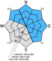
| Mid Slope Winds: | SW | SW | SW |
| Wind Speed: | 35 to 40 mph with gusts to 70 mph. | 35 to 40 mph with gusts to 70 mph. | 30 to 35 mph with gusts to 55 mph, decreasing to 15 to 20 mph with gusts to 30 mph in the afternoon. |
| Expected snowfall: | 1 to 3 | Likely 2 to 6 in. with possible 6 to 10 | 2 to 4 |
For 8000 ft. to 9000 ft.
| Friday | Friday Night | Saturday | |
|---|---|---|---|
| Weather: | Mostly cloudy skies with a slight chance of snow in the morning. A chance of snow and rain in the afternoon. | Cloudy skies with rain and snow. | Cloudy skies with rain and snow. |
| Temperatures: | 41 to 47 deg. F. | 29 to 36 deg. F. | 31 to 38 deg. F. |
| Ridge Top Winds: | SW | SW | SW |
| Wind Speed: | 70 to 80 mph with gust to 125 mph. | 70 to 80 mph with gusts to 125 mph. Gusts decreasing to 110 mph after midnight. | 40 to 50 mph with gusts to 75 mph. |
| Expected snowfall: | 1 to 3 | Likely 6 to 12 in. with possible 12 to 18 | 3 to 6 |


