


For 7000 ft. to 8000 ft.
| Monday | Monday Night | Tuesday | |
|---|---|---|---|
| Weather: | Partly cloudy this morning becoming mostly cloudy by mid day. | Mostly cloudy skies. | Mostly cloudy skies with a slight chance of showers. |
| Temperatures: | 48 to 55 deg. F. | 28 to 35 deg. F. | 46 to 53 deg. F. |
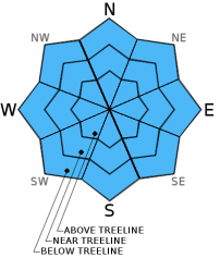
| Mid Slope Winds: | SW | SW | SW |
| Wind Speed: | 15 to 20 mph with gusts to 30 mph. | 15 to 20 mph with gusts to 30 mph. | 10 to 15 mph with gusts to 25 mph. |
| Expected snowfall: | 0 | 0 | 0 |
For 8000 ft. to 9000 ft.
| Monday | Monday Night | Tuesday | |
|---|---|---|---|
| Weather: | Partly cloudy this morning becoming mostly cloudy by mid day. | Mostly cloudy skies. | Mostly cloudy skies with a slight chance of showers. |
| Temperatures: | 42 to 49 deg. F. | 26 to 33 deg. F. | 45 to 51 deg. F. |
| Ridge Top Winds: | SW | SW | SW |
| Wind Speed: | 25 to 35 mph with gusts to 55 mph. | 20 to 30 mph with gusts to 50 mph. | 20 to 30 mph. Gusts to 50 mph, decreasing to 35 mph in the afternoon. |
| Expected snowfall: | 0 | 0 | 0 |


