


For 7000 ft. to 8000 ft.
| Friday | Friday Night | Saturday | |
|---|---|---|---|
| Weather: | Cloudy. Chance of rain and snow in the morning. Rain likely in the afternoon. | Cloudy. Chance of rain in the evening, then chance of rain and snow after midnight. | Cloudy. Rain with a chance of snow. |
| Temperatures: | 37 to 42 deg. F. | 28 to 33 deg. F. | 41 to 46 deg. F. |
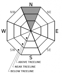
| Mid Slope Winds: | SW | SW | SW |
| Wind Speed: | 20 to 30mph with gusts to 65mph. | 25 to 35mph with gusts to 75mph. | 20 to 30 mph. Gusts to 60mph increasing to 70mph in the afternoon. |
| Expected snowfall: | 0 | Up to 2 | Up to 3 |
For 8000 ft. to 9000 ft.
| Friday | Friday Night | Saturday | |
|---|---|---|---|
| Weather: | Cloudy. Chance of rain or snow in the morning. Rain and snow likely in the afternoon. | Cloudy. Rain and a chance of snow. | Cloudy. Rain and a chance of snow. |
| Temperatures: | 34 to 40 deg. F. | 26 to 31 deg. F. | 39 to 45 deg. F. |
| Ridge Top Winds: | SW | SW | SW |
| Wind Speed: | 30 to 50mph. Gusts up to 85mph increasing to 95mph in the afternoon. | 30 to 50mph with gusts to 105mph. | 30 to 50mph with gusts to 105mph. |
| Expected snowfall: | Up to 2 | Up to 4 | Up to 6 |


