


For 7000 ft. to 8000 ft.
| Tuesday | Tuesday Night | Wednesday | |
|---|---|---|---|
| Weather: | Mostly cloudy then becoming partly cloudy. | Partly cloudy then becoming clear. | Sunny |
| Temperatures: | 43 to 49 deg. F. | 18 to 25 deg. F. | 44 to 51 deg. F. |
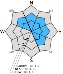
| Mid Slope Winds: | W | NW | |
| Wind Speed: | 15 to 25mph with gusts to 35mph. | Northwest 15 to 20mph shifting to the East after midnight. Gusts to 30mph. | Light winds. |
| Expected snowfall: | 0 | 0 | 0 |
For 8000 ft. to 9000 ft.
| Tuesday | Tuesday Night | Wednesday | |
|---|---|---|---|
| Weather: | Partly cloudy. | Partly cloudy then becoming clear. | Sunny |
| Temperatures: | 40 to 46 deg. F. | 18 to 25 deg. F. | 40 to 47 deg. F. |
| Ridge Top Winds: | W | NW becoming E | SE |
| Wind Speed: | 25 to 35mph with gusts to 50mph. | Northwest 25 to 30mph with gusts to 45mph becoming East 15 to 20mph with gusts to 30mph after midnight. | 10 to 15mph with gusts to 25mph. |
| Expected snowfall: | 0 | 0 | 0 |


