


For 7000 ft. to 8000 ft.
| Sunday | Sunday Night | Monday | |
|---|---|---|---|
| Weather: | Partly cloudy then becoming mostly cloudy. Slight chance of snow in the afternoon. | Cloudy. Snow likely in the evening then snow after midnight. | Mostly cloudy. Snow showers likely in the morning then chance of snow showers in the afternoon. |
| Temperatures: | 26 to 31 deg. F. | 14 to 19 deg. F. | 24 to 29 deg. F. |
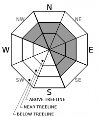
| Mid Slope Winds: | SW | SW | W |
| Wind Speed: | Light winds becoming 20 to 30mph with gusts to 60mph in the afternoon. | 20 to 30mph with gusts to 60mph. | 10 to 15mph. Gusts to 40mph decreasing to 30mph in the afternoon. |
| Expected snowfall: | 0 | 2 to 5 | Up to 2 |
For 8000 ft. to 9000 ft.
| Sunday | Sunday Night | Monday | |
|---|---|---|---|
| Weather: | Partly cloudy then becoming mostly cloudy. Slight chance of snow in the afternoon. | Cloudy. Snow likely in the evening then snow after midnight. | Mostly cloudy. Snow showers likely in the morning then chance of snow showers in the afternoon. |
| Temperatures: | 23 to 28 deg. F. | 11 to 16 deg. F. | 20 to 26 deg. F. |
| Ridge Top Winds: | SW | SW | W |
| Wind Speed: | 10 to 15mph with gusts to 40mph increasing to 30 to 45mph with gusts to 85mph in the afternoon. | 30 to 45mph with gusts to 85mph. | 15 to 25mph. Gusts up to 65mph decreasing to 40mph in the afternoon. |
| Expected snowfall: | 0 | 2 to 5 | Up to 2 |


