


For 7000 ft. to 8000 ft.
| Wednesday | Wednesday Night | Thursday | |
|---|---|---|---|
| Weather: | Partly cloudy skies, becoming mostly cloudy. | Mostly cloudy skies. Isolated showers after midnight over the northern portion of the forecast area. | Mostly cloudy skies, becoming partly cloudy. Isolated showers in the morning over the northern portion of the forecast area. |
| Temperatures: | 51 to 57 deg. F. | 31 to 37 deg. F. | 50 to 56 deg. F. |
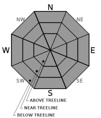
| Mid Slope Winds: | SW | SW | SW |
| Wind Speed: | 15 to 25 mph. Gusts up to 35 mph increasing to 50 mph in the afternoon. | 15 to 25 mph. Gusts to 55 mph decreasing to 45 mph after midnight. | 10 to 15 mph. Gusts to 40 mph decreasing to 30 mph in the afternoon. |
| Expected snowfall: | 0 | 0 to trace | 0 to trace |
For 8000 ft. to 9000 ft.
| Wednesday | Wednesday Night | Thursday | |
|---|---|---|---|
| Weather: | Partly cloudy skies, becoming mostly cloudy. | Mostly cloudy skies. Isolated showers after midnight over the northern portion of the forecast area. | Mostly cloudy skies, becoming partly cloudy. Isolated showers in the morning over the northern portion of the forecast area. |
| Temperatures: | 45 to 51 deg. F. | 31 to 36 deg. F. | 45 to 51 deg. F. |
| Ridge Top Winds: | SW | SW | SW |
| Wind Speed: | 20 to 35 mph. Gusts to 50 mph increasing to 70 mph in the afternoon. | 30 to 40 mph with gusts to 85 mph, decreasing to 20 to 35 mph with gusts to 75 mph after midnight. | 20 to 35 mph. Gusts to 75 mph decreasing to 50 mph in the afternoon. |
| Expected snowfall: | 0 | 0 to trace | 0 to trace |


