


For 7000 ft. to 8000 ft.
| Sunday | Sunday Night | Monday | |
|---|---|---|---|
| Weather: | Mostly cloudy. Chance of showers in the afternoon. | Cloudy. Slight chance of showers through the night. | Cloudy. Slight chance of showers. |
| Temperatures: | 47 to 53 deg. F. | 30 to 35 deg. F. | 47 to 53 deg. F. |
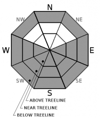
| Mid Slope Winds: | SW | SW | SW |
| Wind Speed: | 15 to 20mph with gusts to 40mph. | 10 to 15mph with gusts to 25mph. | 15 to 20mph with gusts to 40mph. |
| Expected snowfall: | 0 | 0 | 0 |
For 8000 ft. to 9000 ft.
| Sunday | Sunday Night | Monday | |
|---|---|---|---|
| Weather: | Mostly cloudy. Slight chance of showers in the afternoon. | Cloudy. Slight chance of showers. | Cloudy. Slight chance of showers. |
| Temperatures: | 42 to 50 deg. F. | 28 to 33 deg. F. | 40 to 48 deg. F. |
| Ridge Top Winds: | SW | SW | S |
| Wind Speed: | 25 to 35mph. Gusts to 80mph decreasing to 70mph in the afternoon. | 25 to 35mph with gusts to 75mph. | 20 to 35mph with gusts to 70mph. |
| Expected snowfall: | 0 to trace | 0 | 0 |


