THIS AVALANCHE FORECAST EXPIRED ON April 12, 2018 @ 6:51 am
Avalanche Forecast published on April 11, 2018 @ 6:51 am
Issued by Andy Anderson - Tahoe National Forest - Sierra Avalanche Center

The avalanche danger may rise to MODERATE during the day if enough warming occurs for loose wet avalanches to become possible. Once the storm arrives over the forecast area this evening the avalanche danger will quickly rise to CONSIDERABLE during the night due to newly formed wind slabs and storm slabs. Slab avalanche activity will be an issue tonight and slab instabilities will linger into tomorrow. 

3. Considerable

?

Above Treeline
Dangerous avalanche conditions. Careful snowpack evaluation, cautious route-finding and conservative decision-making essential.

3. Considerable

?

Near Treeline
Dangerous avalanche conditions. Careful snowpack evaluation, cautious route-finding and conservative decision-making essential.

2. Moderate

?

Below Treeline
Heightened avalanche conditions on specific terrain features. Evaluate snow and terrain carefully; identify features of concern.
    Dangerous avalanche conditions. Careful snowpack evaluation, cautious route-finding and conservative decision-making essential.
Avalanche Problem 1: Loose Wet
  • Type ?
  • Aspect/Elevation ?
  • Likelihood ?
    Certain
    Very Likely
    Likely
    Possible
    Unlikely
  • Size ?
    Historic
    Very Large
    Large
    Small

Some refreeze should have occurred last night due to temperatures near freezing but partly cloudy skies may have kept the snowpack from experiencing a strong overnight refreeze. Enough warming may occur on some slopes today for loose wet instabilities to become possible on any aspect if slopes get enough sun exposure. If cloud cover becomes more widespread, it may limit the amount of warming that happens today. If loose wet instabilities do form today, they could manifest as roller balls, pinwheels, or loose wet avalanches. If the surface refreeze does melt today, deep wet snow exists below it and larger loose wet instabilities could occur.

Step off your equipment regularly to test how supportable the refreeze is. Once you start stepping into deep wet snow it is time to call it a day.

Avalanche Problem 2: Wind Slab
  • Type ?
  • Aspect/Elevation ?
  • Likelihood ?
    Certain
    Very Likely
    Likely
    Possible
    Unlikely
  • Size ?
    Historic
    Very Large
    Large
    Small

New wind slabs will form on leeward aspects tonight as new snow and strong winds impact the forecast area. These wind slabs will likely form faster than they can bond to the existing snow and wind slab avalanches will become a problem during the night. Some natural wind slab avalanches may become possible and if a person happens to be traveling in the backcountry tonight, expect human triggered wind slabs to become likely.  Wind slabs will form on wind-loaded N-NE-E aspects and cross-loaded NW and SE aspects in near and above treeline terrain. Depending on the amount of snow that accumulates, some wind slabs could grow large enough to bury or injure a person or maybe even a car by tomorrow morning in heavily wind-loaded areas. Wind slab instability will likely linger into tomorrow. 

Avalanche Problem 3: Storm Slab
  • Type ?
  • Aspect/Elevation ?
  • Likelihood ?
    Certain
    Very Likely
    Likely
    Possible
    Unlikely
  • Size ?
    Historic
    Very Large
    Large
    Small

Storm slabs may also become a problem tonight during the storm. Changing conditions and periods of rapid snow accumulation tonight may create and overload weaknesses that form during the storm. Human triggered storm slab avalanches may become possible tonight on steep slopes loaded with new snow. Some of these could grow large enough to bury or injure a person after midnight. 

recent observations

* Deep wet snow existed on all aspects up to the summit of Mt. Judah yesterday by noon with little to no signs of an overnight refreeze.

* Areas of light rain on snow were observed around the forecast area yesterday.

Weather and CURRENT CONDITIONS
weather summary

Light precipitation fell in some parts of the forecast area yesterday. Most of this fell as rain below 8800 ft. with a few places possibly receiving a trace amount of snow at the highest elevations. Cloud cover remained over parts of the area during the night and should increase today as a fast-moving storm approaches the area. The southwest winds should also increase today. The storm should arrive this evening bringing colder temperatures, even stronger southwest winds, and overnight snow. The forecast calls for 4 to 12 inches of new snow above 7000 ft. by tomorrow morning. Snow levels should fall below 7000 ft. so areas at Lake level could also see 3 to 7 inches of new snow. This storm should depart the area tomorrow with a small high pressure starting to build over the region tomorrow through Saturday. 

CONDITIONS ALONG THE SIERRA CREST BETWEEN 8200 FT. AND 9200 FT. IN THE LAST 24 HOURS
6am temperature: 32 to 39 deg. F.
Max. temperature: 45 to 51 deg. F.
Average ridgetop wind direction: Southwest
Average ridgetop wind speed: 40 mph
Maximum ridgetop wind gust: 81 mph
New snowfall: Trace to 1 inches
Total snow depth: 51 to 89 inches
Two-Day Mountain Weather Forecast Produced in partnership with the Reno NWS
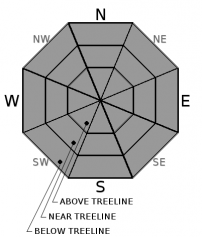
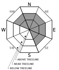
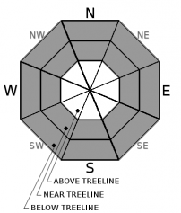
For 7000 ft. to 8000 ft.
Wednesday Wednesday Night Thursday
Weather: Partly cloudy becoming mostly cloudy in the afternoon with a some scattered showers. Snow level 7500 ft. Cloudy with snow. Snow levels below 7000 ft. Partly cloudy becoming mostly cloudy with a chance of snow showers. Snow level below 7000 ft.
Temperatures: 40 to 48 deg. F. 20 to 25 deg. F. 29 to 35 deg. F.
Mid Slope Winds: Southwest Southwest West
Wind Speed: 15 to 20 mph with gusts to 40 mph increasing to 20 to 30 mph with gusts to 65 mph in the afternoon 20 to 35 mph with gusts to 60 mph decreasing to 50 mph after midnight 15 to 25 mph with gusts to 40 mph
Expected snowfall: up to 1 4 to 10 up to 1
For 8000 ft. to 9000 ft.
Wednesday Wednesday Night Thursday
Weather: Partly cloudy becoming mostly cloudy in the afternoon with a some scattered snow showers. Cloudy with snow. Partly cloudy becoming mostly cloudy with a chance of snow showers.
Temperatures: 36 to 42 deg. F. 15 to 21 deg. F. 23 to 29 deg. F.
Ridge Top Winds: Southwest Southwest West
Wind Speed: 25 to 35 mph with gusts to 70 mph increasing to 30 to 50 mph with gusts to 85 mph in the afternoon 35 to 55 mph with gusts to 100 mph decreasing to 30 to 40 mph with gusts to 85 mph after midnight 20 to 30 mph with gusts to 60 mph decreasing to 45 mph in the afternoon
Expected snowfall: up to 1 6 to 12 up to 1
Disclaimer

This avalanche advisory is provided through a partnership between the Tahoe National Forest and the Sierra Avalanche Center. This advisory covers the Central Sierra Nevada Mountains between Yuba Pass on the north and Ebbetts Pass on the south. Click here for a map of the forecast area. This advisory applies only to backcountry areas outside established ski area boundaries. This advisory describes general avalanche conditions and local variations always occur. This advisory expires 24 hours after the posted time unless otherwise noted. The information in this advisory is provided by the USDA Forest Service who is solely responsible for its content.

For a recorded version of the Avalanche Advisory call (530) 587-3558 x258