


For 7000 ft. to 8000 ft.
| Thursday | Thursday Night | Friday | |
|---|---|---|---|
| Weather: | Periods of sun this morning becoming mostly cloudy by this afternoon. Scattered snow showers. | Mostly cloudy becoming clear overnight. Scattered snow showers in the evening. | Sunny |
| Temperatures: | 38 to 43 deg. F. | 24 to 29 deg. F. | 51 to 56 deg. F. |
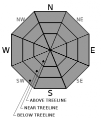
| Mid Slope Winds: | Northwest | Northwest | Variable |
| Wind Speed: | Light in the morning increasing to 10 to 15 mph with gusts to 30 mph in the afternoon | 10 to 20 mph with gusts to 35 mph becoming light in the evening | Light winds with gusts to 25 mph in the morning |
| Expected snowfall: | Trace to 2 | Trace with a chance of up to 1 | 0 |
For 8000 ft. to 9000 ft.
| Thursday | Thursday Night | Friday | |
|---|---|---|---|
| Weather: | Periods of sun this morning becoming mostly cloudy by this afternoon. Scattered snow showers. | Mostly cloudy becoming clear overnight. Scattered snow showers in the evening. | Sunny |
| Temperatures: | 32 to 38 deg. F. | 22 to 27 deg. F. | 46 to 52 deg. F. |
| Ridge Top Winds: | Northwest | North | Northeast |
| Wind Speed: | 15 to 20 mph with gusts to 25 mph increasing to 35 mph in the afternoon | 15 to 25 mph with gusts to to 50 mph | 15 to 25 mph with gusts to to 45 mph |
| Expected snowfall: | Trace to 2 | Trace with a chance of up to 1 | 0 |


