THIS AVALANCHE FORECAST EXPIRED ON December 31, 2018 @ 7:00 am
Avalanche Forecast published on December 30, 2018 @ 7:00 am
Issued by Andy Anderson - Tahoe National Forest - Sierra Avalanche Center

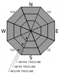
LOW avalanche danger exists for all elevations today. While some difficult (but not impossible) to trigger wind slabs may still lurk in isolated near and above treeline terrain, human-triggered avalanches should remain unlikely in most places today.

1. Low

?

Above Treeline
Generally safe avalanche conditions. Watch for unstable snow on isolated terrain features.

1. Low

?

Near Treeline
Generally safe avalanche conditions. Watch for unstable snow on isolated terrain features.

1. Low

?

Below Treeline
Generally safe avalanche conditions. Watch for unstable snow on isolated terrain features.
    Generally safe avalanche conditions. Watch for unstable snow on isolated terrain features.
Avalanche Problem 1: Normal Caution
  • Type ?
  • Aspect/Elevation ?
  • Likelihood ?
    Certain
    Very Likely
    Likely
    Possible
    Unlikely
  • Size ?
    Historic
    Very Large
    Large
    Small

Even though avalanches are unlikely, they are not impossible. Some wind slabs could still lurk on isolated terrain features in wind-exposed near and above treeline terrain. Despite the strong west winds today, new wind slab formation should remain limited due to the lack of snow available for transport. These strong and shifting winds have left a variety of surfaces on wind-exposed slopes ranging from firm icy crusts to firm hollow-sounding wind slabs to uneven wind-sculpted surfaces.

Use signs of wind-loading and wind-scouring to help identify the places where an isolated area of unstable snow could still linger as well as where firm "difficult to recreate on" snow conditions may exist. Creating safety margins that account for these conditions could help find the softer snow in sheltered areas and avoid any unwanted surprises on exposed terrain. Continue to maintain awareness of the conditions and terrain and manage your group by using good travel techniques while moving through the backcountry.

recent observations

* Observations yesterday from Stevens Peak, Tinkers Knob, and Andesite Ridge all found significant signs of previous wind transport in exposed near and above treeline terrain but few, if any, signs of continued wind transport. 

* On Andesite Peak and on Stevens Peak, some small firm wind slabs resting on top of softer weak snow lingered on westerly aspects

* In sheltered near and below treeline areas on Stevens Peak and in the Cabin Creek area, several inches of weak, soft, unconsolidated snow existed on the snow surface on northerly aspects.

* Some weak snow layers existed in the upper third of the snowpack in all of these locations yesterday. Monitoring these weaknesses will continue as they represent a potential problem during future loading events.

Weather and CURRENT CONDITIONS
weather summary

The winds shifted back to the west during the night as another cold front approaches the region. The strong westerly winds should continue through today and shift back to the east and northeast by tomorrow after the cold front passes over the area. In addition to the wind, this cold front should bring colder temperatures back to the forecast area through New Year's day. While it may also bring a slight chance some light snow flurries, this cold front has very little moisture traveling with it so no accumulation is expected. 

CONDITIONS ALONG THE SIERRA CREST BETWEEN 8200 FT. AND 9200 FT. IN THE LAST 24 HOURS
6am temperature: 26 to 34 deg. F.
Max. temperature: 35 to 40 deg. F.
Average ridgetop wind direction: NE shifting to the W after midnight
Average ridgetop wind speed: 20 to 30 mph
Maximum ridgetop wind gust: 54 mph
New snowfall: 0 inches
Total snow depth: 31 to 37 inches
Two-Day Mountain Weather Forecast Produced in partnership with the Reno NWS
For 7000 ft. to 8000 ft.
Sunday Sunday Night Monday
Weather: Partly cloudy. Snow levels below 7000 feet. Chance of precipitation is 5%. Partly cloudy. Snow levels below 7000 feet. Chance of precipitation is 10%. Partly cloudy. Slight chance of snow showers in the morning. Snow levels below 7000 feet. Chance of precipitation is 15%.
Temperatures: 41 to 46. deg. F. 12 to 18. deg. F. 19 to 24. deg. F.
Mid Slope Winds: West 10 to 15 mph with gusts to 35 mph in the morning becoming light. West 10 to 15 mph with gusts to 25 mph in the evening becoming light. East 15 to 25 mph. Gusts up to 30 mph increasing to 45 mph in the afternoon.
Expected snowfall: No accumulation. | SWE = none. No accumulation. 90% probability no accumulation. | SWE = none. No accumulation. | SWE = trace amounts.
For 8000 ft. to 9000 ft.
Sunday Sunday Night Monday
Weather: Partly cloudy. Snow levels below 7000 feet. Chance of precipitation is 5%. Partly cloudy. Snow levels below 7000 feet. Chance of precipitation is 10%. Partly cloudy. Slight chance of snow showers in the morning. Snow levels below 7000 feet. Chance of precipitation is 15%.
Temperatures: 36 to 41. deg. F. 8 to 14. deg. F. 15 to 20. deg. F.
Ridge Top Winds: West 20 to 30 mph with gusts to 65 mph. North 20 to 35 mph with gusts to 70 mph. East 25 to 40 mph with gusts to 85 mph.
Expected snowfall: No accumulation. | SWE = none. No accumulation. 90% probability no accumulation. | SWE = none. No accumulation. | SWE = trace amounts.
Disclaimer

This avalanche forecast is provided through a partnership between the Tahoe National Forest and the Sierra Avalanche Center. This forecast covers the Central Sierra Nevada Mountains between Yuba Pass on the north and Ebbetts Pass on the south. Click here for a map of the forecast area. This forecast applies only to backcountry areas outside established ski area boundaries. This forecast describes general avalanche conditions and local variations always occur. This forecast expires 24 hours after the posted time unless otherwise noted. The information in this forecast is provided by the USDA Forest Service who is solely responsible for its content.

For a recorded version of the avalanche forecast call (530) 587-3558 x258