THIS AVALANCHE FORECAST EXPIRED ON March 11, 2018 @ 8:00 am
Avalanche Forecast published on March 10, 2018 @ 7:00 am
Issued by Andy Anderson - Tahoe National Forest - Sierra Avalanche Center

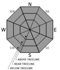
The avalanche danger will remain LOW for all elevations today since significant avalanche activity is unlikely. Unlikely does not mean impossible. Some unstable snow may still lurk on isolated terrain features somewhere in the forecast area in the form of a remotely possible but very unlikely deep slab problem or small and mostly inconsequential wet snow issues in lower elevation terrain.

1. Low

?

Above Treeline
Generally safe avalanche conditions. Watch for unstable snow on isolated terrain features.

1. Low

?

Near Treeline
Generally safe avalanche conditions. Watch for unstable snow on isolated terrain features.

1. Low

?

Below Treeline
Generally safe avalanche conditions. Watch for unstable snow on isolated terrain features.
    Generally safe avalanche conditions. Watch for unstable snow on isolated terrain features.
Avalanche Problem 1: Normal Caution
  • Type ?
  • Aspect/Elevation ?

Significant avalanche activity is unlikely today on a regional scale, but some unlikely but not impossible instabilities may still lurk on a few isolated terrain features across the region. These isolated instabilities could take the form of small wet snow issues like roller balls, pinwheels, or wet snow sluffs in lower elevation terrain where wet surface snow exists or where rain falls on the snow surface. This kind of instability should only involve a small amount of snow.

In the very unlikely event of an isolated slab avalanche today, it would be a lingering deep slab that may still lurk on some isolated terrain feature somewhere in the forecast area where the weak layer remains weak. Unfortunately, if one of these unlikely but still remotely possible deeps slabs were to occur, the consequences would still be serious. 

Continue to make observations and assess the current conditions while traveling in the backcountry. In addition to looking for clues on the surface, use a probe or shovel to get a feel for what layers are buried in the snowpack. When there is uncertainty about a choice or the conditions, give yourself a buffer and choose the more cautious and conservative plan.

recent observations

* Yesterday snowpit observations in Shirley Canyon and in the Slab Cliffs area showed the once persistent weak layer continues to gain strength. This data matches well with other snowpit tests and observations from around the forecast area this week indicating that the previous facet layer buried deep in the snowpack has become increasingly denser, more cohesive, and more rounded. 

* Wet sticky surface snow existed on all aspects up to at least 7000 ft. in the Shirley Canyon area yesterday and numerous small roller balls occurred on steep low elevation terrain.

* Around Incline Peak, the snow surface remained soft and cold on N aspects and shaded NW and NE aspects above 8600 ft. Wet surface snow in this area remained limited to the more sun-exposed E-SE aspects.

* Ski cuts on a SE facing test slope around 1 pm triggered a few minor roller balls in the Incline Lake Peak area.

Weather and CURRENT CONDITIONS
weather summary

A small storm should pass through the forecast area during the next 24 hours. The main focus of this storm should pass to the south of the region and precipitation and winds should remain light for this area. The forecast calls for up to 1 inch of new snow today above 6500-7000 ft. and up to 2 more inches tonight. Areas south of Highway 50 have the best chances for the upper end of forecasted accumulation. Below 6500-7000 ft. this light precipitation may fall as rain due to warmer temperatures associated with this system. By tomorrow expect a return of sunny to partly cloudy skies as a high-pressure ridge moves into the area. 

CONDITIONS ALONG THE SIERRA CREST BETWEEN 8200 FT. AND 9200 FT. IN THE LAST 24 HOURS
6am temperature: 29 to 35 deg. F.
Max. temperature: 37 to 43 deg. F.
Average ridgetop wind direction: Southwest to South
Average ridgetop wind speed: 25 to 30 mph
Maximum ridgetop wind gust: 61 mph
New snowfall: 0 inches
Total snow depth: 49 to 80 inches
Two-Day Mountain Weather Forecast Produced in partnership with the Reno NWS
For 7000 ft. to 8000 ft.
Saturday Saturday Night Sunday
Weather: Cloudy with a chance of snow and rain in the afternoon. Snow levels starting at 6000 feet increasing to 7000 feet in the afternoon. Mostly cloudy with rain and snow likely. Snow levels around 7000 ft. Sunny becoming partly cloudy in the afternoon
Temperatures: 38 to 43 deg. F. 29 to 34 deg. F. 43 to 48 deg. F.
Mid Slope Winds: Variable Variable Variable
Wind Speed: Light Light Light
Expected snowfall: up to 1 up to 2 0
For 8000 ft. to 9000 ft.
Saturday Saturday Night Sunday
Weather: Cloudy with a chance of snow in the afternoon. Mostly cloudy with snow likely. Sunny becoming partly cloudy in the afternoon
Temperatures: 33 to 39 deg. F. 26 to 31 deg. F. 38 to 44 deg. F.
Ridge Top Winds: South Variable Variable
Wind Speed: 10 to 15 mph with gusts to 30 mph Light Light
Expected snowfall: up to 1 up to 2 0
Disclaimer

This avalanche advisory is provided through a partnership between the Tahoe National Forest and the Sierra Avalanche Center. This advisory covers the Central Sierra Nevada Mountains between Yuba Pass on the north and Ebbetts Pass on the south. Click here for a map of the forecast area. This advisory applies only to backcountry areas outside established ski area boundaries. This advisory describes general avalanche conditions and local variations always occur. This advisory expires 24 hours after the posted time unless otherwise noted. The information in this advisory is provided by the USDA Forest Service who is solely responsible for its content.

For a recorded version of the Avalanche Advisory call (530) 587-3558 x258