THIS AVALANCHE FORECAST EXPIRED ON March 14, 2018 @ 6:55 am
Avalanche Forecast published on March 13, 2018 @ 6:55 am
Issued by Steve Reynaud - Tahoe National Forest

Avalanche danger will quickly be on the rise as this winter storm intensifies and snow levels begin to drop throughout the day.   Considerable avalanche danger will exist today and throughout the night at all elevations.  Loose wet avalanches will be likely due to high elevation rain today.  Wind slab and storm slab avalanche problems will become likely this afternoon as the storm increases and snow levels drop.  Dangerous avalanche conditions will exist with human and natural triggered avalanches expected.

3. Considerable

?

Above Treeline
Dangerous avalanche conditions. Careful snowpack evaluation, cautious route-finding and conservative decision-making essential.

3. Considerable

?

Near Treeline
Dangerous avalanche conditions. Careful snowpack evaluation, cautious route-finding and conservative decision-making essential.

3. Considerable

?

Below Treeline
Dangerous avalanche conditions. Careful snowpack evaluation, cautious route-finding and conservative decision-making essential.
    Dangerous avalanche conditions. Careful snowpack evaluation, cautious route-finding and conservative decision-making essential.
Avalanche Problem 1: Loose Wet
  • Type ?
  • Aspect/Elevation ?
  • Likelihood ?
    Certain
    Very Likely
    Likely
    Possible
    Unlikely
  • Size ?
    Historic
    Very Large
    Large
    Small

Loose wet avalanches will be likely on all aspects in near treeline and below treeline terrain due to high elevation rain. Remote sensors this morning were showing rain along the Sierra Crest and Mt. Rose up to 8500-9000'.  Snow levels could fluctuate today before dropping later this afternoon.  Most instabilities should be in the form of roller balls and pinwheels but some loose wet avalanches could be larger and big enough to injure or bury a backcountry user.  As temperatures cool and the snow level drops later today, loose wet instabilities will decrease.

Look for roller balls and pinwheels for signs of instabilities.  Avoid deep, unsupportable wet snow on steep slopes.

Avalanche Problem 2: Wind Slab
  • Type ?
  • Aspect/Elevation ?
  • Likelihood ?
    Certain
    Very Likely
    Likely
    Possible
    Unlikely
  • Size ?
    Historic
    Very Large
    Large
    Small

Wind slabs could develop in high elevation terrain above 8500-9000' where new snow is accumulating this morning.  As the storm intensifies later today and snow levels drop, wind slabs will become more widespread on W-NW-N-NE-E-SE aspects in near treeline and above treeline terrain.  Gale force S-SW winds are forecasted throughout today and into Wednesday.

Look for blowing snow, cornice formation, and wind pillows.  Avoid steep wind loaded areas and run out zones below wind loaded areas. 

Avalanche Problem 3: Storm Slab
  • Type ?
  • Aspect/Elevation ?
  • Likelihood ?
    Certain
    Very Likely
    Likely
    Possible
    Unlikely
  • Size ?
    Historic
    Very Large
    Large
    Small

Storm slabs could develop later today as snow levels drop, snowfall accumulates, and snowfall intensity increases.  These storm slabs will be possible on all aspects in near treeline and below treeline terrain.  

Look for signs of cracking and/or cohesion of the new storm snow.  Avoid steep terrain with signs of unstable snow.

recent observations

* Warm temperatures with mostly light winds observed throughout the forecast area over the last couple days.  Minor loose wet activity reported.  Wet surface snow on north aspects by mid day up to 8000'.  Weak to no overnight refreeze of the snowpack in many areas.

* Other observations over the past week from around the forecast area targeting the recent deep slab problem have overall shown signs of increasing stability. Outliers continue to present, most recently from the Luther Pass and Echo Summit areas. General trends in snowpit data are that the once faceted weak layer of concern is located 3 to 6 feet deep in the snowpack on NW-N-NE-ENE aspects, remains significantly less dense than the slab above it, and often presents as loose grains. Varying degrees of rounding of the once faceted snow have be observed. In some locations, faceted crystals are no longer visible under magnification. In other locations, striated faceted crystals remain.  Snowpack tests mostly indicate that it is difficult to trigger weak layer failure (ECT, CT). There are some exceptions. Tests specifically examining propagation potential (such as the PST) tend to indicate that propagation could still occur along the weak layer in the unlikely event that snowpack failure is triggered.

Weather and CURRENT CONDITIONS
weather summary

A series of winter storms are forecasted to bring rain and snow to our area today through Saturday.  This morning, rain levels are near 8500-9000' and are forecasted to drop later this afternoon.  Snow should be down to Lake level tonight and into Wednesday with up to 1 to 2' of snow along the Sierra Crest and 4 to 8'' at Lake level.  A colder and stronger storm is forecasted for Thursday night through Saturday morning.  Snow levels with this storm should be around 5000'.  Sunday into Monday look to dry out with the possibility of lingering snow showers.

CONDITIONS ALONG THE SIERRA CREST BETWEEN 8200 FT. AND 9200 FT. IN THE LAST 24 HOURS
6am temperature: 32 to 38 deg. F.
Max. temperature: 47 deg. F.
Average ridgetop wind direction: SW
Average ridgetop wind speed: 40 to 60 mph
Maximum ridgetop wind gust: 87 mph
New snowfall: Rain .10'' to .20 inches
Total snow depth: 45 to 77 inches
Two-Day Mountain Weather Forecast Produced in partnership with the Reno NWS
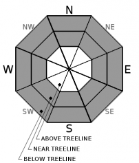
For 7000 ft. to 8000 ft.
Tuesday Tuesday Night Wednesday
Weather: Cloudy. Chance of rain and snow. Cloudy. Rain in the evening snow through the night. Cloudy. Snow likely.
Temperatures: 39 to 44 deg. F. 21 to 26 deg. F. 29 to 34 deg. F.
Mid Slope Winds: S SW SW
Wind Speed: 20 to 30mph. Gusts to 55mph increasing to 65mph in the afternoon. 10 to 15mph. Gusts to 45mph decreasing to 35mph after midnight. 10 to 15mph with gusts to 35mph.
Expected snowfall: 2 to 6 6 to 12 2 to 5
For 8000 ft. to 9000 ft.
Tuesday Tuesday Night Wednesday
Weather: Mostly cloudy. Chance of snow and rain. Cloudy. Snow. Cloudy. Snow likely.
Temperatures: 34 to 40 deg. F. 17 to 22 deg. F. 24 to 30 deg. F.
Ridge Top Winds: S SW SW
Wind Speed: 30 to 50mph with gusts to 95mph. 20 to 35mph. Gusts to 75 decreasing to 60mph after midnight. 20 to 30mph. Gusts to 60mph decreasing to 50mph after midnight.
Expected snowfall: 3 to 7 6 to 12 3 to 6
Disclaimer

This avalanche advisory is provided through a partnership between the Tahoe National Forest and the Sierra Avalanche Center. This advisory covers the Central Sierra Nevada Mountains between Yuba Pass on the north and Ebbetts Pass on the south. Click here for a map of the forecast area. This advisory applies only to backcountry areas outside established ski area boundaries. This advisory describes general avalanche conditions and local variations always occur. This advisory expires 24 hours after the posted time unless otherwise noted. The information in this advisory is provided by the USDA Forest Service who is solely responsible for its content.

For a recorded version of the Avalanche Advisory call (530) 587-3558 x258