THIS AVALANCHE FORECAST EXPIRED ON December 2, 2019 @ 6:59 am
Avalanche Forecast published on December 1, 2019 @ 6:59 am
Issued by Andy Anderson - Tahoe National Forest - Sierra Avalanche Center

Warming temperatures, intense snow and rain, and strong winds have resulted in HIGH avalanche danger in near and above treeline terrain and CONSIDERABLE avalanche danger in below treeline terrain. The backcountry will hold a complex mix of wind slab, storm slab, and loose wet avalanche problems today.

Dangerous avalanche activity is very likely today. Travel in, near, or below avalanche terrain is not recommended.   

4. High

?

Above Treeline
Very dangerous avalanche conditions. Travel in avalanche terrain not recommended.

4. High

?

Near Treeline
Very dangerous avalanche conditions. Travel in avalanche terrain not recommended.

3. Considerable

?

Below Treeline
Dangerous avalanche conditions. Careful snowpack evaluation, cautious route-finding and conservative decision-making essential.
    Very dangerous avalanche conditions. Travel in avalanche terrain not recommended.
Avalanche Problem 1: Wind Slab
  • Type ?
  • Aspect/Elevation ?
  • Likelihood ?
    Certain
    Very Likely
    Likely
    Possible
    Unlikely
  • Size ?
    Historic
    Very Large
    Large
    Small

Strong SSW and S winds and heavy snow have built new slabs of drifted snow on traditional leeward aspects and in some unusual places. These wind slabs rest on top of lighter snow that will not support them and they will continue to grow in size and extent as more snow and wind impact the forecast area today. Natural and human triggered wind slab avalanches will be very likely today. Wind slab avalanches could be large and destructive (D2-D3). In addition to entraining enough snow to have serious consequences for anyone one caught in an avalanche, the numerous obstacles present in the early season snowpack would make matters even worse. 

Avalanche Problem 2: Storm Slab
  • Type ?
  • Aspect/Elevation ?
  • Likelihood ?
    Certain
    Very Likely
    Likely
    Possible
    Unlikely
  • Size ?
    Historic
    Very Large
    Large
    Small

A warming storm means the snow gets heavier on the surface than below. The new heavy snow is also accumulating on top of lighter old snow. Heavy snow on top of lighter weaker snow represents a great recipe for a storm slab avalanche problem. Slabs of new snow may fail within the storm snow or at the old snow / new snow interface. Human triggered storm slab avalanches will be likely today. These avalanches could involve enough snow to bury or injure a person (D2). Rain falling on snow could also trigger storm slab avalanches and they could entrain wet snow at elevations near or below snow line.

Avalanche Problem 3: Loose Wet
  • Type ?
  • Aspect/Elevation ?
  • Likelihood ?
    Certain
    Very Likely
    Likely
    Possible
    Unlikely
  • Size ?
    Historic
    Very Large
    Large
    Small

At lower elevations where rain falls on existing snow, expect to see loose wet avalanches. Most of these should remain small but any avalanche could have consequences since collisions with barely covered or exposed rocks, stumps, and other obstacles would be inevitable. Rain could also trigger the storm slabs or wind slabs mentioned above especially if snow level climbs higher than forecasted. 

recent observations

* Observers reported that the snow remained light and cold prior to the onset of this storm. The snowpack had a high degree of variability in coverage and many shallowly buried and exposed obstacles still existed.  

* Some cracking occurred in wind-loaded areas near Carson Pass yesterday. 

* In areas where a thin layer of snow existed from Nov. 20, a thin weak layer now exists at the base of the snowpack. While this layer is not very widespread or continuous in most places, some signs of instability like whumpfing in sheltered areas in the Mt. Rose backcounrty and an isolated unstable test result on Carson Pass were noted yesterday. 

Weather and CURRENT CONDITIONS
weather summary

During the night a storm moved into the area bring warmer air, precipitation, and strong SSW and S winds. So far about 1-2.5 inches of water has fallen from the sky. In many places, snow levels have risen to close to 7000 ft, so some of this has fallen as rain below that elevation. At the higher elevations, 8 to 15 inches of heavy snow has accumulated. The forecast calls for another 1 to 2 ft of heavy snow at the upper elevations today and tonight. The NWS predicts snow levels to hover around 7000 ft today and 7500 ft tomorrow. Precipitation and winds should start to taper off by Monday afternoon. For more details check in with the Reno NWS.

CONDITIONS ALONG THE SIERRA CREST BETWEEN 8200 FT. AND 9200 FT. IN THE LAST 24 HOURS
6am temperature: 25 to 31 deg. F.
Max. temperature: 27 to 33 deg. F.
Average ridgetop wind direction: SSW and S
Average ridgetop wind speed: 30 to 35 mph
Maximum ridgetop wind gust: 84 mph
New snowfall: 8 to 15 inches
Total snow depth: 22 to 31 inches
Two-Day Mountain Weather Forecast Produced in partnership with the Reno NWS
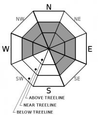
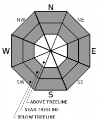
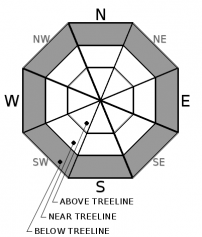
For 7000 ft. to 8000 ft.
Sunday Sunday Night Monday
Weather: Cloudy. Snow through the day with some rain possible in the afternoon. Snow levels below 7000 feet in the morning rising close to 7000 ft in the afternoon. Chance of precipitation is 100%. Cloudy. Snow and rain. Snow levels 7000 feet. Chance of precipitation is 100%. Cloudy. Snow and rain in the morning, then rain and snow likely in the afternoon. Snow levels 7500 feet. Chance of precipitation is 90%.
Temperatures: 30 to 35 deg. F. 27 to 32 deg. F. 33 to 38 deg. F.
Mid Slope Winds: South 15 to 25 mph with gusts to 40 mph. South 15 to 20 mph with gusts to 35 mph. South around 15 mph with gusts to 30 mph.
Expected snowfall: 80% probability of 7 to 10 inches. 20% probability of 10 to 15 inches. | SWE = 0.95 to 1.40 inches. 70% probability of 3 to 6 inches. 30% probability up to 3 inches. | SWE = 0.65-1.10 inches. 70% probability of 2 to 5 inches. 30% probability up to 2 inch. | SWE = 0.25-0.50 inch.
For 8000 ft. to 9000 ft.
Sunday Sunday Night Monday
Weather: Cloudy. Snow. Snow levels below 7000 feet in the morning rising close to 7000 ft in the afternoon. Chance of precipitation is 100%. Cloudy. Snow. Snow levels 7000 feet. Chance of precipitation is 100%. Cloudy. Snow in the morning, then snow and possibly some rain in the afternoon. Snow levels 7500 feet. Chance of precipitation is 90%.
Temperatures: 27 to 32 deg. F. 25 to 30 deg. F. 30 to 35 deg. F.
Ridge Top Winds: South 25 to 35 mph with gusts to 50 mph. South 20 to 35 mph with gusts to 45 mph. South 15 to 30 mph with gusts to 45 mph.
Expected snowfall: 80% probability of 10 to 15 inches. 20% probability of 15 to 22 inches. | SWE = 1.00-1.55 inches. 80% probability of 6 to 9 inches. 20% probability of 9 to 12 inches. | SWE = 0.60 to 1.20 inches. 70% probability of 3 to 6 inches. 30% probability up to 3 inches. | SWE = 0.30-0.55 inch.
Disclaimer

This avalanche forecast is provided through a partnership between the Tahoe National Forest and the Sierra Avalanche Center. This forecast covers the Central Sierra Nevada Mountains between Yuba Pass on the north and Ebbetts Pass on the south. Click here for a map of the forecast area. This forecast applies only to backcountry areas outside established ski area boundaries. This forecast describes general avalanche conditions and local variations always occur. This forecast expires 24 hours after the posted time unless otherwise noted. The information in this forecast is provided by the USDA Forest Service who is solely responsible for its content.

For a recorded version of the avalanche forecast call (530) 587-3558 x258