


For 7000 ft. to 8000 ft.
| Thursday | Thursday Night | Friday | |
|---|---|---|---|
| Weather: | Sunny. Snow levels below 7000 feet. Chance of precipitation is 0%. | Clear. Snow levels below 7000 feet. Chance of precipitation is 0%. | Partly cloudy. Snow levels below 7000 feet. Chance of precipitation is 0%. |
| Temperatures: | 37 to 43. deg. F. | 19 to 24. deg. F. | 40 to 46. deg. F. |
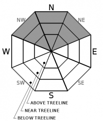
| Mid Slope Winds: | Light winds. | Light winds. Gusts up to 25 mph in the evening. | Light winds becoming southwest around 15 mph with gusts to 25 mph in the afternoon. |
| Expected snowfall: | No accumulation. | SWE = none. | No accumulation. | SWE = none. | No accumulation. | SWE = none. |
For 8000 ft. to 9000 ft.
| Thursday | Thursday Night | Friday | |
|---|---|---|---|
| Weather: | Sunny. Snow levels below 7000 feet. Chance of precipitation is 0%. | Clear. Snow levels below 7000 feet. Chance of precipitation is 0%. | Partly cloudy. Snow levels below 7000 feet. Chance of precipitation is 0%. |
| Temperatures: | 31 to 37. deg. F. | 16 to 21. deg. F. | 34 to 40. deg. F. |
| Ridge Top Winds: | East around 15 mph with gusts to 30 mph in the morning becoming light. | Southwest 15 to 25 mph. Gusts up to 35 mph increasing to 45 mph after midnight. | Southwest 15 to 25 mph with gusts to 40 mph. |
| Expected snowfall: | No accumulation. | SWE = none. | No accumulation. | SWE = none. | No accumulation. | SWE = none. |


