THIS AVALANCHE FORECAST EXPIRED ON April 25, 2020 @ 6:55 am
Avalanche Forecast published on April 24, 2020 @ 6:55 am
Issued by Steve Reynaud - Tahoe National Forest

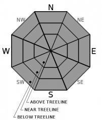
A weak refreeze of the snow surface is expected again today with above freezing overnight temperatures and clear skies.  Loose wet avalanches and cornice fall will be possible as rapid warming occurs.  MODERATE avalanche danger will exist today at all elevations.

2. Moderate

?

Above Treeline
Heightened avalanche conditions on specific terrain features. Evaluate snow and terrain carefully; identify features of concern.

2. Moderate

?

Near Treeline
Heightened avalanche conditions on specific terrain features. Evaluate snow and terrain carefully; identify features of concern.

2. Moderate

?

Below Treeline
Heightened avalanche conditions on specific terrain features. Evaluate snow and terrain carefully; identify features of concern.
    Heightened avalanche conditions on specific terrain features. Evaluate snow and terrain carefully; identify features of concern.
Avalanche Problem 1: Loose Wet
  • Type ?
  • Aspect/Elevation ?
  • Likelihood ?
    Certain
    Very Likely
    Likely
    Possible
    Unlikely
  • Size ?
    Historic
    Very Large
    Large
    Small

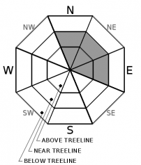
Clear overnight skies will provide a brief and superficial snow surface refreeze due to radiational cooling.  Overnight low temperatures were in the mid 30's to mid 40's at most locations.  Rapid warming occurring early this morning will melt and break down these surface crusts quickly.  E-SE-S aspects will melt the fastest and could be wet and unsupportable by mid-morning.  SW-W-NW-N-NE aspects will have varied melt rates throughout the day.  Timing will be critical if you want, or need, to travel in avalanche terrain today.  Loose wet avalanches large enough to injure or bury a backcountry user are possible.

Loose wet avalanches could occur as soon as the snow becomes wet and unsupportable.  Changing aspects may help to avoid deteriorating snow conditions.  Avoid avalanche terrain as the snow becomes wet and deep.

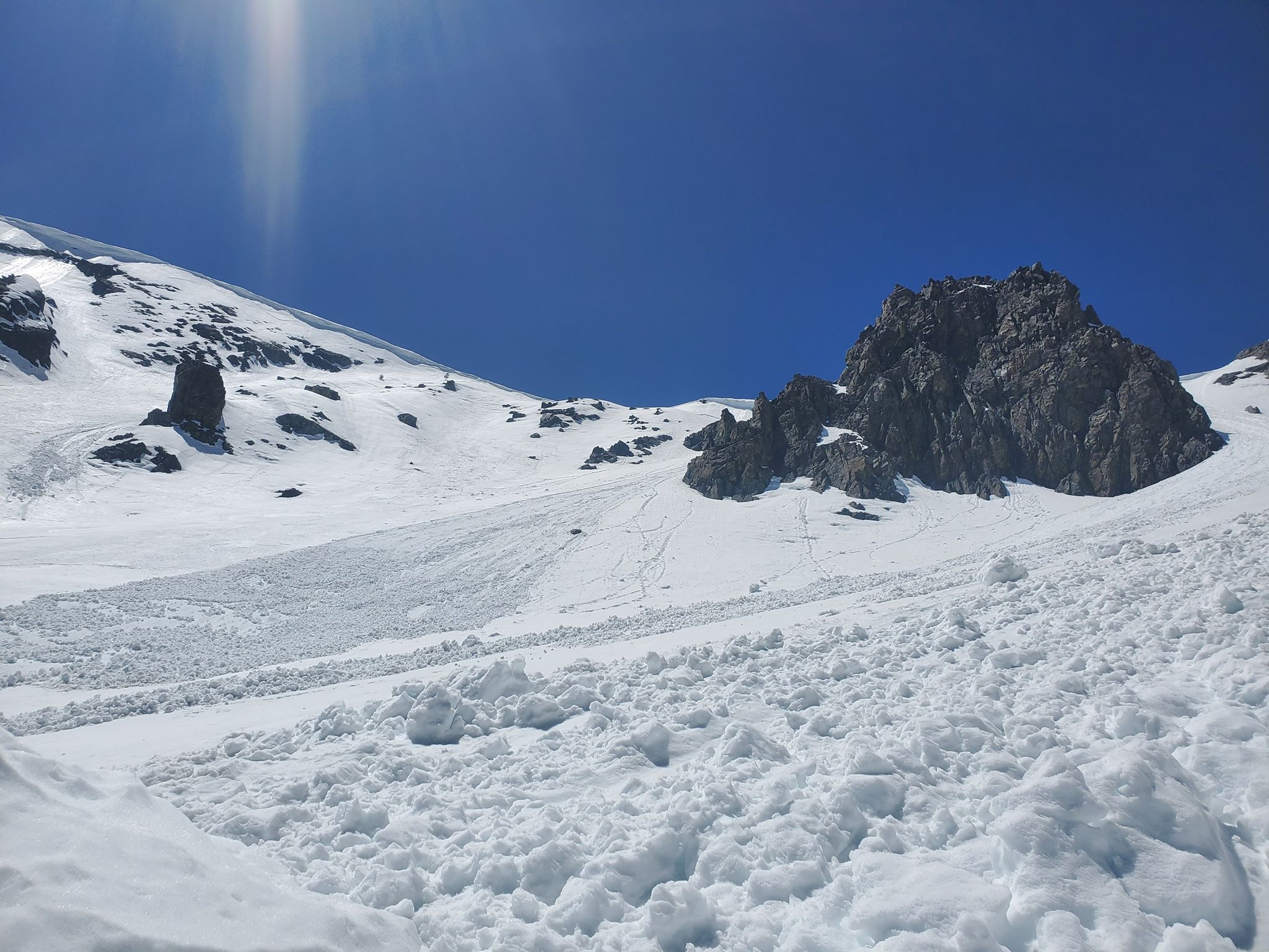
Photo:  Recent loose wet avalanche on Mt. Tallac, Desolation Wilderness area.

Avalanche Problem 2: Cornice
  • Type ?
  • Aspect/Elevation ?
  • Likelihood ?
    Certain
    Very Likely
    Likely
    Possible
    Unlikely
  • Size ?
    Historic
    Very Large
    Large
    Small

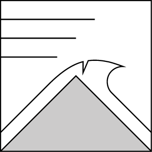
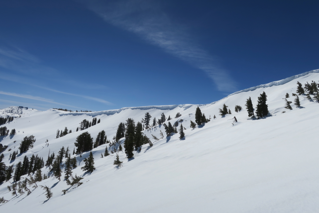
Cornice fall remains possible throughout the forecast region with a weak overnight refreeze and rapid warming today.  Large cornice blocks could break and slide downslope.  This cornice fall could also release loose wet avalanches or wet slab avalanches as they fall and load the slopes below.

Avoid areas and slopes below large cornices.  Stay well back from the edges of cornices along ridgelines and avoid any cracks that are along the backside of cornices


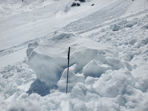
Photos:  Large cornice chunk from recent cornice fall on Mt. Tallac.  Large cornices on Carson Pass.

recent observations

Loose wet avalanches were reported from Mt. Tallac, in the Desolation Wilderness area, yesterday.  A group descending at 12:30pm on E-SE aspects caused numerous loose wet avalanches to run downslope.  Previous large loose wet avalanches and cornice fall was also observed in this area.

Observations from Little Roundtop, Carson Pass area, showed mostly supportable conditions into the midday.  By the early afternoon, snow became unsupportable below 8500'.  Evidence of previous loose wet avalanche activity along with cornice fall was observed in this area.

Snow surface conditions warmed quickly on Relay Peak, in the Mt. Rose area.  E aspects were wet and unsupportable by 9am with some sections of good corn snow found early on S/SW aspects.  Melt freeze crusts of 3-4'' thick became wet and unsupportable quickly yesterday.   

Weather and CURRENT CONDITIONS
weather summary

High pressure continues to build into the west with well above average temperatures and light winds expected today.  Overnight low temperatures were in the mid 30's to mid 40's, with daytime highs expected into the high 50' to 60's above 7000'.  Some cloud cover with slightly increased winds are expected this weekend with continued warm temperatures.  Quiet and warm weather continues into next week.

CONDITIONS ALONG THE SIERRA CREST BETWEEN 8200 FT. AND 9200 FT. IN THE LAST 24 HOURS
6am temperature: 35 to 46 deg. F.
Max. temperature: 46 to 56 deg. F.
Average ridgetop wind direction: W
Average ridgetop wind speed: 10 to 20 mph
Maximum ridgetop wind gust: 31 mph
New snowfall: 0 inches
Total snow depth: 47 to 71 inches
Two-Day Mountain Weather Forecast Produced in partnership with the Reno NWS
For 7000 ft. to 8000 ft.
Friday Friday Night Saturday
Weather: Sunny. Snow levels 9500 feet. Chance of precipitation is 0%. Partly cloudy. Snow levels 10000 feet. Chance of precipitation is 0%. Partly cloudy then becoming mostly cloudy. Snow levels 9000 feet. Chance of precipitation is 0%.
Temperatures: 58 to 64. deg. F. 36 to 41. deg. F. 59 to 65. deg. F.
Mid Slope Winds: Light winds becoming west 10 to 15 mph with gusts to 25 mph in the afternoon. West winds 10 to 15 mph with gusts up to 25 mph in the evening then becoming light. Light winds becoming west 10 to 15 mph with gusts up to 25 mph in the afternoon.
Expected snowfall: No accumulation. | SWE = none. No accumulation. | SWE = none. No accumulation. | SWE = none.
For 8000 ft. to 9000 ft.
Friday Friday Night Saturday
Weather: Sunny. Snow levels 9500 feet. Chance of precipitation is 0%. Partly cloudy. Snow levels 10000 feet. Chance of precipitation is 0%. Mostly cloudy. Snow levels 9500 feet. Chance of precipitation is 0%.
Temperatures: 52 to 58. deg. F. 34 to 39. deg. F. 54 to 60. deg. F.
Ridge Top Winds: Light winds becoming west around 15 mph with gusts to 25 mph in the afternoon. West around 15 mph with gusts to 25 mph. Southwest around 15 mph with gusts to 25 mph.
Expected snowfall: No accumulation. | SWE = none. No accumulation. | SWE = none. No accumulation. | SWE = none.
Disclaimer

This avalanche forecast is provided through a partnership between the Tahoe National Forest and the Sierra Avalanche Center. This forecast covers the Central Sierra Nevada Mountains between Yuba Pass on the north and Ebbetts Pass on the south. Click here for a map of the forecast area. This forecast applies only to backcountry areas outside established ski area boundaries. This forecast describes general avalanche conditions and local variations always occur. This forecast expires 24 hours after the posted time unless otherwise noted. The information in this forecast is provided by the USDA Forest Service who is solely responsible for its content.

For a recorded version of the avalanche forecast call (530) 587-3558 x258