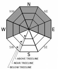
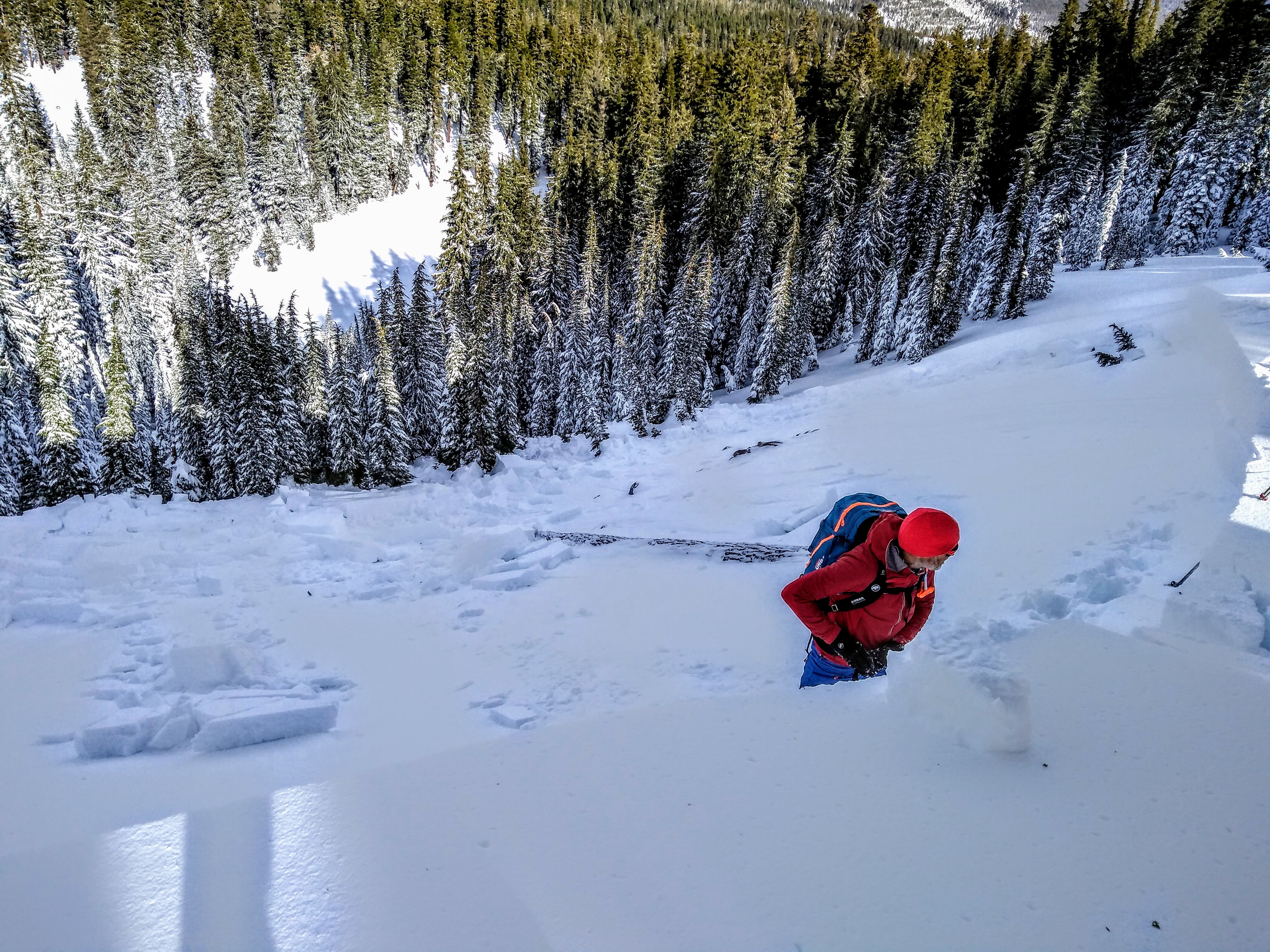
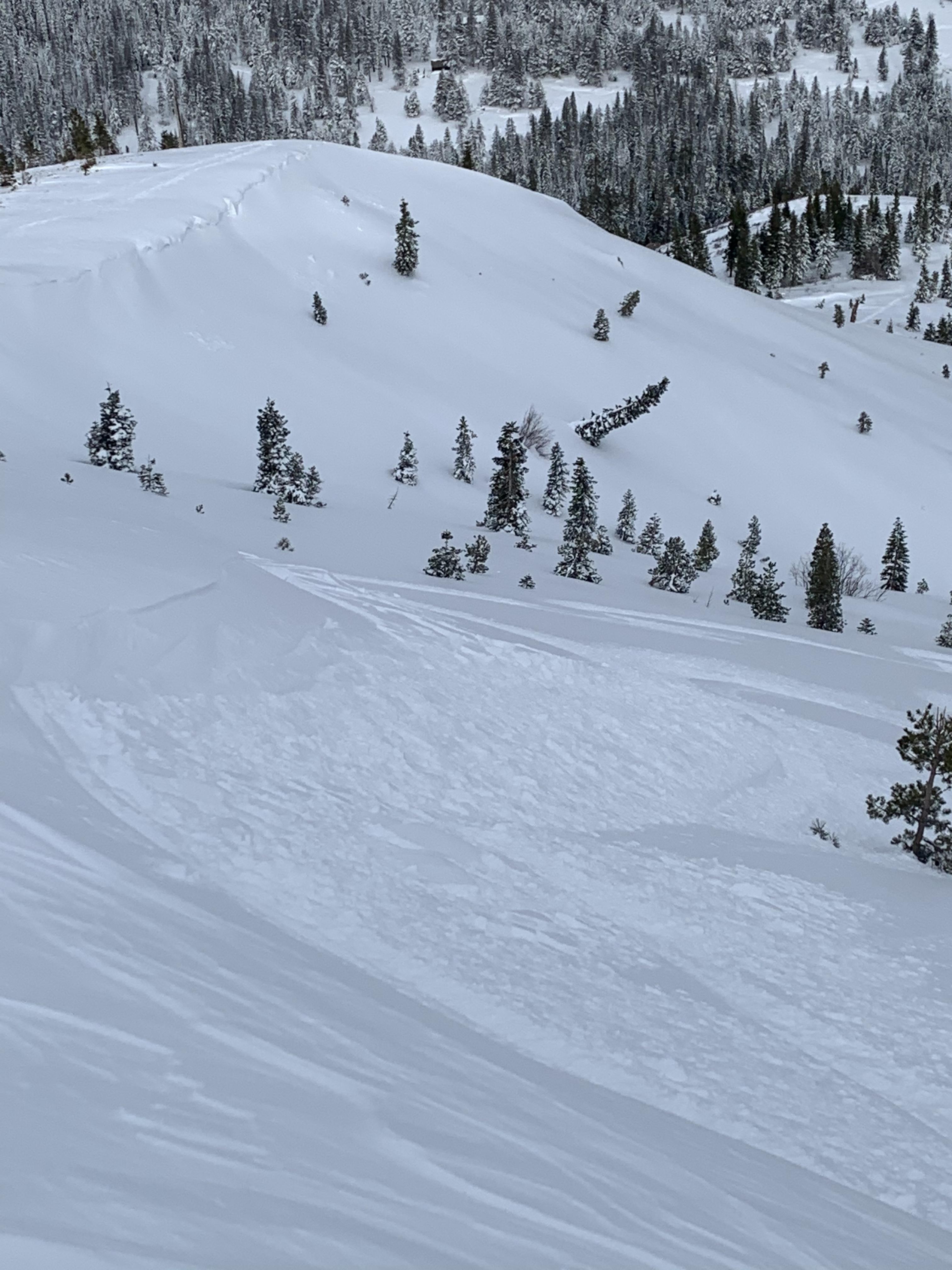
THIS AVALANCHE FORECAST EXPIRED ON December 29, 2020 @ 6:59 am
Avalanche Forecast published on December 28, 2020 @ 6:59 am
Issued by Brandon Schwartz - Tahoe National Forest

Dangerous avalanche conditions continue today following two consecutive days of avalanche activity. It is still not time to go big. Conservative, sub 30 degree slope angle terrain choices are highly recommended. Persistent slab and wind slab avalanches continue to occur and are stabilizing at slower than typical rates. CONSIDERABLE avalanche danger continues at all elevations.

3. Considerable

?

Above Treeline
Dangerous avalanche conditions. Careful snowpack evaluation, cautious route-finding and conservative decision-making essential.

3. Considerable

?

Near Treeline
Dangerous avalanche conditions. Careful snowpack evaluation, cautious route-finding and conservative decision-making essential.

3. Considerable

?

Below Treeline
Dangerous avalanche conditions. Careful snowpack evaluation, cautious route-finding and conservative decision-making essential.
    Dangerous avalanche conditions. Careful snowpack evaluation, cautious route-finding and conservative decision-making essential.
Avalanche Problem 1: Persistent Slab
  • Type ?
  • Aspect/Elevation ?
  • Likelihood ?
    Certain
    Very Likely
    Likely
    Possible
    Unlikely
  • Size ?
    Historic
    Very Large
    Large
    Small

Persistent slab avalanches have occurred during the past two days. This avalanche problem is clearly here as an avalanche that occurred yesterday was remote triggered from 150 yards away. The problematic weak layer of old faceted (sugary) snow, the Dec 11 PWL is buried deep in the snowpack. This weak layer has reactivated under the recent new snow load. This avalanche problem exists on W-NW-N-NE-E aspects, has a widespread distribution in below treeline and near treeline terrain, and isolated distribution above treeline.

Whumpfing, shooting cracks, recent avalanches, and unstable snowpit test results are all indications of unstable snow in the area. Do not write off the significance of any of these clues when dealing with a persistent slab avalanche problem, even if they seem isolated. Some people saw no signs of instability yesterday while others were triggering avalanches. Don't be fooled. "Despite our best efforts to be objective, you will always be influenced by the snow that was under your feet yesterday" - Janet Kellam. Don't let post storm travel without incident cloud current decision making.

If you choose not to scale back route choices to less than 30 degree angle slopes only, this is a difficult avalanche problem to manage. Signs of instability may or may not readily present themselves prior to triggering an avalanche. Do not underestimate potential avalanche size, potential runout distance, or the hazard from connected terrain above or to the side. Think bigger avalanche than expected. Ski, snowboard, or snowmobile slope cuts are not the right tool for this avalanche problem and are likely to lead to an accident. This is not a surface instability, this weak layer is too deep for slope cuts.

   Remote triggered persistent slab avalanche on Dec 27 on Carpenter Ridge.

Avalanche Problem 2: Wind Slab
  • Type ?
  • Aspect/Elevation ?
  • Likelihood ?
    Certain
    Very Likely
    Likely
    Possible
    Unlikely
  • Size ?
    Historic
    Very Large
    Large
    Small

Ski and snowmobile triggered wind slab avalanches occurred each of the last two days. Avalanche size has ranged from small to large depending on if the wind slab failed at the old/new snow interface up to 6 feet deep or in the upper portion of the snowpack. The old/new snow interface has been noted to contain some graupel which has the potential for slower than typical stabilization. Moderate speed E winds over the last 24 hours may have redistributed snow on the ground making wind slabs possible on all aspects above treeline and remaining on NW-N-NE-E-SE aspects in near treeline terrain.

Slopes near ridgetops in the immediate vicinity of cornices and pillows of wind drifted snow are highly suspect. Recent E winds may have scoured these wind slabs slightly, but they are still plenty thick. Identify specific areas of concern and move around them with caution and an avoidance mindset. Deeper persistent slab avalanches may occur on slopes with wind drifted snow where the obvious inclination is to think wind slab, especially near treeline. Again, don't be fooled.

    Dec 27 skier triggered wind slab avalanche (D1) and Dec 26 snowmobile triggered wind slab avalanche (D2).

recent observations

* A persistent slab avalanche was remotely triggered yesterday from 150 yards away while digging a snowpit in low angle terrain. This occurred on Carpenter Ridge (Independence Lake zone) on a near treeline NE aspect at 8,550'. Crown depth ranged from 2 to 5 feet with failure occurring on the faceted Dec 11 PWL. The crown depth was deepest under pillows of wind drifted snow. The slope angle at the avalanche site ranged from 32 to 38 degrees. The slope angle at the trigger point was 26 degrees. Very long shooting cracks connected from the trigger point over to the steeper slope where the avalanche occurred.

* Small wind slab avalanches were skier triggered yesterday on Donner Ridge. This occurred on N to NE aspect near treeline terrain at around 7,600'. Crown depth was less than 1 foot.

* Mixed results in snowpit data were reported from around the forecast area ranging from clearly unstable to no signs of instability.

Weather and CURRENT CONDITIONS
weather summary

A weather system is moving through the forecast area today for cloudy skies, light snowfall, and below average air temperatures. Ridgetop winds remain out of the E at moderate speed. Lighter wind speeds are forecast for this afternoon. Strong to gale force ridgetop winds out of the E are expected late tonight into tomorrow morning. Tomorrow will be a few degrees warmer than today. The next weather system to impact the region is forecast for Wednesday night into Thursday.

CONDITIONS ALONG THE SIERRA CREST BETWEEN 8200 FT. AND 9200 FT. IN THE LAST 24 HOURS
6am temperature: 14 to 20 deg. F.
Max. temperature: 23 to 28 deg. F.
Average ridgetop wind direction: E
Average ridgetop wind speed: 31 mph
Maximum ridgetop wind gust: 52 mph
New snowfall: Trace to 2 inches
Total snow depth: 25 to 36 inches
Two-Day Mountain Weather Forecast Produced in partnership with the Reno NWS
For 7000 ft. to 8000 ft.
Monday Monday Night Tuesday
Weather: Cloudy. Chance of snow in the morning then a slight chance of snow in the afternoon. Snow levels below 7000 feet. Chance of precipitation is 50%. Mostly cloudy with a slight chance of snow in the evening then becoming partly cloudy. Snow levels below 7000 feet. Chance of precipitation is 10%. Sunny. Snow levels below 7000 feet. Chance of precipitation is 0%.
Temperatures: 24 to 29. deg. F. 10 to 16. deg. F. 30 to 35. deg. F.
Mid Slope Winds: East winds to 10 mph. East winds 10 mph increasing to east 10 to 20 mph after midnight. East winds 10 to 20 mph with gusts up to 35 mph in the morning decreasing to east 10 to 15 mph in the afternoon.
Expected snowfall: 80% probability up to 2 inches. 20% probability of 2 to 4 inches. | SWE = less than 0.10 inch. Trace amounts. | SWE = trace amounts. No accumulation. | SWE = none.
For 8000 ft. to 9000 ft.
Monday Monday Night Tuesday
Weather: Cloudy. Chance of snow in the morning then a slight chance of snow in the afternoon. Snow levels below 7000 feet. Chance of precipitation is 55%. Mostly cloudy with a slight chance of snow in the evening then becoming partly cloudy. Snow levels below 7000 feet. Chance of precipitation is 10%. Sunny. Snow levels below 7000 feet. Chance of precipitation is 0%.
Temperatures: 20 to 25. deg. F. 8 to 14. deg. F. 26 to 32. deg. F.
Ridge Top Winds: Northeast 10 to 15 mph in the morning becoming light. North around 15 mph with gusts to 30 mph increasing to northeast 30 to 40 mph with gusts to 80 mph after midnight. Northeast 25 to 40 mph with gusts to 80 mph decreasing to 15 to 25 mph with gusts to 50 mph in the afternoon.
Expected snowfall: 60% probability up to 2 inches. 40% probability of 2 to 4 inches. | SWE = up to 0.10 inch. Up to 1 inch. | SWE = less than 0.10 inch. No accumulation. | SWE = none.
Disclaimer

This avalanche forecast is provided through a partnership between the Tahoe National Forest and the Sierra Avalanche Center. This forecast covers the Central Sierra Nevada Mountains between Yuba Pass on the north and Ebbetts Pass on the south. Click here for a map of the forecast area. This forecast applies only to backcountry areas outside established ski area boundaries. This forecast describes general avalanche conditions and local variations always occur. This forecast expires 24 hours after the posted time unless otherwise noted. The information in this forecast is provided by the USDA Forest Service who is solely responsible for its content.

For a recorded version of the avalanche forecast call (530) 587-3558 x258