THIS AVALANCHE FORECAST EXPIRED ON February 12, 2020 @ 6:58 am
Avalanche Forecast published on February 11, 2020 @ 6:58 am
Issued by Steve Reynaud - Tahoe National Forest

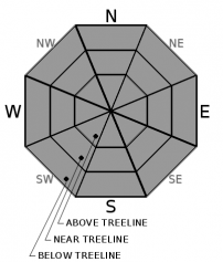
Sunny conditions with elevated winds will continue today.  Firm and variable snow surfaces exist throughout the backcountry providing challenging travel conditions.  LOW avalanche danger exists at all elevations with normal caution advised.

1. Low

?

Above Treeline
Generally safe avalanche conditions. Watch for unstable snow on isolated terrain features.

1. Low

?

Near Treeline
Generally safe avalanche conditions. Watch for unstable snow on isolated terrain features.

1. Low

?

Below Treeline
Generally safe avalanche conditions. Watch for unstable snow on isolated terrain features.
    Generally safe avalanche conditions. Watch for unstable snow on isolated terrain features.
Avalanche Problem 1: Normal Caution
  • Type ?
  • Aspect/Elevation ?
  • Likelihood ?
    Certain
    Very Likely
    Likely
    Possible
    Unlikely
  • Size ?
    Historic
    Very Large
    Large
    Small

Challenging backcountry conditions continue for our area.  Firm and variable crusts exist on most aspects and elevations.  Strong to gale force NE winds today will prevent most near and above treeline areas from softening.  Long sliding falls continue to be one of the biggest hazards for backcountry users.  Some snow surface softening may occur on southerly aspects in wind protected lower elevations.  The weather today should limit any significant loose wet instabilities from forming on these southerly aspects

Make sure to have a travel plan for your group that matches our current conditions.  Advanced travel skills may be required in steep and firm terrain.

recent observations

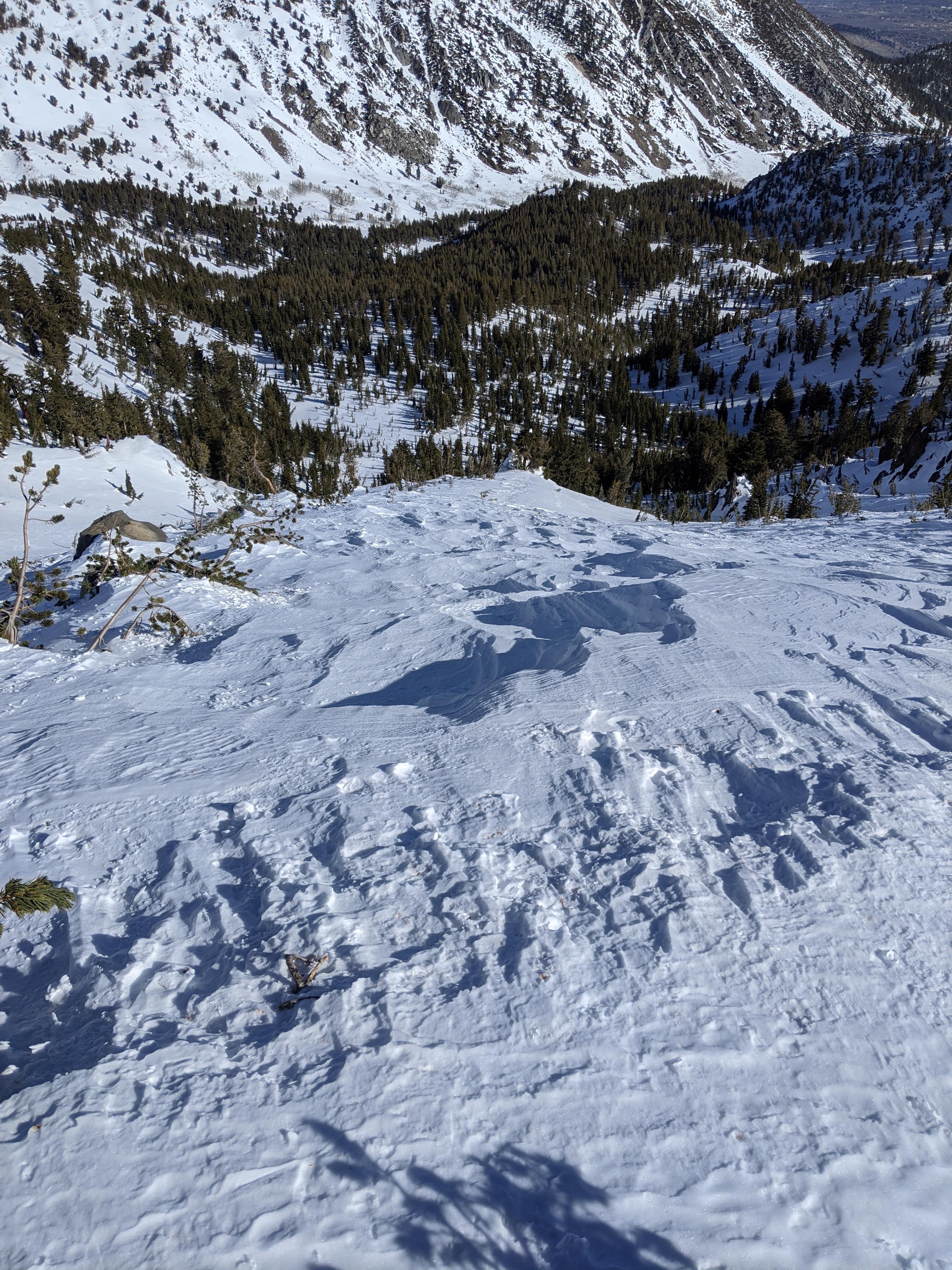
Observations from Mt. Judah (Donner Summit area), Incline Lake Peak and Tamarack Peak (Mt. Rose area) all showed firm and variable snow surface conditions.  Firm crusts existed on most aspects and elevations.  Cold NE winds kept most southerly aspects from softening throughout the day.  Soft wind blown snow and sun softened snow exist in limited areas.

 Wind scoured features on NE aspect near the top of Tamarack Peak.

Weather and CURRENT CONDITIONS
weather summary

A dry NE flow will continue today with mild temperatures at the lower elevations.  Winds will remain elevated over the upper ridges and peaks with current morning wind speeds of 25 to 60mph along the Sierra Crest.  Wind gusts over Lake Tahoe could reach 25 to 30mph today.  Some increases in clouds are expected on Thursday and Friday with a slight chance of minor precipitation.  The holiday weekend storm is also trending drier with low chances of us seeing any precipitation.    

CONDITIONS ALONG THE SIERRA CREST BETWEEN 8200 FT. AND 9200 FT. IN THE LAST 24 HOURS
6am temperature: 20 to 25 deg. F.
Max. temperature: 29 to 37 deg. F.
Average ridgetop wind direction: NE/E
Average ridgetop wind speed: 25 to 60 mph
Maximum ridgetop wind gust: 119 mph
New snowfall: 0 inches
Total snow depth: 41 to 51 inches
Two-Day Mountain Weather Forecast Produced in partnership with the Reno NWS
For 7000 ft. to 8000 ft.
Tuesday Tuesday Night Wednesday
Weather: Sunny. Snow levels below 7000 feet. Chance of precipitation is 0%. Clear. Snow levels below 7000 feet. Chance of precipitation is 0%. Partly cloudy. Snow levels below 7000 feet. Chance of precipitation is 0%.
Temperatures: 40 to 46. deg. F. 22 to 27. deg. F. 41 to 47. deg. F.
Mid Slope Winds: East around 15 mph with gusts to 30 mph. Light winds. Light winds.
Expected snowfall: No accumulation. | SWE = none. No accumulation. | SWE = none. No accumulation. | SWE = none.
For 8000 ft. to 9000 ft.
Tuesday Tuesday Night Wednesday
Weather: Sunny. Snow levels below 7000 feet. Chance of precipitation is 0%. Clear. Snow levels below 7000 feet. Chance of precipitation is 0%. Partly cloudy. Snow levels below 7000 feet. Chance of precipitation is 0%.
Temperatures: 33 to 38. deg. F. 20 to 25. deg. F. 34 to 39. deg. F.
Ridge Top Winds: Northeast 15 to 30 mph with gusts to 50 mph. North around 15 mph with gusts to 35 mph. North around 15 mph with gusts to 30 mph.
Expected snowfall: No accumulation. | SWE = none. No accumulation. | SWE = none. No accumulation. | SWE = none.
Disclaimer

This avalanche forecast is provided through a partnership between the Tahoe National Forest and the Sierra Avalanche Center. This forecast covers the Central Sierra Nevada Mountains between Yuba Pass on the north and Ebbetts Pass on the south. Click here for a map of the forecast area. This forecast applies only to backcountry areas outside established ski area boundaries. This forecast describes general avalanche conditions and local variations always occur. This forecast expires 24 hours after the posted time unless otherwise noted. The information in this forecast is provided by the USDA Forest Service who is solely responsible for its content.

For a recorded version of the avalanche forecast call (530) 587-3558 x258