THIS AVALANCHE FORECAST EXPIRED ON February 25, 2020 @ 6:59 am
Avalanche Forecast published on February 24, 2020 @ 6:59 am
Issued by Andy Anderson - Tahoe National Forest - Sierra Avalanche Center

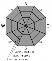
A shallow layer of wet surface snow should form on sun-exposed slopes today, but it should not get deep enough for significant wet loose avalanche activity. Shady slopes may remain firm all day. LOW avalanche danger exists with normal caution advised.

1. Low

?

Above Treeline
Generally safe avalanche conditions. Watch for unstable snow on isolated terrain features.

1. Low

?

Near Treeline
Generally safe avalanche conditions. Watch for unstable snow on isolated terrain features.

1. Low

?

Below Treeline
Generally safe avalanche conditions. Watch for unstable snow on isolated terrain features.
    Generally safe avalanche conditions. Watch for unstable snow on isolated terrain features.
Avalanche Problem 1: Normal Caution
  • Type ?
  • Aspect/Elevation ?
  • Likelihood ?
    Certain
    Very Likely
    Likely
    Possible
    Unlikely
  • Size ?
    Historic
    Very Large
    Large
    Small

Sunny warm weather today will form a layer of soft wet loose snow on top of refrozen surfaces. Mid to lower elevation slopes will experience the most warming and more exposed upper elevation slopes will take longer to soften. N winds at the upper elevations, a solid overnight refreeze, and well-established snowpack drainage should keep significant loose wet avalanche activity unlikely today. The sun-exposed E-SE aspects will soften first followed by the S-SW-W aspects. Northerly aspects should remain mostly firm.

Variable and challenging conditions with the potential for long sliding falls on firm surfaces and/or collisions with exposed obstacles exist on many backcountry slopes. Careful timing that allows soft corn snow to form on sun-exposed slopes and terrain selection that matches your group's skills and equipment can make backcountry travel more fun and safer.

recent observations

* Spring melt-freeze conditions continue on sun-exposed E-SE-S-SW-W aspects. Firm refrozen surfaces exist on these slopes in the morning. As the day warms up, a layer of soft corn snow forms on the surface of these slopes.

* NW-N-NE aspects hold mostly firm surfaces in exposed near and above treeline areas. In more sheltered areas, a mix of breakable crusts, firm surfaces, and a few isolated areas of softer faceted surface snow exist.

Weather and CURRENT CONDITIONS
weather summary

After a breezy afternoon, the winds shifted to the NE last night and decreased. Wind should continue to decrease today as a high-pressure ridge builds over the area. This ridge will also bring warmer temperatures and sunny skies with daytime highs climbing well above average over the next few days.  

CONDITIONS ALONG THE SIERRA CREST BETWEEN 8200 FT. AND 9200 FT. IN THE LAST 24 HOURS
6am temperature: 28 to 32 deg. F.
Max. temperature: 36 to 46 deg. F.
Average ridgetop wind direction: W shifting to NE after 8 pm
Average ridgetop wind speed: W: 20 to 30 mph | NE: 10 to 20 mph
Maximum ridgetop wind gust: 56 mph
New snowfall: 0 inches
Total snow depth: 39 to 47 inches
Two-Day Mountain Weather Forecast Produced in partnership with the Reno NWS
For 7000 ft. to 8000 ft.
Monday Monday Night Tuesday
Weather: Sunny. Chance of precipitation is 0%. Clear. Chance of precipitation is 0%. Sunny. Chance of precipitation is 0%.
Temperatures: 43 to 49 deg. F. 23 to 28 deg. F. 45 to 51 deg. F.
Mid Slope Winds: Light winds. Light winds. Light winds. Gusts up to 25 mph in the afternoon.
Expected snowfall: No accumulation. | SWE = none. No accumulation. | SWE = none. No accumulation. | SWE = none.
For 8000 ft. to 9000 ft.
Monday Monday Night Tuesday
Weather: Sunny. Chance of precipitation is 0%. Clear. Chance of precipitation is 0%. Sunny. Chance of precipitation is 0%.
Temperatures: 37 to 45 deg. F. 21 to 26 deg. F. 40 to 46 deg. F.
Ridge Top Winds: North 15 to 30 mph with gusts to 50 mph. Northeast 15 to 30 mph. Gusts up to 55 mph decreasing to 40 mph after midnight. East 15 to 25 mph with gusts to 55 mph.
Expected snowfall: No accumulation. | SWE = none. No accumulation. | SWE = none. No accumulation. | SWE = none.
Disclaimer

This avalanche forecast is provided through a partnership between the Tahoe National Forest and the Sierra Avalanche Center. This forecast covers the Central Sierra Nevada Mountains between Yuba Pass on the north and Ebbetts Pass on the south. Click here for a map of the forecast area. This forecast applies only to backcountry areas outside established ski area boundaries. This forecast describes general avalanche conditions and local variations always occur. This forecast expires 24 hours after the posted time unless otherwise noted. The information in this forecast is provided by the USDA Forest Service who is solely responsible for its content.

For a recorded version of the avalanche forecast call (530) 587-3558 x258