THIS AVALANCHE FORECAST EXPIRED ON February 4, 2020 @ 6:57 am
Avalanche Forecast published on February 3, 2020 @ 6:57 am
Issued by Andy Anderson - Tahoe National Forest - Sierra Avalanche Center

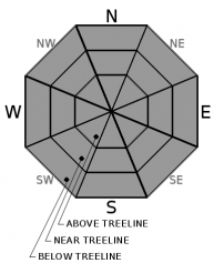
Firm icy surfaces on exposed slopes and variable conditions on sheltered slopes will represent today's main concerns for backcountry travelers. Significant avalanche activity should remain unlikely due to the limited amount of new snow that accumulated. LOW avalanche danger exists at all elevations.

1. Low

?

Above Treeline
Generally safe avalanche conditions. Watch for unstable snow on isolated terrain features.

1. Low

?

Near Treeline
Generally safe avalanche conditions. Watch for unstable snow on isolated terrain features.

1. Low

?

Below Treeline
Generally safe avalanche conditions. Watch for unstable snow on isolated terrain features.
    Generally safe avalanche conditions. Watch for unstable snow on isolated terrain features.
Avalanche Problem 1: Normal Caution
  • Type ?
  • Aspect/Elevation ?
  • Likelihood ?
    Certain
    Very Likely
    Likely
    Possible
    Unlikely
  • Size ?
    Historic
    Very Large
    Large
    Small

1 to 3 inches of cold new snow resting on firm snow surfaces should result in "dust on crust" conditions on sheltered slopes. Hard icy surfaces will exist on more exposed slopes as a result of wind scouring by strong SW and NE winds. While a small sluff of loose dry snow or a very small and isolated slab of wind drifted snow may not be impossible, long sliding falls on firm slopes and challenging travel conditions on sheltered slopes could pose greater risks to backcountry travelers than avalanche activity today.

Travel using normal caution in the backcountry. Assess terrain and conditions and build a travel plan with appropriate safety margins. Maintain active communication as you travel to make sure that your group stays within their abilities in these potentially firm and challenging conditions. Dialing the slope angle down can ease travel challenges and make the "dust on crust" conditions feel softer and less crusty.

recent observations

* Yesterday north of Donner Summit near White Rock Lake, snowmobilers reported "dust on crust" conditions with about 1 inch of new snow by the afternoon. 

* On Elephants Hump near Carson Pass yesterday, skiers reported 1-2 inches of new snow on top of surface crusts. Observers also saw some softer weaker snow just below the surface crust.

* In the Mt. Rose backcountry, observers found variable firm conditions on Chickadee Ridge and Incline Lake Peak yesterday morning. Snowfall started in this area around 11 am. 


Weather and CURRENT CONDITIONS
weather summary

The cold front blew through the area yesterday with strong SW winds and about 1-3 inches of new snow. The winds shifted to the NE in the evening and temperatures continued to plummet with lows dropping into the single digits overnight. The forecast calls more NE and E wind and cold weather today and tomorrow. Warmer weather should start to return to the region around midweek.

CONDITIONS ALONG THE SIERRA CREST BETWEEN 8200 FT. AND 9200 FT. IN THE LAST 24 HOURS
6am temperature: 2 to 11 deg. F.
Max. temperature: 30 to 41 deg. F.
Average ridgetop wind direction: SW shifting to NE after 6 pm
Average ridgetop wind speed: SW: 40 mph | NE: 20 mph
Maximum ridgetop wind gust: 72 mph
New snowfall: 1 to 3 inches
Total snow depth: 45 to 55 inches
Two-Day Mountain Weather Forecast Produced in partnership with the Reno NWS
For 7000 ft. to 8000 ft.
Monday Monday Night Tuesday
Weather: Sunny then becoming partly cloudy. Snow levels below 7000 feet. Chance of precipitation is 5%. Clear. Snow levels below 7000 feet. Chance of precipitation is 0%. Sunny. Snow levels below 7000 feet. Chance of precipitation is 0%.
Temperatures: 17 to 22 deg. F. 4 to 10 deg. F. 22 to 27 deg. F.
Mid Slope Winds: North around 15 mph with gusts to 35 mph. Northeast around 15 mph with gusts to 30 mph. East around 15 mph with gusts to 30 mph.
Expected snowfall: No accumulation. | SWE = none. No accumulation. | SWE = none. No accumulation. | SWE = none.
For 8000 ft. to 9000 ft.
Monday Monday Night Tuesday
Weather: Sunny then becoming partly cloudy. Snow levels below 7000 feet. Chance of precipitation is 5%. Clear. Snow levels below 7000 feet. Chance of precipitation is 0%. Sunny. Snow levels below 7000 feet. Chance of precipitation is 0%.
Temperatures: 11 to 17 deg. F. 1 to 7 deg. F. 18 to 24 deg. F.
Ridge Top Winds: North 15 to 30 mph with gusts to 60 mph. Northeast 20 to 35 mph. Gusts up to 45 mph after midnight. East 20 to 35 mph with gusts to 45 mph.
Expected snowfall: No accumulation. | SWE = none. No accumulation. | SWE = none. No accumulation. | SWE = none.
Disclaimer

This avalanche forecast is provided through a partnership between the Tahoe National Forest and the Sierra Avalanche Center. This forecast covers the Central Sierra Nevada Mountains between Yuba Pass on the north and Ebbetts Pass on the south. Click here for a map of the forecast area. This forecast applies only to backcountry areas outside established ski area boundaries. This forecast describes general avalanche conditions and local variations always occur. This forecast expires 24 hours after the posted time unless otherwise noted. The information in this forecast is provided by the USDA Forest Service who is solely responsible for its content.

For a recorded version of the avalanche forecast call (530) 587-3558 x258