THIS AVALANCHE FORECAST EXPIRED ON February 6, 2020 @ 6:54 am
Avalanche Forecast published on February 5, 2020 @ 6:54 am
Issued by Steve Reynaud - Tahoe National Forest

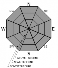
A warming trend beginning today will start to allow the snow surface to soften with the potential for small loose wet instabilities.  Normal caution is advised with LOW avalanche danger expected throughout the forecast region.

1. Low

?

Above Treeline
Generally safe avalanche conditions. Watch for unstable snow on isolated terrain features.

1. Low

?

Near Treeline
Generally safe avalanche conditions. Watch for unstable snow on isolated terrain features.

1. Low

?

Below Treeline
Generally safe avalanche conditions. Watch for unstable snow on isolated terrain features.
    Generally safe avalanche conditions. Watch for unstable snow on isolated terrain features.
Avalanche Problem 1: Normal Caution
  • Type ?
  • Aspect/Elevation ?
  • Likelihood ?
    Certain
    Very Likely
    Likely
    Possible
    Unlikely
  • Size ?
    Historic
    Very Large
    Large
    Small

The snow surface remains a variety of supportable and unsupportable crusts.  Challenging travel conditions could be encountered with firm and variable surfaces.  With increasing cloud cover today and continued NE winds, softening of these crusts should be limited at the higher elevations.  At mid and lower elevations, some small loose wet instabilities could occur.  These would be in the form of roller balls and pinwheels in areas that warm up quickly around rocks, cliffs, and gully features.  Loose wet instabilities are expected to increase over the next few days as temperatures continue to warm.  

In some isolated near and above treeline areas, wind slabs may exist from the recent NE wind event.  In most cases, these wind slabs should be small and not be a concern for backcountry users. 

Normal caution is advised throughout the forecast area.  Make sure your group has a travel plan, practices good communication, and everyone carries the proper equipment (including avalanche rescue gear).     

recent observations

Variable snow surface conditions were reported from Castle Peak (Donner Summit area) yesterday.  Most areas had breakable crust on the surface, or slightly buried under the recent snow.  Minimal to no wind slab development was found in this area from the recent NE/E wind event.

Weather and CURRENT CONDITIONS
weather summary

Today will start a warming trend that will go through Saturday.  Increasing clouds with elevated NE/N winds will continue through tonight limiting some of the warming for today.  A slight chance of very light precipitation is possible for today with snow levels at 7000'.  Thursday and Friday will have clearing skies and be much warmer with lighter winds.  A dry low pressure system will move into our area Saturday night.  Increasing winds and the chance of very light snow will be possible on Sunday.  A NE wind event, even stronger than the one we just had, could be possible as the low moves out of our area on Sunday. 


CONDITIONS ALONG THE SIERRA CREST BETWEEN 8200 FT. AND 9200 FT. IN THE LAST 24 HOURS
6am temperature: 24 to 30 deg. F.
Max. temperature: 25 to 30 deg. F.
Average ridgetop wind direction: E to NE
Average ridgetop wind speed: 25 to 45 mph
Maximum ridgetop wind gust: 78 mph
New snowfall: 0 inches
Total snow depth: 42 to 53 inches
Two-Day Mountain Weather Forecast Produced in partnership with the Reno NWS
For 7000 ft. to 8000 ft.
Wednesday Wednesday Night Thursday
Weather: Partly cloudy. Snow levels below 7000 feet. Chance of precipitation is 10%. Partly cloudy. Slight chance of snow showers after midnight. Snow levels 7000 feet. Chance of precipitation is 10%. Sunny. Snow levels below 7000 feet increasing to 7500 feet in the afternoon. Chance of precipitation is 0%.
Temperatures: 37 to 42. deg. F. 23 to 28. deg. F. 42 to 48. deg. F.
Mid Slope Winds: Northeast 10 to 15 mph with gusts to 20 mph. Northeast 10 to 15 mph with gusts to 25 mph. Light winds.
Expected snowfall: No accumulation. | SWE = none. No accumulation. | SWE = none. No accumulation. | SWE = none.
For 8000 ft. to 9000 ft.
Wednesday Wednesday Night Thursday
Weather: Partly cloudy. Snow levels below 7000 feet increasing to 7000 feet in the afternoon. Chance of precipitation is 10%. Partly cloudy. Slight chance of snow showers after midnight. Snow levels 7000 feet. Chance of precipitation is 10%. Sunny. Snow levels below 7000 feet increasing to 7500 feet in the afternoon. Chance of precipitation is 5%.
Temperatures: 33 to 39. deg. F. 23 to 28. deg. F. 38 to 44. deg. F.
Ridge Top Winds: Northeast 20 to 35 mph with gusts to 60 mph. North 15 to 30 mph with gusts to 50 mph shifting to the northeast 15 to 20 mph with gusts to 35 mph after midnight. Northeast 15 to 25 mph with gusts to 40 mph.
Expected snowfall: No accumulation. | SWE = none. No accumulation. | SWE = none. No accumulation. | SWE = none.
Disclaimer

This avalanche forecast is provided through a partnership between the Tahoe National Forest and the Sierra Avalanche Center. This forecast covers the Central Sierra Nevada Mountains between Yuba Pass on the north and Ebbetts Pass on the south. Click here for a map of the forecast area. This forecast applies only to backcountry areas outside established ski area boundaries. This forecast describes general avalanche conditions and local variations always occur. This forecast expires 24 hours after the posted time unless otherwise noted. The information in this forecast is provided by the USDA Forest Service who is solely responsible for its content.

For a recorded version of the avalanche forecast call (530) 587-3558 x258