THIS AVALANCHE FORECAST EXPIRED ON February 9, 2020 @ 6:52 am
Avalanche Forecast published on February 8, 2020 @ 6:52 am
Issued by Brandon Schwartz - Tahoe National Forest

Another round of snow surface melt leading to the possibility of loose wet avalanches is expected today. MODERATE avalanche danger will develop today at all elevations as daytime warming and snow surface melt progresses.

2. Moderate

?

Above Treeline
Heightened avalanche conditions on specific terrain features. Evaluate snow and terrain carefully; identify features of concern.

2. Moderate

?

Near Treeline
Heightened avalanche conditions on specific terrain features. Evaluate snow and terrain carefully; identify features of concern.

2. Moderate

?

Below Treeline
Heightened avalanche conditions on specific terrain features. Evaluate snow and terrain carefully; identify features of concern.
    Heightened avalanche conditions on specific terrain features. Evaluate snow and terrain carefully; identify features of concern.
Avalanche Problem 1: Loose Wet
  • Type ?
  • Aspect/Elevation ?
  • Likelihood ?
    Certain
    Very Likely
    Likely
    Possible
    Unlikely
  • Size ?
    Historic
    Very Large
    Large
    Small

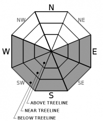
A loose wet avalanche problem is expected to develop again today at all elevations mainly on E-SE-S-SW-W aspects. Avalanche size is expected mainly at D1 with an isolated D2 not impossible. When more than a couple of inches of surface wet snow is present, anticipate loose wet avalanches. Avoidance of this avalanche problem can be accomplished by the following: 1) The use of timing travel prior to excessive snow surface melt. 2) Utilizing lower angle slopes without steeper slopes above. 3) Selecting aspects without direct sun exposure when necessary.

Conditions last night were conducive to snow surface refreeze. Slower melt rates are expected today from increasing SW winds creating convective cooling of the snow surface and maximum daytime air temperatures about 5 degrees cooler than yesterday. That said, wind protected slopes with exposed rocks and direct sun exposure will still warm quickly today. While the vast majority of loose wet avalanches today are expected to be fairly small, consequences can be greatly increased by downslope hazards such as rocks, trees, cliffs, or terrain traps.

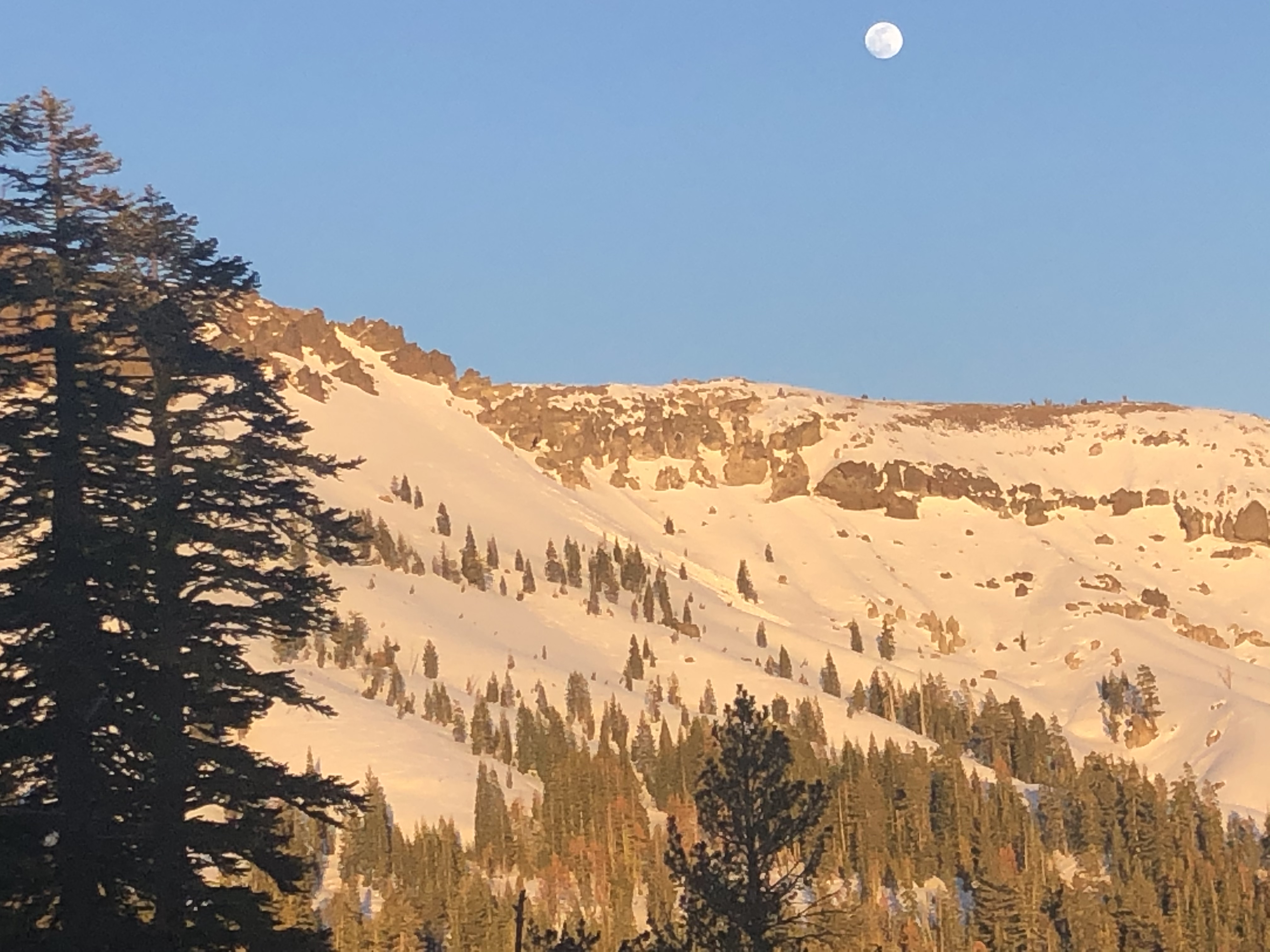
 Loose wet avalanche from yesterday afternoon on a SW aspect of Castle Peak (Donner Summit area).

recent observations

* A loose wet avalanche, possibly large enough to bury a person was reported yesterday afternoon on a SW aspect of Castle Peak (Donner Summit area). This avalanche appears to have been skier or snowboarder triggered. This is the largest loose wet avalanche reported from the current warming cycle at size D1.5 to D2.

* Several small (size D1) loose wet avalanches have been reported from areas of direct sun exposure over the past two days.

* Little to no snow is available today for drifting by the increasing SW winds.

Weather and CURRENT CONDITIONS
weather summary

Another day of sunshine and warm air temperatures is forecast for today, but this time with wind. An approaching cold front is increasing SW winds which are expected to be strong this afternoon. Winds are forecast to abruptly shift to the NE tonight following frontal passage. This will also cool air temperatures significantly. Winds will increase out of the NE with gale force ridgetop winds expected for Sunday and Monday. Light snowfall will occur tonight and tomorrow. Maximum daytime air temperatures above 7,000' for tomorrow are forecast to be 10 to 15 degrees colder than today. Wind chill will make it feel substantially colder.

CONDITIONS ALONG THE SIERRA CREST BETWEEN 8200 FT. AND 9200 FT. IN THE LAST 24 HOURS
6am temperature: 30 to 34 deg. F.
Max. temperature: 44 to 50 deg. F.
Average ridgetop wind direction: NE shifting to SW
Average ridgetop wind speed: 23 mph
Maximum ridgetop wind gust: 51 mph
New snowfall: 0 inches
Total snow depth: 41 to 52 inches
Two-Day Mountain Weather Forecast Produced in partnership with the Reno NWS
For 7000 ft. to 8000 ft.
Saturday Saturday Night Sunday
Weather: Sunny. Chance of precipitation is 0%. Clear then becoming mostly cloudy. Chance of snow through the night. Snow levels below 7000 feet. Chance of precipitation is 25%. Mostly cloudy. Chance of snow through the day. Snow levels below 7000 feet. Chance of precipitation is 30%.
Temperatures: 43 to 49. deg. F. 15 to 20. deg. F. 24 to 30. deg. F.
Mid Slope Winds: Southwest 15 to 25 mph with gusts to 55 mph. North around 15 mph with gusts to 40 mph. Northeast 15 to 20 mph increasing to 20 to 30 mph in the afternoon. Gusts up to 65 mph.
Expected snowfall: No accumulation. | SWE = none. 80% probability up to 1 inch. 20% probability no accumulation. | SWE = less than 0.10 inch. 60% probability up to 2 inches. 40% probability of 2 to 3 inches. | SWE = less than 0.10 inch.
For 8000 ft. to 9000 ft.
Saturday Saturday Night Sunday
Weather: Sunny. Chance of precipitation is 0%. Clear then becoming mostly cloudy. Chance of snow through the night. Snow levels below 7000 feet. Chance of precipitation is 25%. Mostly cloudy. Chance of snow. Snow levels below 7000 feet. Chance of precipitation is 30%.
Temperatures: 37 to 43. deg. F. 10 to 15. deg. F. 18 to 24. deg. F.
Ridge Top Winds: Southwest 20 to 35 mph with gusts to 60 mph. West 15 to 25 mph shifting to the northeast after midnight. Gusts up to 45 mph. Northeast 25 to 35 mph increasing to 30 to 45 mph in the afternoon. Gusts up to 80 mph.
Expected snowfall: No accumulation. | SWE = none. 80% probability up to 1 inch. 20% probability no accumulation. | SWE = less than 0.10 inch. 60% probability up to 2 inches. 40% probability of 2 to 4 inches. | SWE = less than 0.10 inch.
Disclaimer

This avalanche forecast is provided through a partnership between the Tahoe National Forest and the Sierra Avalanche Center. This forecast covers the Central Sierra Nevada Mountains between Yuba Pass on the north and Ebbetts Pass on the south. Click here for a map of the forecast area. This forecast applies only to backcountry areas outside established ski area boundaries. This forecast describes general avalanche conditions and local variations always occur. This forecast expires 24 hours after the posted time unless otherwise noted. The information in this forecast is provided by the USDA Forest Service who is solely responsible for its content.

For a recorded version of the avalanche forecast call (530) 587-3558 x258