THIS AVALANCHE FORECAST EXPIRED ON January 31, 2020 @ 6:42 am
Avalanche Forecast published on January 30, 2020 @ 6:42 am
Issued by Brandon Schwartz - Tahoe National Forest

Shallow, difficult to trigger slabs of wind drifted snow exist near treeline and above treeline. Warming conditions and snow surface melt will allow for rollerballs and maybe some small loose wet avalanches. Isolated small avalanches may occur today, well within the definition of today's forecast of LOW avalanche danger for all elevations.

1. Low

?

Above Treeline
Generally safe avalanche conditions. Watch for unstable snow on isolated terrain features.

1. Low

?

Near Treeline
Generally safe avalanche conditions. Watch for unstable snow on isolated terrain features.

1. Low

?

Below Treeline
Generally safe avalanche conditions. Watch for unstable snow on isolated terrain features.
    Generally safe avalanche conditions. Watch for unstable snow on isolated terrain features.
Avalanche Problem 1: Wind Slab
  • Type ?
  • Aspect/Elevation ?
  • Likelihood ?
    Certain
    Very Likely
    Likely
    Possible
    Unlikely
  • Size ?
    Historic
    Very Large
    Large
    Small

Strong winds over the past 48 hours first from the SW and then from the NE have scoured and drifted snow into lee areas on a variety of aspects near and above treeline. Shallow hard wind slabs are interspersed within areas of wind scoured slopes. Recently formed wind slabs have been very difficult to trigger over the past two days. The isolated wind slab avalanche at size D1 is the lingering concern.

Identify the smoother looking, possibly tiger striped slopes where recently formed wind slabs exist. Assess the terrain and determine how rocks, trees, cliffs, or terrain traps below could create injury or burial from what would otherwise be a small inconsequential avalanche. If a wind slab is present and the terrain below looks unforgiving, choose another slope to work with. Keep in mind that with isolated instability, everything seems stable right up until the moment that it is not. Resist lazy brain complacency.

Avalanche Problem 2: Loose Wet
  • Type ?
  • Aspect/Elevation ?
  • Likelihood ?
    Certain
    Very Likely
    Likely
    Possible
    Unlikely
  • Size ?
    Historic
    Very Large
    Large
    Small

Warming air temperatures and decreased winds today will allow for minor amounts of surface wet snow formation and loose wet avalanche problems. For today, expect this problem to occur near rocks and cliffs on SE-S-SW aspects. This is where the greatest amount of incoming solar radiation and snow surface heating will occur. Rollerballs are an indication that instability associated with loose wet avalanches is forming. Avalanche size for today is expected at D1 so consequences would come from things like cliffs or terrain traps below. This avalanche problem is expected to become more likely and widespread over the next two days as the warming trend continues.

recent observations

* Blowing and drifting snow has been observed over the past two days in ridgetop areas from SW wind on Tuesday and from NE wind on Wednesday.

* Shallow, dense, difficult to trigger wind slabs have been noted on all aspects in near to above treeline areas. A patchy mix of wind scoured areas and wind slabs exists near and above treeline.

Weather and CURRENT CONDITIONS
weather summary

High pressure will slowly build over the region today and tomorrow, breaking down Saturday night. Ridgetop winds decreased to light to moderate in speed last night. Lingering cloud cover this morning is expected to decrease as the day progresses. A maximum daytime air temperature warming trend, decreasing winds, and air temperature inversion conditions are forecast for the next few days. A strong cold front is forecast to move through the forecast area Saturday night through Sunday with gale force winds, snowfall, and dramatic cooling of air temperatures.

CONDITIONS ALONG THE SIERRA CREST BETWEEN 8200 FT. AND 9200 FT. IN THE LAST 24 HOURS
6am temperature: 30 to 35 deg. F.
Max. temperature: 34 to 39 deg. F.
Average ridgetop wind direction: NE
Average ridgetop wind speed: 28 mph
Maximum ridgetop wind gust: 75 mph
New snowfall: 0 inches
Total snow depth: 46 to 54 inches
Two-Day Mountain Weather Forecast Produced in partnership with the Reno NWS
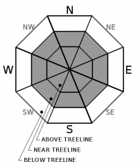
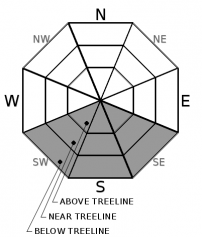
For 7000 ft. to 8000 ft.
Thursday Thursday Night Friday
Weather: Mostly cloudy then becoming partly cloudy. Snow levels 8000 feet. Chance of precipitation is 0%. Clear. Snow levels 7500 feet. Chance of precipitation is 0%. Sunny. Snow levels 8000 feet. Chance of precipitation is 0%.
Temperatures: 40 to 45. deg. F. 25 to 30. deg. F. 48 to 53. deg. F.
Mid Slope Winds: Light winds. Light winds. Light winds.
Expected snowfall: No accumulation. | SWE = none. No accumulation. | SWE = none. No accumulation. | SWE = none.
For 8000 ft. to 9000 ft.
Thursday Thursday Night Friday
Weather: Mostly cloudy then becoming partly cloudy. Snow levels 8000 feet. Chance of precipitation is 0%. Clear. Snow levels 7500 feet. Chance of precipitation is 0%. Sunny. Snow levels 8000 feet. Chance of precipitation is 0%.
Temperatures: 35 to 41. deg. F. 26 to 31. deg. F. 45 to 51. deg. F.
Ridge Top Winds: North around 15 mph with gusts to 30 mph. Northeast around 15 mph with gusts to 30 mph. Northeast around 15 mph with gusts to 30 mph.
Expected snowfall: No accumulation. | SWE = none. No accumulation. | SWE = none. No accumulation. | SWE = none.
Disclaimer

This avalanche forecast is provided through a partnership between the Tahoe National Forest and the Sierra Avalanche Center. This forecast covers the Central Sierra Nevada Mountains between Yuba Pass on the north and Ebbetts Pass on the south. Click here for a map of the forecast area. This forecast applies only to backcountry areas outside established ski area boundaries. This forecast describes general avalanche conditions and local variations always occur. This forecast expires 24 hours after the posted time unless otherwise noted. The information in this forecast is provided by the USDA Forest Service who is solely responsible for its content.

For a recorded version of the avalanche forecast call (530) 587-3558 x258