THIS AVALANCHE FORECAST EXPIRED ON March 12, 2020 @ 6:59 am
Avalanche Forecast published on March 11, 2020 @ 6:59 am
Issued by Andy Anderson - Tahoe National Forest - Sierra Avalanche Center

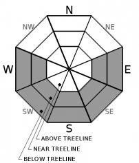
Expect generally stable snow again today since cool winds and some afternoon cloud cover should limit warming. Some small wet snow instabilities are not impossible on isolated terrain features in areas where cloud cover does not block the sun in the north or where rain might fall on the snowpack in the south. LOW avalanche danger exists at all elevations.

1. Low

?

Above Treeline
Generally safe avalanche conditions. Watch for unstable snow on isolated terrain features.

1. Low

?

Near Treeline
Generally safe avalanche conditions. Watch for unstable snow on isolated terrain features.

1. Low

?

Below Treeline
Generally safe avalanche conditions. Watch for unstable snow on isolated terrain features.
    Generally safe avalanche conditions. Watch for unstable snow on isolated terrain features.
Avalanche Problem 1: Loose Wet
  • Type ?
  • Aspect/Elevation ?
  • Likelihood ?
    Certain
    Very Likely
    Likely
    Possible
    Unlikely
  • Size ?
    Historic
    Very Large
    Large
    Small

Sunny skies this morning will start to soften and melt the surface snow as the day warms up. However, cool winds out of the E and NE and some cloud cover this afternoon should interrupt this daytime warming. These cooling factors should limit the amount of wet surface snow formation especially south of HWY 50 where more cloud cover should develop. While some small roller balls or pinwheels may occur on lower elevation steep sunny slopes protected from the winds, significant loose wet avalanche activity should remain unlikely today. A small sluff of loose wet snow is also not impossible on an isolated lower elevation terrain feature if an area receives rain this afternoon or if it gets full sun all day long.

Watch for changing snow conditions as the day warms up and travel using normal caution in the backcountry. Plans that focus on getting done before the snow has a chance to warm up too much or searching for cold soft snow on sheltered north aspects can lead to finding good quality snow and will limit potential exposure to an isolated and unlikely but not impossible loose wet avalanche.

recent observations

* Yesterday observers reported ENE winds transporting minor amounts of snow near ridgelines at Carson Pass and in the Mt. Rose backcountry. No signs of wind slabs instabilities were reported.

* Observations from Tamarack Peak revealed variable snow surfaces including firm scoured surfaces, soft cold snow, breakable crusts, and wet sticky snow (see this observation for details).

* ENE winds limited snow surface softening on both the Tamarack Peak and Elephants Back yesterday. Observers did not report any loose wet instabilities. 

Weather and CURRENT CONDITIONS
weather summary

A low-pressure system in southern CA could push some moisture and cloud cover into our forecast area this afternoon. This cloud cover should start in the south and work north. Some light rain/snow showers may develop south of Hwy 50 with little to no accumulation expected. Light to moderate NE and E winds should continue today and may increase slightly tomorrow as a high-pressure ridge builds over the region. The warmer temperatures should continue through Friday. 

CONDITIONS ALONG THE SIERRA CREST BETWEEN 8200 FT. AND 9200 FT. IN THE LAST 24 HOURS
6am temperature: 28 to 33 deg. F.
Max. temperature: 33 to 45 deg. F.
Average ridgetop wind direction: ENE
Average ridgetop wind speed: 23 to 32 mph
Maximum ridgetop wind gust: 66 mph
New snowfall: 0 inches
Total snow depth: 36 to 49 inches
Two-Day Mountain Weather Forecast Produced in partnership with the Reno NWS
For 7000 ft. to 8000 ft.
Wednesday Wednesday Night Thursday
Weather: Partly cloudy. Isolated showers in the afternoon south of Highway 50. Snow levels 7000 feet increasing to 8000 feet in the afternoon. Chance of precipitation is 15%. Partly cloudy then becoming clear. Snow levels 8500 feet decreasing to 7500 feet after midnight. Chance of precipitation is 5%. Sunny. Chance of precipitation is 0%.
Temperatures: 44 to 50 deg. F. 27 to 32 deg. F. 46 to 52 deg. F.
Mid Slope Winds: East up to 10 mph. Light winds. East up to 10 mph increasing to 10 to 15 mph in the afternoon. Gusts up to 25 mph.
Expected snowfall: Little or no accumulation. | SWE = trace amounts. No accumulation. | SWE = none. No accumulation. | SWE = none.
For 8000 ft. to 9000 ft.
Wednesday Wednesday Night Thursday
Weather: Partly cloudy. Scattered snow showers in the afternoon south of Highway 50. Snow levels 7000 feet increasing to 8000 feet in the afternoon. Chance of precipitation is 25%. Partly cloudy then becoming clear. Snow levels 8500 feet decreasing to 7500 feet after midnight. Chance of precipitation is 5%. Sunny. Chance of precipitation is 0%.
Temperatures: 37 to 45 deg. F. 25 to 30 deg. F. 39 to 47 deg. F.
Ridge Top Winds: Northeast 15 to 25 mph with gusts to 35 mph. Northeast 10 to 20 mph with gusts to 30 mph. East 15 to 25 mph with gusts to 45 mph.
Expected snowfall: 80% probability no accumulation. 20% probability up to 1 inch. | SWE = trace amounts. No accumulation. | SWE = none. No accumulation. | SWE = none.
Disclaimer

This avalanche forecast is provided through a partnership between the Tahoe National Forest and the Sierra Avalanche Center. This forecast covers the Central Sierra Nevada Mountains between Yuba Pass on the north and Ebbetts Pass on the south. Click here for a map of the forecast area. This forecast applies only to backcountry areas outside established ski area boundaries. This forecast describes general avalanche conditions and local variations always occur. This forecast expires 24 hours after the posted time unless otherwise noted. The information in this forecast is provided by the USDA Forest Service who is solely responsible for its content.

For a recorded version of the avalanche forecast call (530) 587-3558 x258